There are currently 3833 movies on our website
Home
Online Filmy Recenzie
FILMY
Zahraničné filmy dabing
Zahraničné filmy titulky
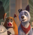
Animované filmy
Sk , Cz filmy a rozprávky
Seriály
Klasika /Horory/
Klasika /Akčné/
Dokumenty
Novinky
New Add
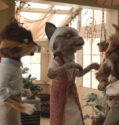
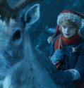
Já a moji bratři
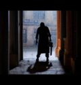
Stín smrti
Útek cez hranice
Jen na skok
Kanadské dobrodružství
Černá smrt
Katolická škola
Broad Peak
Třináct životů
Stačí přidat lásku
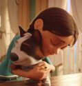
Lou
Athena
Napospas osudu
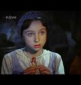
Kouzelný svět Davida Copperfielda
Nebudeš sama
Zátopek
Svatba na Jamajce
Oko za oko
Nútené pristátie
Moře stromů
Elser
Záhadné zmiznutia
Velká premiéra
Muži na pokraji nervového zhroucení
Rosaline
Na scestí
Plni milosti
Tancovať ďalej
Kyberúnos
Píseň k Vánocům
Mamka a taťka
Môj kamoš obor
Kickboxer: Odplata
To nic, drahá
Kde je Albert?
Jack Strong
Dokonalá shoda
Deset dnů dobrého muže
Kovbojové a vetřelci
Krvelačná monstra
Bláznivo zamilovaní
Je to nádhera!
Tvůj snoubenec, můj milenec
StreetDance 3D
Medvěd na koksu
Klíč k sexu
Nejdelší víkend
Royalteen: Princezna Margrethe
Někdo klepe na dveře
Matka
Kráter
Hádej, kdo je vrah
Moře času
Růže
Air: Zrození legendy
Gangster, policajt a ďábel
Laurence Anyways
Středomořská horečka
Bourneův odkaz
Závod s časem
Storm a tajné psaní
Sedm psychopatů
Pomsta
Nitro Rush: Smrtící spiknutí
Na pokraji šílenství
Krev a zlato
Combustión
Zóna smrti: Čas odplaty
Cesta do nemožna
Code 8
Empire State
Ukryté dítě
García a García
Láska natvrdo
Matka roku
Grace
Erryho směsky
Ptačí teror
Krásný život
Šlápni na to!
Šťastně podvedená
Jabloňový květ
Interstellar SK
Soundtrack života (CZ)
Gabby Petito a její příběh (CZ)
Zabijakova pomsta 2022 (SK)
Nadosmrti 2021 (cz)
Love by Design 2023 (cz)
Dungeons & Dragons: Čest zlodějů
Příběh z Montany
Zamilovaný boháč 2
Na tenkém ledě
Ve víru tajemství
Superžena
Vyšší moc
Annin čas
Na doraz
Paradise City
Přání k narozeninám
Za lepším světem
Marhuľový ostrov
Od podlahy
Hra
Hugo a jeho velký objev
Íá
Operace Mořský vlk
Doznání
Země
Motýľ: Útek z väzenia
Na linke je vrah
Tři svatby navíc
Foodies
Bezúhonnost Josepha Chamberse
Vyproštění 2
Ztracený král
Horké letní noci
Služka
Infinity Pool
Hra
Hasiči
Cigán
Tajemství Jacka Rozparovače
Láska přes okno: Dálka
Tichá hora
Smrtící sestup
Spirála lží
Maturitný ples
Hurá na Francúzsko!
Mine
Drak
Osmdesát dopisů
Nesmírnost
Jane
Tváře v davu
Dort
Trezor
Monster Trucks
Kája + Oliva
USS Indianapolis: Boj o přežití
Operace Camarón
Oni naklonovali Tyrona
Dvě letenky do Řecka
Vítězství je naše
Noční rande
Čórka
Bláznivé prázdniny s babkou
Flash
Dámsky klub 2: Ďalšia kapitola
Klub nájemných vrahů
Věčná dcera
Vous n’aurez pas ma haine
Zabiják
Válka vynálezců
Rychle a zběsile 10
Temná zrada
Hledá se plyšák
Burani v Paříži
Červená, bílá a královsky modrá
Rachel Stoneová: Sázka na Srdce
Tři mušketýři: D’Artagnan
Cool Girl!
Bílá nenávist
Láska podle plánu
Ramona
Manifest West
Příběh dřevorubce
Deset dnů zlého muže
Pappa Mia!
Loď lásky
Ti nejhorší
Tini: Violettina proměna
Věčná láska na kvadrát
Nic ve zlým
Jack Mimoun a tajemný ostrov
Šampaňské!
Mr. Olympia – Příběh bratrů Weiderových
Od písně k písni
Knižní klub zabijáků
Rozhodně nejsi zvaná na mou bat micvu!
Lion
Buď chlap!
Aftersun
Whitney Houston: I Wanna Dance with Somebody
Jižní hlídka
Holky na tahu
Alibi na klíč: Den D
Jak zaháčkovat doktora
Happy Ending
Den a půl
Košer trest
Životní příběh vládce Amazonu
Osm hor
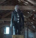
The Ghost Within
Bristol Fashion
Rytíř pohárů
Děda
Narkóza
Bláznův ráj
Městečko Wander
Asterix a Obelix: Říše středu
Úhlavní nepřítel
Pan pravý
Krysař
Zamilovaná Stella
Fér hra
Kosatka
Baletka
Hovoří ženy
Citrónová romance
Spoiler Alert
Klára
Past na rodinu
Mníška 2
Král Škorpion – Bitva osudu
Odsun
Vánoce v paláci
Dívka, která unikla: Příběh Kary Robinsonové
Lov
Dom pri močiari
Vocasy na tripu
578: Phát đạn của kẻ điên
Nikdy neříkej nikdy
Planeta Česko
Crypto Boy
Kickboxer: Vengeance
Chůvy
Sezení
King Skate
Trabantem tam a zase zpátky
Čerstvý vítr do kongresu
Mečiar
Muž taiči
Emily
Noční útok
Život pro samouky
Muž, který stál v cestě
Barbie
Odobrať z priateľov 2
Freestyle
Ehrengard: Umění svádět
Pátrání za devatero horami
Jízda s Madeleine
Bowling Saturn
Malá vlna
2 srdce
Láska na první pohled
Lauřina hvězdička
Hrabě
V plamenech
Strážkyně času
V obležení
Asteroid City
Indiana Jones a nástroj osudu
Bank of Dave
Meg 2: Příkop
Maggie Moore(s)
Zom100: Co chceš stihnout, než tě sejme zombie
Smrtící přátelství
Róise a Frank
Spy Kids: Armageddon
A do kuchyně!
Vinylová láska
Santiniho jazyk
Láska a jiné závislosti
Archiv
Vice
Šesť týždňov
Poslové spravedlnosti
Přetížení
Mastičkář
Řeč ulice 2
Podivuhodný příběh Henryho Sugara
Na křídlech lásky
Najdu tě?
Labuť
Colette
Astronaut
Akce Dárce
Matky a jiné lásky
Odstřelovač: Bílý havran
Ještěr
Uprostřed ničeho
Jeanne má každý rád
Metronom
Holky na tripu
Lovci bizonů
Rallye smrti 4: Anarchie
Velký George Foreman
Otrava
Ukolébavka
Nesnesitelná tíha obrovského talentu
Medúza Deluxe
Americká spravedlnost
Strašidelný dům
Prci, prci, prcičky: Holky sobě
Pes na Vánoce
Nikdy výjimečně někdy vždycky
Corpus Christi
Oloturé
LX 2048
Vrátná
Books of Blood
Chvíle obyčejného štěstí
The Lie
Láska a příšery
Chicagský tribunál
Vlk ze Snow Hollow
Galerie zlomených srdcí
Vyšinutý
V úskalí
Boratův navázaný telefilm
Abrakadabra
Nancy Drew a tajemné schodiště
School’s Out Forever
Noční směna
The Cleansing Hour
Don’t Tell a Soul
Debt Collectors
Nightlife: Na tahu
Díra
Rytíři spravedlnosti
Cesta do Ameriky 2
Noví mutanti
Kletba
The Dark and the Wicked
Pojď si hrát
Greenland: Poslední úkryt
Kulky spravedlnosti
The Short History of the Long Road
Gabriel’s Inferno
Possessor
Escape Room: Niet úniku
Temný dom
Mimo dosah
Halloween zabíja
Poslední z vyvolených
Duna
V obležení
Švindlíř
Výheň
Za nepřátelskou linií
Annette
After: Tajemství
Lapsis
Ada
The Deep House
Nebezpečný
Megalodon Rising
Finch
Paranormal Activity: Next of Kin
Nie je čas zomrieť
Shang-Chi a legenda o deseti prstenech
Titán
American Night
Respect
Deväť dní
The Art of Flight
Posledná noc v Soho
Nikam zvlášt
Demigod
Poslední šance
Benedetta
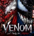
Venom 2: Carnage prichádza
Snakehead
Spencer
Meg 2: Příkop
Black Friday
The Matrix Resurrections
Ricardovi
Onoda
Noční klid
Nitram
Neznášam ťa, láska
The Last Son
Je suis Karl
Tři přání pro Popelku
Mystére: Vicky a jej tajomstvo
Médium
Mass
Jízda smrti
Bod varu
Eternals
The Tragedy of Macbeth
Králova dcera
Nejhorší člověk na světě
Blue Bayou
The Jack in the Box: Awakening
Show Me the Father
Deadlock
Správa
Waldo
Úniková místnost
Zlato
The Requin
Clean
Následky
Renoir
Kód 355
WarHunt
The Commando
Vydrž!
KIMI
Last Survivors
The King’s Man: Prvá misia
AI Love You
Borrego
Shut In
Texaský masakr motorovou pilou
Rose: Milostný příběh
Klan Gucci
Pěstní msta
Vezmi si ma
Zapomeň na UFO
Bez východiska
Amigo
Vreskot
Fresh
Utíkej a střílej
Cube
West Side Story
Divoženka
V lásce a válce
Tak káže Boh
Spider-Man: Bez domova
Margrete – kráľovná severu
Lékořicová Pizza
Eiffel
Hodina nejistoty
The Exorcism of God
Panama
Offseason
Gasoline Alley
Hlboká voda
Smrť na Níle
Vraždy podle Goyi
Pes
Moonfall
Apex
The Calm Beyond
C’mon C’mon
Nejsi moje máma
Všechny staré nože
The Sadness
Krupobití
The Batman
Uncharted
Cyrano
Silverton v obležení
Ježko Sonic 2
Stratené mesto
Štúdio 666
Morbius
Seveřan
Fantastické zvery: Tajomstvá Dumbledora
Fortress: Sniper’s Eye
Maturitní ročník
Memory
Žhářka
Všechno, všude, najednou
Útěk z pole
Otec Stu
Doctor Strange v mnohovesmíre šialenstva
Muž z Toronta
Spiderhead
Men
Watcher
Jurský svet: Nadvláda
Čierny telefón
Death Hunt
The Reef: Stalked
La pasajera
Život po Jangovi
Eradication
Resurrection
Třináct životů
Divoch
Earwig
Muréna
Moloch
Top Gun: Maverick
Samaritán
Fall
Nene
Thor: Láska a hrom
Beštia
Dobrou noc, mami
Kde zpívají raci
Emily the Criminal
Lou
Tři tisíce let touhy
Jazzmanovo blues
The Spy Who Never Dies
Dalších 365 dní
Pozvánka do pekla
Blondýnka
Sousedi na život a na smrt
Hádej, kdo je vrah
Blank
Control
Summering
Dead for a Dollar
The Infernal Machine
Into the Deep
The Forgiven
Why?
Jeepers Creepers: Reborn
Hellraiser
Grimcutty
Nix
Old Man
Deadstream
Neznámí
Škola dobra a zla
Raymond & Ray
Two Witches
Matriarcha
Accident Man 2: Zabijakova dovolenka
The Visitor
Halloween končí
Terrifier 2
Argentina, 1985
If I Can’t Have Love, I Want Power
Vstupenka do raja
The Lair
Válečnice
Předávkování
Úsmev
Rubikon
Good Mourning
Jan Žižka
Margaux
Čističi vesmíru
Erupcia lásky
They/Them
Mr. Malcolm’s List
Time Is Up 2
Aftersun
Snivokraj
Paradise City
Black Adam
Lamborghini
Weird: The Al Yankovic Story
Gone in the Night
Black Site
The Friendship Game
Detective Knight: Redemption
Christmas Bloody Christmas
Fabelmanovci
Recept na smrt
Menu
The System
R.I.P.D. 2: Rise of the Damned
Vlčí lov
V zajatí mysle
Dog Gone
Devotion
About Fate
House Party
Dům ďábla
The Price We Pay
Sick
Tělo
Když promluvila
Gieokeui bam
Play Dead
What Josiah Saw
The Offering
Hunt
Stockholm
Veneciafrenia
M3GAN
Candy Land
Black Panther: Wakanda nechť žije
Erna i krig
Condor’s Nest
Krycie meno Banshee
The Locksmith
Novembre
Don’t Fuck in the Woods
Clerks III
Infinity Pool
After: Pouto
The Ghosts of Monday
Muž jménem Otto
Whitney Houston: I Wanna Dance with Somebody
Velryba
Poslední rytíři
Věčná dcera
Transfusion
Nocebo
Letní mráz
Women Talking
Blood
Nezvěstná
Divoká stvoření jižních krajin
Bostonský škrtič
Pět ďáblů
Medvídek Pú: Krev a med
Huesera: Sběratelka kostí
Unwelcome
The Unheard
Dokonalá závislost
Supercela
The Old Way
80 for Brady
Shazam! Hněv bohů
Poslední střih
Marlowe
Jevy
Bunker
Korzet
Freeze
Chhapaak
Posadnutosť
Vřískot 6
Hodiny
Renfield
Carnifex
Sound of Silence
Mafia Mamma
From Black
The Tank
Kingudamu
The Covenant
Sisu
La niña de la comunión
To Catch a Killer
John Wick: Kapitola 4
Among the Living
Bloodlust Zombies
Day Zero (2022)
The Independent
Malum
Influencer
Zlato Rýna
Hypnotik
Big George Foreman
Simulant
Breaking
BlackBerry
Ride On
Koputus
Klub nájemných vrahů
Black Lotus
Nefarious
Saint Seiya: Rytíři zvěrokruhu – Počátek
Superposition
Do hajzlu!
Last Sentinel
A Good Person
Capra cu trei iezi
Prizefighter: The Life of Jem Belcher
Warhorse One
As bestas
The Black Demon
Flash
Asteroid City
A pak přišla láska…
Vše je ztraceno
Ladíme!
Ladíme 2
Nekřič a toč
Má mě rád, nemá mě rád
Nenápadné zlo
Pěsti ze železa
Rogue One: Star Wars Story
Mythica: Hledání hrdinů
Mythica: Hledání hrdinů
Rodinné portréty
Zvědavá pekařka: Čokoládová závislost
Nekonečná bouře
Trojuholník smútku
Dávám tomu rok
Královna pouště
Pád
Pavouci útočí
Tým jedna
Útok pětihlavého žraloka
Vlkodlak: zabijácký virus
Zjevení
Grand Prix
Krev šampiona
Ve stínu gangu
Přetlak
Pavouci
Spolu
Štrnganie kľúčov
Výšlap smrti
Všechno nejhorší
Poslední cesta
Ďábelský dům
Deň vykúpenia
Kovbojové a vetřelci
Na hraně temnoty
Přípitek
To musí být láska
Největší dar
Oběť
A do kuchyně!
Johnny
Bez kalhot
Zelený rytíř
Ukradené jméno
Skutečné vraždy: Střemhlavý pád
S rodinou za každou cenu
Belfast
Žraločí tornádo 4
X
V měsíčním světle
Stříbrňák
Čung_E
Ray Donovan: The Movie
Il Boemo
Nepoučitelní
The Boy
Šílená noc
Tuláci
Pachuť pomsty
Furioza
Za vším hledej ženu
Bankový lupič
Mandle a mořský koník
Švec
Kecky
Útok z hlubin 3
BANGER.
Cop Car
Útěk z pole
Smrt Dicka Longa
Omamná láska
Helene
Když promluvila
Agnes Joy
Noční směna
10 000 svätých
Vítejte doma
Křehký
Pěkně daleko
V létě ti řeknu, jak se mám
Rozpolcená
Bohové Egypta
Princ Mamánek
Sirotek: První oběť
Luther: Pád z nebes
Pomsta
Poslední šance
Bojovnice
Infiltrátor
Šťastlivec
Like.Share.Follow
Modrá lagúna: Nový začiatok
Následníci
Orol Deviatej légie
Rezistencia
Kolej
Alvin a Chipmunkovia 3
Vampire Academy
Smrtící milostný dopis
Žraločí tornádo 3
Toto je koniec
5 x jinak
Megalodon Rising
Aladin a lampa smrti
Deň D
Plane
Madeleine Collins
M3GAN
Věrný až za hrob
Vražda v Paříži
Pok-sun nesmí přežít
Srdeční záležitost
Princezna zakletá v čase 2
Jedna noc v Bangkoku
#Loupež
A E I O U – Rychlá abeceda lásky
Australský gangster
Haute couture
Test
Holčičí film
Vládci ulice: Moc lásky
Svetlonoc
Chupa
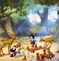
Sněhurka a kouzelní trpaslíci
Špatná chůva
Nebezpečná závislost
Cirkus Maximum
Bullet Train
Náměsíčná
Avatar: Cesta vody
Personal Shopper
Mikádo
Netvor
Lhář na plný úvazek
Zázračný kůň
Bros
Válka Bohů
Jak přežít single
Star Trek: Do temnoty
Běženky a kapři
Čierne na bielom koni
Dve ženy
3/19
Trpká pomsta
Mighty Morphin Power Rangers: Jednou provždy
Shazam! Hněv bohů
Znovu Paříž
(K)lamač srdcí
Zavolejte Jane
Animal
Follow Me
Absence blízkosti
Polski film
Zrcadla ve tmě
Redeeming Love
Služobníci
Andělé všedního dne
Dokonalý KLUK
Duch žraloka
Laskavý dotek
Nebezpečný žralok
Atlas ptáků
Šibenice
Maigret
The Inhabitant
Der Räuber Hotzenplotz
Biely zabijak
Supernova
Fabelmanovi
Peter Pan a Wendy
Tři tisíce let touhy
AKA
Hrana zlomu
Popoluška v Monte Carle
Zelená jako smaragd
Život naruby
Churchill
Rimini
Mej žen jü
Někdo klepe na dveře
Moře času
Nejdelší víkend
Royalteen: Princezna Margrethe
Klíč k sexu
Medvěd na koksu
Biřmování
Děti Nagana
Výheň
Air: Zrození legendy
Hráči se smrtí
Závod s časem
Bourneův odkaz
Ostrov
Monsters of Man
Recept na smrt
Ant-Man a Wasp: Quantumania
Kmotra
Jizda života
Fanfik
Dobrý časy
Kousek
Dobývání Měsíce
Mstitel bezpráví 2
Oldboy
Princezná
Machete
Laurence Anyways
G.I. Joe 2: Odveta
Gangster, policajt a ďábel
Lekce života
Na pokraji šílenství
Vengeance 2
Pomsta
Storm a tajné psaní
Code 8
Tin & Tina
Grace
Mixed by Erry
Láska natvrdo / Hammerharte Jungs
Krev a zlato / Blood & Gold
Combustión
Nikdy víc / Never Goin’ Back
Věznice 77 / Modelo 77
Pan Nepolapitelný
Skutečné vraždy: Školní sraz
Po strništi bos
Zamilovaný boháč / Ricos de Amor
Kniha lásky
Podoba vody / The Shape of Water 2017
Odd Thomas 2013
Zmensovani 2017
Personal Shopper (2016) CZ
Vesmírná propast / Zvjozdnyj razum (2022) CZ
Bratrstvo černé pracky (2002)
Bláznivej tábor 2007
Nebezpečný cíl 2008
Noční incident 2011 (CZ)
Palmy a stožáry 2022 (CZ)
Náměsíčná 2017 (CZ)
Mrtvá hlídka (2002)
Válka Bohů (2011)
Královna XXL (2008)
Absence blízkosti (2017) CZ
Polski film (2012) CZ
Zrcadla ve tmě (2021) CZ
Redeeming Love (2022) CZ
Služobníci (2020) SK
Hviezdna brána: Atlantída / Stargate: Atlantis S05E20 – Nepriateľ pred bránami (CZ)
Hviezdna brána: Atlantída / Stargate: Atlantis S05E19 – Vegas (CZ)
Hviezdna brána: Atlantída / Stargate: Atlantis S05E18 – Totožnosť (CZ)
Hviezdna brána: Atlantída / Stargate: Atlantis S05E17 – Nákaza (CZ)
Hviezdna brána: Atlantída / Stargate: Atlantis S05E16 – Geniálne riešenie (CZ)
Hviezdna brána: Atlantída / Stargate: Atlantis S05E15 – Pozostatky (CZ)
Hviezdna brána: Atlantída / Stargate: Atlantis S05E14 – Návrat márnotratného syna (CZ)
Hviezdna brána: Atlantída / Stargate: Atlantis S05E13 – Inkvizícia (CZ)
Hviezdna brána: Atlantída / Stargate: Atlantis S05E12 – Utečenci (CZ)
Hviezdna brána: Atlantída / Stargate: Atlantis S05E11 – Stratený kmeň (CZ)
Hviezdna brána: Atlantída / Stargate: Atlantis S05E10 – Prvý kontakt (CZ)
Hviezdna brána: Atlantída / Stargate: Atlantis S05E09 – Stopár (CZ)
Hviezdna brána: Atlantída / Stargate: Atlantis S05E08 – Kráľovná (CZ)
Hviezdna brána: Atlantída / Stargate: Atlantis S05E07 – Šepoty (CZ)
Hviezdna brána: Atlantída / Stargate: Atlantis S05E06 – Svätyňa (CZ)
Hviezdna brána: Atlantída / Stargate: Atlantis S05E05 – Duša bez tela (CZ)
Hviezdna brána: Atlantída / Stargate: Atlantis S05E04 – Daedalos na druhú (CZ)
Hviezdna brána: Atlantída / Stargate: Atlantis S05E03 – Spretrhané väzby (CZ)
Hviezdna brána: Atlantída / Stargate: Atlantis S05E02 – Živná pôda (CZ)
Hviezdna brána: Atlantída / Stargate: Atlantis S05E01 – Záchranná operácia (CZ)
Hviezdna brána: Atlantída / Stargate: Atlantis S04E20 – Posledný muž (CZ)
Hviezdna brána: Atlantída / Stargate: Atlantis S04E19 – Príbuzní, 2. časť (CZ)
Hviezdna brána: Atlantída / Stargate: Atlantis S04E18 – Príbuzní, 1. časť (CZ)
Hviezdna brána: Atlantída / Stargate: Atlantis S04E17 – Prestupná stanica (CZ)
Hviezdna brána: Atlantída / Stargate: Atlantis S04E16 – Trojica (CZ)
Hviezdna brána: Atlantída / Stargate: Atlantis S04E15 – Vydedenec (CZ)
Hviezdna brána: Atlantída / Stargate: Atlantis S04E14 – Harmony (CZ)
Hviezdna brána: Atlantída / Stargate: Atlantis S04E13 – Karanténa (CZ)
Hviezdna brána: Atlantída / Stargate: Atlantis S04E12 – Vojnová korisť (CZ)
Hviezdna brána: Atlantída / Stargate: Atlantis S04E11 – Všetky moje hriechy budú spomenuté (CZ)
Hviezdna brána: Atlantída / Stargate: Atlantis S04E10 – Smrtiaca špirála (CZ)
Hviezdna brána: Atlantída / Stargate: Atlantis S04E09 – Ťažké rozhodnutia (CZ)
Hviezdna brána: Atlantída / Stargate: Atlantis S04E08 – Veštec (CZ)
Hviezdna brána: Atlantída / Stargate: Atlantis S04E07 – Nezvestné (CZ)
Hviezdna brána: Atlantída / Stargate: Atlantis S04E06 – Strata pamäte (CZ)
Hviezdna brána: Atlantída / Stargate: Atlantis S04E05 – Cestovatelia (CZ)
Hviezdna brána: Atlantída / Stargate: Atlantis S04E04 – Dvojník (CZ)
Hviezdna brána: Atlantída / Stargate: Atlantis S04E03 – Stretnutie (CZ)
Hviezdna brána: Atlantída / Stargate: Atlantis S04E02 – Záchranné lano (CZ)
Hviezdna brána: Atlantída / Stargate: Atlantis S04E01 – Unášaní prúdom (CZ)
Hviezdna brána: Atlantída / Stargate: Atlantis S03E20 – Zaútočiť prvý (CZ)
Hviezdna brána: Atlantída / Stargate: Atlantis S03E19 – Msta (CZ)
Hviezdna brána: Atlantída / Stargate: Atlantis S03E18 – Ponorenie (CZ)
Hviezdna brána: Atlantída / Stargate: Atlantis S03E17 – Nedeľa (CZ)
Hviezdna brána: Atlantída / Stargate: Atlantis S03E16 – Archa (CZ)
Hviezdna brána: Atlantída / Stargate: Atlantis S03E15 – Hra (CZ)
Hviezdna brána: Atlantída / Stargate: Atlantis S03E14 – Rodneyho povznesenie (CZ)
Hviezdna brána: Atlantída / Stargate: Atlantis S03E13 – Bezohľadný hrdina (CZ)
Hviezdna brána: Atlantída / Stargate: Atlantis S03E12 – Ozveny (CZ)
Hviezdna brána: Atlantída / Stargate: Atlantis S03E11 – Návrat, 2. časť (CZ)
Hviezdna brána: Atlantída / Stargate: Atlantis S03E10 – Návrat, 1. časť (CZ)
Hviezdna brána: Atlantída / Stargate: Atlantis S03E09 – Preludy (CZ)
Hviezdna brána: Atlantída / Stargate: Atlantis S03E08 – McKay a pani Millerová (CZ)
Hviezdna brána: Atlantída / Stargate: Atlantis S03E07 – Spoločný záujem (CZ)
Hviezdna brána: Atlantída / Stargate: Atlantis S03E06 – Skutočný svet (CZ)
Hviezdna brána: Atlantída / Stargate: Atlantis S03E05 – Potomkovia (CZ)
Hviezdna brána: Atlantída / Stargate: Atlantis S03E04 – Sateda (CZ)
Hviezdna brána: Atlantída / Stargate: Atlantis S03E03 – Neodolateľný (CZ)
Hviezdna brána: Atlantída / Stargate: Atlantis S03E02 – Nechcené deti (CZ)
Hviezdna brána: Atlantída / Stargate: Atlantis S03E01 – Krajina nikoho (CZ)
Hviezdna brána: Atlantída / Stargate: Atlantis S02E20 – Spojenci (CZ)
Hviezdna brána: Atlantída / Stargate: Atlantis S02E19 – Peklo (CZ)
Hviezdna brána: Atlantída / Stargate: Atlantis S02E18 – Michael (CZ)
Hviezdna brána: Atlantída / Stargate: Atlantis S02E17 – Prevrat (CZ)
Hviezdna brána: Atlantída / Stargate: Atlantis S02E16 – Dlhé lúčenie (CZ)
Hviezdna brána: Atlantída / Stargate: Atlantis S02E15 – Veža (CZ)
Hviezdna brána: Atlantída / Stargate: Atlantis S02E14 – Pod tlakom (CZ)
Hviezdna brána: Atlantída / Stargate: Atlantis S02E13 – Kritické množstvo (CZ)
Hviezdna brána: Atlantída / Stargate: Atlantis S02E12 – Povznešenie (CZ)
Hviezdna brána: Atlantída / Stargate: Atlantis S02E11 – Úľ (CZ)
Hviezdna brána: Atlantída / Stargate: Atlantis S02E10 – Zblúdilci (CZ)
Hviezdna brána: Atlantída / Stargate: Atlantis S02E09 – Aurora (CZ)
Hviezdna brána: Atlantída / Stargate: Atlantis S02E08 – Premena (CZ)
Hviezdna brána: Atlantída / Stargate: Atlantis S02E07 – Inštinkt (CZ)
Hviezdna brána: Atlantída / Stargate: Atlantis S02E06 – Všemohúci (CZ)
Hviezdna brána: Atlantída / Stargate: Atlantis S02E05 – Odsúdenci (CZ)
Hviezdna brána: Atlantída / Stargate: Atlantis S02E04 – Duet (CZ)
Hviezdna brána: Atlantída / Stargate: Atlantis S02E03 – Lovná zver (CZ)
Hviezdna brána: Atlantída / Stargate: Atlantis S02E02 – Všemohúci (CZ)
Hviezdna brána: Atlantída / Stargate: Atlantis S02E01 – V obliehaní, 3. časť (CZ)
Hviezdna brána: Atlantída / Stargate: Atlantis S01E20 – V obliehaní časť druhá (CZ)
Hviezdna brána: Atlantída / Stargate: Atlantis S01E19 – V obliehaní (CZ)
Hviezdna brána: Atlantída / Stargate: Atlantis S01E18 – Dar (CZ)
Hviezdna brána: Atlantída / Stargate: Atlantis S01E17 – Listy z Pegasu (CZ)
Hviezdna brána: Atlantída / Stargate: Atlantis S01E16 – Bratstvo (CZ)
Hviezdna brána: Atlantída / Stargate: Atlantis S01E15 – Skôr než zaspím (CZ)
Hviezdna brána: Atlantída / Stargate: Atlantis S01E14 – Útočisko (CZ)
Hviezdna brána: Atlantída / Stargate: Atlantis S01E13 – Horúca zóna (CZ)
Hviezdna brána: Atlantída / Stargate: Atlantis S01E12 – Všetkému napriek (CZ)
Deň D / Jour J 2017 (SK)
Kámoši / Bros 2022 (CZ)
Čierne na bielom koni 2022 (SK)
Dve ženy 2022 (SK)
3/19 2021 (SK)
Hviezdna brána: Atlantída / Stargate: Atlantis S01E11 – Oko búrka (CZ)
Hviezdna brána: Atlantída / Stargate: Atlantis S01E10 – Búrka (CZ)
Hviezdna brána: Atlantída / Stargate: Atlantis S01E09 – Domov (CZ)
Hviezdna brána: Atlantída / Stargate: Atlantis S01E08 – V podzemí (CZ)
Hviezdna brána: Atlantída / Stargate: Atlantis S01E07 – Otrávená studnica (CZ)
Hviezdna brána: Atlantída / Stargate: Atlantis S01E06 – Koniec detstva (CZ)
Hviezdna brána: Atlantída / Stargate: Atlantis S01E05 – Podozrenie (CZ)
Hviezdna brána: Atlantída / Stargate: Atlantis S01E04 – (CZ)
Hviezdna brána: Atlantída / Stargate: Atlantis S01E03 – Hra na schovávačku (CZ)
Hviezdna brána: Atlantída / Stargate: Atlantis S01E01+E02 – Vynorenie 1+2 (CZ)
Streda – Requiem pro krkavce (E08) (CZ)
Wednesday – Čert aby sa v tebe vyznal (E07)(CZ)
Wednesday – Niečo za nič (E06)(CZ)
Wednesday – Čo človek zasieva, to smrtka žne (E05)(CZ)
Wednesday – Vedľa teba umieram (E04)(CZ)
Wednesday – Priateľ, alebo vrah (E03)(CZ)
Wednesday – Ako kôl v cintorínskom plote (E02)(CZ)
Wednesday – ročné dievča Wednesday (E01)(CZ)
Ozark S03E10 – Všetko, alebo nič (CZ)
Ozark S03E09 – Fire Pink (CZ)
Ozark S03E08 – Nerozluční priatelia (CZ)
Ozark S03E07 – V prípade núdze (CZ)
Ozark S03E06 – Tvoj dom je aj môj dom (CZ)
Ozark S03E05 – Návšteva z Michoacánu (CZ)
Ozark S03E04 – Súboj šéfov (CZ)
Ozark S03E03 – Bol tu Kevin Cronin (CZ)
Ozark S03E02 – Partnerstvo (CZ)
Ozark S03E01 – Vo vojne (CZ)
Ozark S02E10 – Zlaté pobrežie (CZ)
Ozark S02E09 – Jazvec (CZ)
Ozark S02E08 – Hlboký spánok (CZ)
Ozark S02E07 – Jediná cesta von (CZ)
Ozark S02E06 – Vonkajšia temnota (CZ)
Ozark S02E05 – Veľký deň (CZ)
Ozark S02E04 – Osamelosť (CZ)
Ozark S02E03 – Kliatba rodu Langmorov (CZ)
Ozark S02E02 – Drahocenná krv Ježišova (CZ)
Ozark S02E01 – Reparácia (CZ)
Ozark S01E10 – Hrana (CZ)
Ozark S01E09 – Čiernu kávu prosím (CZ)
Ozark S01E08 – Kaleidoskop (CZ)
Ozark S01E07 – Vtáčia búdka (CZ)
Ozark S01E06 – Kniha Ruth (CZ)
Ozark S01E05 – Nadvláda (CZ)
Ozark S01E04 – Dnes večer improvizujeme (CZ)
Ozark S01E03 – Pozvoľný spánok (CZ)
Ozark S01E02 – Modrá mačka (CZ)
Ozark S01E01 – Cukor (CZ)
Koruna / The Crown S03E10 – Cry of Heart(CZ)
Koruna / The Crown S03E09 – Zápletka (CZ)
Koruna / The Crown S03E08 – Rozkolísaný človek (CZ)
Koruna / The Crown S03E07 – Mesačný prach (CZ)
Koruna / The Crown S03E06 – Princ z Walesu(CZ)
Koruna / The Crown S03E05 – Prevrat(CZ)
Koruna / The Crown S03E04 – Bubíšek(CZ)
Koruna / The Crown S03E03 – Aberfan (CZ)
Koruna / The Crown S03E02 – Margaretologie (CZ)
Koruna / The Crown S03E01 – Olding (CZ)
Koruna / The Crown S02E10 – Záhadný muž(CZ)
Crown / The Crown S02E09 – Patriarchálne rodiny
Koruna / The Crown S02E08 – Drahá Jacqueline(CZ)
Koruna / The Crown S02E07 – Manželstvo(CZ)
Koruna / The Crown S02E06 – Minulosť (CZ)
Koruna / The Crown S02E05 – Bábky(CZ)
Crown / The Crown S02E04 – Beryl(CZ)
Koruna / The Crown S02E03 – Lisabon(CZ)
Koruna / The Crown S02E02 – Medzi mužmi(CZ)
Koruna / The Crown S02E01 – Neopatrenie(CZ)
Koruna / The Crown – S01E10 – Gloriana (CZ)
Koruna / The Crown – S01E09 – Atentátnici (CZ)
Koruna / The Crown – S01E08 – Pride and Joy (CZ)
Koruna / The Crown – S01E07 – Scientia potentia est (CZ)
Koruna / The Crown – S01E06 – Traskavá želatína (CZ)
Koruna / The Crown – S01E05 – Dym a zrkadlá (CZ)
Koruna / The Crown – S01E04 – Vyššia moc (CZ)
Koruna / The Crown – S01E03 – Windsor (CZ)
Koruna / The Crown – S01E02 – Hyde Park Corner (CZ)
Koruna / The Crown – S01E01 – Wolfertonská senzácia (CZ)
Orange Is the New Black S04E13 – Toast už nikdy nebude chlebom (CZ)
Orange Is the New Black S04E12 – Zvieratá (CZ)
Orange Is the New Black S04E11 – S ľuďmi to vie (CZ)
Orange Is the New Black S04E10 – Králik, lebka, králik, lebka (CZ)
Orange Is the New Black S04E09 – Dbám o čistotu (CZ)
Orange Is the New Black S04E08 – Priatelia na nízkych miestach (CZ)
Orange Is the New Black S04E07 – V mojej hlave to znelo lepšie (CZ)
Orange Is the New Black S04E06 – Ty hajzle (CZ)
Orange Is the New Black S04E05 – Vždy budeme mať Baltimore (CZ)
Orange Is the New Black S04E04 – Doktor psycho (CZ)
Orange Is the New Black S04E03 – Hovor alebo mlč (CZ)
Orange Is the New Black S04E02 – Môžete chodiť v obleku (CZ)
Orange Is the New Black S04E01 – Pevné telo (CZ)
Orange Is the New Black S03E13 – Never žiadny dievča (CZ)
Orange Is the New Black S03E12 – Nenúť ma si pre teba dôjsť (CZ)
Orange Is the New Black S03E11 – Môžeme byť hrdinovia (CZ)
Orange Is the New Black S03E10 – Chlupy a kozičky (CZ)
Orange Is the New Black S03E09 – Kde mám drejdl? (CZ)
Orange Is the New Black S03E08 – Strach a iné zápachy (CZ)
Orange Is the New Black S03E07 – Zviazaný jazyk (CZ)
Orange Is the New Black S03E06 – Ching Chong Chang (CZ)
Orange Is the New Black S03E05 – Predstieraj, pokiaľ to pôjde (CZ)
Orange Is the New Black S03E04 – Prst, ktorý zadržiava vodu v hrádzi (CZ)
Orange Is the New Black S03E03 – Empatia nie je sexi (CZ)
Orange Is the New Black S03E02 – Ploštica posteľná (CZ)
Orange Is the New Black S03E01 – Den matek (CZ)
Orange Is the New Black S02E13 – Zásady slušného správania (CZ)
Orange Is the New Black S02E12 – Zmena (CZ)
Orange Is the New Black S02E11 – Daj si pauzu od svojich hodnôt (CZ)
Orange Is the New Black S02E10 – Sadistický fúzatý Kaňúr (CZ)
Orange Is the New Black S02E09 – Propustka (CZ)
Orange Is the New Black S02E08 – Kvetináče (CZ)
Orange Is the New Black S02E07 – Comic Sans (CZ)
Orange Is the New Black S02E06 – A nakoniec pizza (CZ)
Orange Is the New Black S02E05 – Jednoduchá korisť (CZ)
Orange Is the New Black S02E04 – Úplne iná diera (CZ)
Orange Is the New Black S02E03 – Objatia môžu klamať (CZ)
Orange Is the New Black S02E02 – Vyzerá modro, chutí na červeno (CZ)
Orange Is the New Black S02E01 – Smädný vtáčik (CZ)
Orange Is the New Black S01E13 – Šialenosť nevyliečiš (CZ)
Orange Is the New Black S01E12 – Podraz ma raz (CZ)
Orange Is the New Black S01E11 – Vysoké citlivky (CZ)
Orange Is the New Black S01E10 – Bora Bora Bora (CZ)
Orange Is the New Black S01E09 – Deň prečudovania (CZ)
Orange Is the New Black S01E08 – Moskovská pašeračka (CZ)
Orange Is the New Black S01E07 – Krvavá šiška (CZ)
Orange Is the New Black S01E06 – Väzenská politika (CZ)
Orange Is the New Black S01E05 – Slepice (CZ)
Orange Is the New Black S01E04 – Imaginárny nepriatelia (CZ)
Orange Is the New Black S01E03 – Lesbická žiadosť zamietnutá (CZ)
Orange Is the New Black S01E02 – Rana do hrudníka (CZ)
Orange Is the New Black S01E01 – Nebola som pripravená (CZ)
Zaklinac / The Witcher S01E08 (CZ)
Zaklinac / The Witcher S01E07 (CZ)
Zaklinac / The Witcher S01E06 (CZ)
Zaklinac / The Witcher S01E05 (CZ)
Zaklinac / The Witcher S01E04 (CZ)
Zaklinac / The Witcher S01E03 (CZ)
Zaklinac / The Witcher S01E02 (CZ) = CSFD 84%
Zaklinac / The Witcher S01E01 – The End’s Beginning (CZ)(2019)
Na zdravie S01E22(CZ)
Na zdravie S01E21(CZ)
Na zdravie S01E20(CZ)
Na zdravie S01E19(CZ)
Na zdravie S01E18(CZ)
Na zdravie S01E17(CZ)
Na zdravie S01E16(CZ)
Na zdravie S01E15(CZ)
Na zdravie S01E14(CZ)
Na zdravie S01E13(CZ)
Na zdravie S01E12(CZ)
Na zdravie S01E11(CZ)
Na zdravie S01E10(CZ)
Na zdravie S01E09(CZ)
Na zdravie S01E08(CZ)
Na zdraví S01E07(CZ)
Na zdraví S01E06(CZ)
Na zdravie S01E05(CZ)
Na zdravie S01E04(CZ)
Na zdravie S01E03(CZ)
Na zdravie S01E02(CZ)
Na zdravie S01E01(CZ)
Rick and Morty – A Rick in King Mortur’s Mort (S06E09)(CZ)
Rick and Morty – Analyze Piss (S06E08)(CZ)
Rick and Morty – Full Meta Jackrick (S06E07)
Rick and Morty – JuRicksic Mort (S06E06)(CZ)
Rick and Morty – Final DeSmithation (S06E05)(CZ)
Rick and Morty – Night Family (S06E04)(CZ)
Rick and Morty – Bethic Twinstinct (S06E03)(CZ)
Rick and Morty – Rick: A Mort Well Lived (S06E02)(CZ)
Rick and Morty – Solaricks (S06E01)(CZ)
Rick and Morty – Rickdependence Spray (S05E04)(2021)(CZ)
Rick and Morty – A Rickconvenient Mort (S05E03)(2021)(CZ)
Rick and Morty – Mortyplicity (S05E02)(2021)(CZ)
Rick and Morty – Mort Dinner Rick Andre (S05E01)(2021)(CZ)
Rick and Morty – The Wedding Squanchers (S02E10)(CZ)
Rick and Morty – Look Who’s Purging Now (S02E09)(CZ)
Rick and Morty – Interdimensional Cable 2: Tempting Fate (S02E08)(CZ)
Rick and Morty – Big Trouble in Little Sanchez (S02E07)(CZ)
Rick and Morty – The Ricks Must Be Crazy (S02E06)(CZ)
Rick and Morty – Get Schwifty (S02E05)(CZ)
Rick and Morty – Total Rickall (S02E04)(CZ)
Rick and Morty – Auto Erotic Assimilation (S02E03)(CZ)
Rick and Morty – Mortynight Run (S02E02)(CZ)
Rick and Morty – A Rickle in Time (S02E01)(CZ)
Rick and Morty S01E11 – Ricksy Business (CZ)(2013)
Rick and Morty S01E10 – Close Rick-counters of the Rick Kind (CZ)(2013)
Rick and Morty S01E09 – Something Ricked This Way Comes (CZ)(2013)
Rick and Morty S01E08 – Rixty Minutes (CZ)(2013)
Rick and Morty S01E07 – Raising Gazorpazorp (CZ)(2013)
Rick and Morty S01E06 – Rick Potion #9 (CZ)(2013)
Rick and Morty S01E05 – Meeseeks and Destroy (CZ)(2013)
Rick and Morty S01E04 – M. Night Shaym-Aliens! (CZ)(2013)
Rick and Morty S01E03 – Anatomy Park (CZ)(2013)
Rick and Morty S01E03 – Anatomy Park (2013)
Rick and Morty S01E02 – Lawnmower Dog (CZ)(2013)
Rick and Morty S01E01 – Pilot (CZ)(2013)
Dunaj, k vašim službám S01E08 (SK)
Dunaj, k vašim službám S01E07 (SK)
Dunaj, k vašim službám S01E06 (SK)
Dunaj, k vašim službám S01E05 (SK)
Dunaj, k vasim sluzbam S01E04 (SK)
Dunaj, k vasim sluzbam S01E03 (SK)
Dunaj, k vasim sluzbam S01E02 (SK)
Dunaj, k vasim sluzbam S01E01 (SK)
Expedícia Návrat do budúcnosti S01E04(CZ)
Expedícia Návrat do budúcnosti S01E03(CZ)
Expedícia Návrat do budúcnosti S01E02(CZ)
Expedícia Návrat do budúcnosti S01E01(CZ)
Lovci pokladov Na hrane histórie S01E09(CZ)
Lovci pokladov Na hrane histórie S01E08(CZ)
Lovci pokladov Na hrane histórie S01E07(CZ)
Lovci pokladov Na hrane histórie S01E06(CZ)
Lovci pokladov Na hrane histórie S01E05(CZ)
Lovci pokladov Na hrane histórie S01E04(CZ)
Lovci pokladov Na hrane histórie S01E03(CZ)
Lovci pokladov Na hrane histórie S01E02 (CZ)
Lovci pokladov Na hrane histórie S01E01 (CZ)
Lovci pokladov Na hrane histórie S01E10 (CZ)
Rabbit Hole – The Person in Your Ear (E04)(SK)
Rabbit Hole – Algoritmy kontroly (E03)(SK)
Rabbit Hole – V každom okamihu (E02)(SK)
Rabbit Hole – Pilotný diel (E01)(SK)
Transatlantic – Oheň na snehu (E07)(CZ)
Transatlantic – Čistý duševný automatizmus (E06)(CZ)
Transatlantic – Čo definuje človeka (E05)(CZ)
Transatlantic – Nie je cesty späť (E04)(CZ)
Transatlantic – Divočina (E03)(CZ)
Transatlantic – Anjel histórie (E02)(CZ)
Transatlantic – Odchod, hlas a oddanosť (E01)(CZ)
Tlapkova patrola S09E19(SK)
Tlapkova patrola S09E18(SK)
Tlapkova patrola S09E17(SK)
Tlapkova patrola S09E16(SK)
Tlapkova patrola S09E15(SK)
Tlapkova patrola S09E14(SK)
Tlapkova patrola S09E13(SK)
Tlapkova patrola S09E12(SK)
Tlapkova patrola S09E11(SK)
Tlapkova patrola S09E10(SK)
Tlapkova patrola S09E09(SK)
Tlapkova patrola S09E08(SK)
Tlapkova patrola S09E07(SK)
Tlapkova patrola S09E06(SK)
Tlapkova patrola S09E05(SK)
Tlapkova patrola S09E04(SK)
Tlapkova patrola S09E03(SK)
Tlapkova patrola S09E02(SK)
Tlapkova patrola S09E01(SK)
Tlapkova patrola S08E26(SK)
Tlapkova patrola S08E25(SK)
Tlapkova patrola S08E24(SK)
Tlapkova patrola S08E23(SK)
Tlapkova patrola S08E22(SK)
Tlapkova patrola S08E21(SK)
Tlapkova patrola S08E20(SK)
Tlapkova patrola S08E19(SK)
Tlapkova patrola S08E18(SK)
Tlapkova patrola S08E17(SK)
Tlapkova patrola S08E16(SK)
Tlapkova patrola S08E15(SK)
Tlapkova patrola S08E14(SK)
Tlapkova patrola S08E13(SK)
Tlapkova patrola S08E12(SK)
Tlapkova patrola S08E11(SK)
Tlapkova patrola S08E10(SK)
Tlapkova patrola S08E09(SK)
Tlapkova patrola S08E08(SK)
Tlapkova patrola S08E07(SK)
Tlapkova patrola S08E06(SK)
Tlapkova patrola S08E05(SK)
Tlapkova patrola S08E04(SK)
Tlapkova patrola S08E03(SK)
The Siege (2023)
John Wick : Chapter 4 (2023)(ZVUK KINO)
Assassin (2023)(CZ)
Operace: Národ / Kryptonim Polska (2022)(CZ)
Tlapkova patrola S08E02(SK)
Tlapkova patrola S08E01(SK)
Mikádo / Marocco (2021)(CZ)
Tlapkova patrola S07E26(SK)
Tlapkova patrola S07E25(SK)
Tlapkova patrola S07E24(SK)
Tlapkova patrola S07E23(SK)
Tlapkova patrola S07E22(SK)
Tlapkova patrola S07E21(SK)
Tlapkova patrola S07E20(SK)
Tlapkova patrola S07E19(SK)
Tlapkova patrola S07E18(SK)
Tlapkova patrola S07E17(SK)
Tlapkova patrola S07E16(SK)
Tlapkova patrola S07E15(SK)
Tlapkova patrola S07E14(SK)
Tlapkova patrola S07E13(SK)
Tlapkova patrola S07E12(SK)
Tlapkova patrola S07E11(SK)
Tlapkova patrola S07E10(SK)
Tlapkova patrola S07E09(SK)
Tlapkova patrola S07E08(SK)
Tlapkova patrola S07E07(SK)
Tlapkova patrola S07E06(SK)
Tlapkova patrola S07E05(SK)
Tlapkova patrola S07E04(SK)
Tlapkova patrola S07E03(SK)
Tlapkova patrola S07E02(SK)
Tlapkova patrola S07E01(SK)
Tlapkova patrola S06E27(SK)
Tlapkova patrola S06E26(SK)
Tlapkova patrola S06E25(SK)
Tlapkova patrola S06E24(SK)
Tlapkova patrola S06E23(SK)
Tlapkova patrola S06E22(SK)
Tlapkova patrola S06E21(SK)
Tlapkova patrola S06E20(SK)
Tlapkova patrola S06E19(SK)
Tlapkova patrola S06E18(SK)
Protiuder / Collateral Damage 2002 (CZ)
Univerzalni uklizecka / Keeping Mum 2005 (CZ)
Hrich 2019 (CZ)
WALL-E / VALL-I 2008 (SK)
Vanocni valcik / The Christmas Waltz 2020 (CZ)
Tlapkova patrola S06E17(SK)
Tlapkova patrola S06E16(SK)
Tlapková patrola S06E15(SK)
Tlapková patrola S06E14(SK)
Tlapková patrola S06E13(SK)
Tlapková patrola S06E12(SK)
Tlapková patrola S06E11(SK)
Tlapková patrola S06E10(SK)
Tlapková patrola S06E09(SK)
Tlapková patrola S06E08(SK)
Tlapková patrola S06E07(SK)
Tlapkova patrola S06E06(SK)
Tlapkova patrola S06E05(SK)
Tlapkova patrola S06E04(SK)
Tlapkova patrola S06E03(SK)
Tlapkova patrola S06E02(SK)
Tlapkova patrola S05E27(SK)
Tlapkova patrola S05E026(SK)
Tlapkova patrola S05E025(SK)
Tlapkova patrola S05E024(SK)
Tlapkova patrola S05E023(SK)
Tlapkova patrola S05E22(SK)
Tlapkova patrola S05E21(SK)
Tlapkova patrola S05E20(SK)
Tlapkova patrola S05E19(SK)
Tlapkova patrola S05E18(SK)
Tlapkova patrola S05E17(SK)
Tlapkova patrola S05E16(SK)
Tlapkova patrola S05E15(SK)
Tlapkova patrola S05E14(SK)
Tlapkova patrola S05E13(SK)
Tlapkova patrola S05E12(SK)
Tlapkova patrola S05E11(SK)
Tlapkova patrola S05E10(SK)
Tlapkova patrola S05E09(SK)
Tlapkova patrola S05E08(SK)
Tlapkova patrola S05E07(SK)
Tlapkova patrola S05E06(SK)
Tlapkova patrola S05E05(SK)
Tlapkova patrola S05E04(SK)
Tlapkova patrola S05E03(SK)
Tlapkova patrola S05E02(SK)
Tlapkova patrola S05E01(SK)
Tlapkova patrola S04E26(SK)
Tlapkova patrola S04E25 (SK)
Tlapkova patrola S04E24 (SK)
Tlapkova patrola S04E23 (SK)
Tlapkova patrola S04E22 (SK)
Tlapkova patrola S04E21 (SK)
Tlapkova patrola S04E20 (SK)
Tlapkova patrola S04E19 (SK)
Tlapkova patrola S04E18 (SK)
Tlapkova patrola S04E17 (SK)
Tlapkova patrola S04E16 (SK)
Tlapkova patrola S04E15 (SK)
Tlapkova patrola S04E14 (SK)
Tlapkova patrola S04E13 (SK)
Tlapkova patrola S04E12 (SK)
Tlapkova patrola S04E11(SK)
Skoro dospela / Girl in Progress 2012 (CZ)
Matilda Roalda Dahla: Muzikal 2022 (CZ)
Hranice lasky 2022 (CZ)
Zradny obdivovatel 2018 (CZ)
Krakonosovo tajemstvi 2022 (CZ)
Mosty / Causeway 2022
Selena Gomez : My Mind and Me (2022)
Zeny a zivot 2022 (CZ)
Unesena princezna 2020 (CZ)
Tajemstvi stare bambitky 2 2022 (CZ)
Zkaza zamku Herm 2007 (CZ)
Moje najdrahsie deti 2021 (SK)
Duch nad zlato (2013) CZ
Bullet Train (2022)(CZ)
Nebezpečná lekce / Plan lekcji (2022)(CZ)
Tlapkova patrola S04E10 (SK)
Tlapkova patrola S04E09 (SK)
Tlapkova patrola S04E08 (SK)
Tlapkova patrola S04E07 (SK)
Tlapkova patrola S04E06 (SK)
Tlapkova patrola S04E05 (SK)
Tlapkova patrola S04E04 (SK)
Tlapkova patrola S04E03 (SK)
Tlapkova patrola S04E02 (SK)
Tlapkova patrola S04E01 (SK)
Tlapkova patrola S03E26 (SK)
Tlapkova patrola S03E25 (SK)
Tlapkova patrola S03E24 (SK)
Tlapkova patrola S03E23 (SK)
Tlapkova patrola S03E22 (SK)
Tlapkova patrola S03E21 (SK)
Tlapkova patrola S03E17 (SK)
Tlapkova patrola S03E16 (SK)
Tlapkova patrola S03E15 (SK)
Tlapkova patrola S03E14 (SK)
Tlapkova patrola S03E13 (SK)
Tlapkova patrola S03E12 (SK)
Tlapkova patrola S03E11(SK)
Tlapkova patrola S03E10 (SK)
Tlapkova patrola S03E09 (SK)
Tlapkova patrola S03E08 (SK)
Tlapkova patrola S03E07 (SK)
Tlapkova patrola S03E06 (SK)
Tlapkova patrola S03E05 (SK)
Tlapkova patrola S03E04 (SK)
Tlapkova patrola S03E03
Tlapkova patrola S03E02 (SK)
Tlapkova patrola S03E01 (SK)
Tlapková patrola S02E26 (SK)
Tlapkova patrola S02E25 (SK)
Tlapkova patrola S02E24 (SK)
Tlapkova patrola S02E23 (SK)
Tlapkova patrola S02E22 (SK)
Tlapkova patrola S02E21 (SK)
Tlapkova patrola S02E20 (SK)
Tlapkova patrola S02E19 (SK)
Tlapkova patrola S02E18 (SK)
Tlapkova patrola S02E17 (SK)
Tlapkova patrola S02E16 (SK)
Tlapkova patrola S02E15 (SK)
Tlapkova patrola S02E14 (SK)
Tlapkova patrola S02E13 (SK)
Tlapková patrola S02E12 (SK)
Tlapkova patrola S02E11 (SK)
Tlapkova patrola S02E10 (SK)
Tlapkova patrola S02E09 (SK)
Tlapkova patrola S02E08 (SK)
Tlapkova patrola S02E07 (SK)
Tlapkova patrola S02E06 (SK)
Tlapkova patrola S02E05 (SK)
Tlapkova patrola S02E04 (SK)
Tlapkova patrola S02E03 (SK)
Tlapkova patrola S02E02 (SK)
Tlapkova patrola S02E01 (SK)
Tlapkova patrola S01E26 (SK)
Tlapkova patrola S01E25 (SK)
Tlapkova patrola S01E24 (SK)
Tlapkova patrola S01E23 (SK)
Tlapkova patrola S01E22 (SK)
Tlapkova patrola S01E21 (SK)
Tlapkova patrola S01E20(SK)
Tlapkova patrola S01E19 (SK)
Tlapkova patrola S01E18 (SK)
Tlapkova patrola S01E17 (SK)
Tlapkova patrola S01E16 (SK)
Tlapkova patrola S01E15 (SK)
Tlapkova patrola S01E14 (SK)
Tlapkova patrola S01E13 (SK)
Tlapkova patrola S01E12 (SK)
Tlapková patrola S01E11 (SK)
Tlapkova patrola S01E10 (SK)
Tlapkova patrola S01E09 (SK)
Tlapkova patrola S01E08 (SK)
Tlapkova patrola S01E07 (SK)
Tlapkova patrola S01E06 (SK)
Tlapkova patrola S01E05 (SK)
Tlapkova patrola S01E04 (SK)
Tlapkova patrola S01E03 (SK)
Tlapkova patrola S01E02 (SK)
Tlapkova patrola S01E01 (SK)
Star Trek: Podivné nové svety / Star Trek: Strange New Worlds – Kvalita milosrdenstva (S01E10) (CZ)
Star Trek: Podivné nové svety / Star Trek: Strange New Worlds – Všetci na cestách (S01E09) (CZ)
Star Trek: Podivné nové svety / Star Trek: Strange New Worlds – Elyzejské kráľovstvo (S01E08) (CZ)
Star Trek: Podivné nové svety / Star Trek: Strange New Worlds – Spev Sirén (S01E07) (CZ)
Star Trek: Podivné nové svety / Star Trek: Strange New Worlds – Povzneste nás tam, kam nedosiahne utrpenie (S01E06) (CZ)
Star Trek: Podivné nové svety / Star Trek: Strange New Worlds – Spock má amok (S01E05) (CZ)
Star Trek: Podivné nové svety / Star Trek: Strange New Worlds – Pamätaj na smrť (S01E04) (CZ)
Star Trek: Podivné nové svety / Star Trek: Strange New Worlds – Duchovia Illyrie (S01E03) (CZ)
Star Trek: Podivné nové svety / Star Trek: Strange New Worlds – Deti kométy (S01E02) (CZ)
Star Trek: Podivné nové svety / Star Trek: Strange New Worlds – Podivné nové svety (S01E01) (CZ)
Avatar: Cesta vody / Avatar: The Way of Water (2022) CZ
Section 8 (2022)
Susedia – S04E16 – Malé divy (SK)
Susedia – S04E17 – Františkov deň (SK)
Susedia – S04E15 – Žreb (SK)
Susedia – S04E14 – Veľká noc nevídaná (SK)
Susedia – S04E13 – Ruské dedičstvo (SK)
Susedia – S04E12 – Akčné hrdinky (SK)
Susedia – S04E11 – Obraz (SK)
Susedia – S04E10 – Kopýtko (SK)
Susedia – S04E09 – Asistent (SK)
Susedia – S04E08 – Spriaznená duša (SK)
Susedia – S04E07 – Valentín (SK)
Susedia – S04E06 – Mamička (SK)
Susedia – S04E05 – Voľby (SK)
Susedia – S04E04 – Kandidát (SK)
Susedia – S04E03 – Výročník (SK)
Susedia – S04E02 – Profesor (alebo Lászlo pomáha) (SK)
Susedia – S04E01 – Sťahovanie (SK)
Susedia – S03E17 – Silvester u Susedov – Prekvapenie (SK)
Susedia – S03E16 – Vianoce (SK)
Susedia – S03E15 – Darčeky (SK)
Susedia – S03E14 – Mikuláš (SK)
Susedia – S03E12 – Vodičák (SK)
Susedia – S03E11 – Žiguli (SK)
Susedia – S03E10 – Kríza stredného veku (SK)
Susedia – S03E09 – Halloween (SK)
Susedia – S03E08 – Piknik (SK)
Susedia – S03E07 – Stávka, 2. časť (SK)
Susedia – S03E06 – Stávka, 1. časť (SK)
Susedia – S03E05 – Mačka a myš (SK)
Susedia – S03E04 – Modelka (SK)
Susedia – S03E03 – Tetovanie (SK)
Susedia – S03E02 – Dôkaz lásky (SK)
Susedia – S03E01 – Návrat (SK)
Susedia – S02E17 – Na dovolenke (SK)
Susedia – S02E16 – Cestovná horúčka (SK)
Susedia – S02E15 – Alarm (SK)
Susedia – S02E14 – Maľovanie (SK)
Susedia – S02E13 – Šváby (SK)
Susedia – S02E12 – Dieťa (SK)
Susedia – S02E11 – Deň matiek (SK)
Susedia – S02E10 – Rozvod part, 2. časť (SK)
Susedia – S02E09 – Rozvod part, 1. časť (SK)
Susedia – S02E08 – Posteľ (SK)
Susedia – S02E07 – Prsteň (SK)
Susedia – S02E06 – Veľká noc (SK)
Susedia – S02E05 – Prvý apríl (SK)
Susedia – S02E04 – Vzácna návšteva (SK)
Susedia – S02E03 – Dcéra (SK)
Susedia – S02E02 – Gergely (SK)
Susedia – S02E01 – Sekretárka (SK)
Susedia – S01E17 – Silvester (SK)
Susedia – S01E16 – Vianoce (SK)
Susedia – S01E15 – Darčeky (SK)
Susedia – S01E14 – Mikuláš (SK)
Susedia – S01E13 – Marta (SK)
Susedia – S01E12 – Zámena manželov, 2. časť (SK)
Susedia – S01E11 – Zámena manželov, 1. časť (SK)
Susedia – S01E10 – Miss lesa (SK)
Susedia – S01E09 – Svokra (SK)
Susedia – S01E08 – Výročie svadby (SK)
Susedia – S01E07 – Narodeniny (SK)
Susedia – S01E06 – Víkend (SK)
Susedia – S01E05 – Horáreň (SK)
Susedia – S01E04 – Kuchárka (SK)
Susedia – S01E03 – Ruja (SK)
Susedia – S01E02 – Dedičstvo (SK)
Susedia – S01E01 – Sťahovanie(SK)
12 opíc / 12 Monkeys S04E10 – Začiatok 1/2 (2015–2018)(CZ)
12 opíc / 12 Monkeys S04E09 – Ešte minútu (2015–2018)(CZ)
12 opíc / 12 Monkeys S04E08 – Démoni (2015–2018)(CZ)
12 opíc / 12 Monkeys S04E07 – Dcéry (2015–2018)(CZ)
12 opíc / 12 Monkeys S04E06 – Zvon (2015–2018)(CZ)
12 opíc / 12 Monkeys S04E05 – Potom (2015–2018)(CZ)
12 opíc / 12 Monkeys S04E04 – Odkaz (2015–2018)(CZ)
12 opíc / 12 Monkeys S04E03 – Zaseknutá doska (2015–2018)(CZ)
12 opíc / 12 Monkeys S04E02 – Uroboros (2015–2018)(CZ)
12 opíc / 12 Monkeys S04E01 – Koniec (2015–2018)(CZ)
12 opíc / 12 Monkeys S03E10 – Svedok (2015–2018)(CZ)
12 opíc / 12 Monkeys S03E09 – Zlodejka (2015–2018)(CZ)
12 opíc / 12 Monkeys S03E08 – Masky (2015–2018)(CZ)
12 opíc / 12 Monkeys S03E07 – Výchova (2015–2018)(CZ)
12 opíc / 12 Monkeys S03E06 – Povaha (2015–2018)(CZ)
12 opíc / 12 Monkeys S03E05 – Kauzalita (2015–2018)(CZ)
12 opíc / 12 Monkeys S03E04 – Bratia (2015–2018)(CZ)
12 opíc / 12 Monkeys S03E03 – Nepriateľ (2015–2018)(CZ)
12 opíc / 12 Monkeys S03E02 – Strážcovia (2015–2018)(CZ)
12 opíc / 12 Monkeys S03E01 – Matka (2015–2018)(CZ)
12 opíc / 12 Monkeys S02E13 – Spomienky na budúcnosť (2015–2018)(CZ)
12 opíc / 12 Monkeys S02E12 – Preliata krv (2015–2018)(CZ)
12 opíc / 12 Monkeys S02E11 – Vzkriesenie (2015–2018)(CZ)
12 opíc / 12 Monkeys S02E10 – Otec (2015–2018)(CZ)
12 opíc / 12 Monkeys S02E09 – Hyena (2015–2018)(CZ)
12 opíc / 12 Monkeys S02E08 – Uspávanka (2015–2018)(CZ)
12 opíc / 12 Monkeys S02E07 – Votrelec (2015–2018)(CZ)
12 opíc / 12 Monkeys S02E06 – Nesmrteľný (2015–2018)(CZ)
12 opíc / 12 Monkeys S02E05 – Rodinné sídlo (2015–2018)(CZ)
12 opíc / 12 Monkeys S02E04 – Sto rokov (2015–2018)(CZ)
12 opíc / 12 Monkeys S02E03 – Sto rokov (2015–2018)(CZ)
12 opíc / 12 Monkeys S02E02 – Poslanie (2015–2018)(CZ)
12 opíc / 12 Monkeys S02E01 – Rok opice (2015–2018)(CZ)
12 opíc / 12 Monkeys S01E13 – Môj náruč (2015–2018)(CZ)
12 opic / 12 Monkeys S01E12 – Paradox (2015–2018)(CZ)
12 opíc / 12 Monkeys S01E11 – Svedok (2015–2018)(CZ)
12 opíc / 12 Monkeys S01E10 – Zásah zhora (2015–2018)(CZ)
12 opíc / 12 Monkeys S01E09 – Zajtra (2015–2018)(CZ)
12 opíc / 12 Monkeys S01E08 – Včera (2015–2018)(CZ)
12 opic / 12 Monkeys S01E07 – Čečensko (2015–2018)(CZ)
12 opíc / 12 Monkeys S01E06 – Červený les (2015–2018)(CZ)
12 opíc / 12 Monkeys S01E05 – Boj o pevnosť (2015–2018)(CZ)
12 opíc / 12 Monkeys S01E04 – Boj o pevnosť (2015–2018)(CZ)
12 opic / 12 opíc S01E03 – Cassandřin komplex (2015–2018) (CZ)
12 opic / 12 Monkeys S01E02 – Psychicky odlišný (2015–2018)(CZ)
The Simpsons S32E22 (CZ)
The Simpsons S32E21 (CZ)
The Simpsons S32E20 (CZ)
The Simpsons S32E19 (CZ)
The Simpsons S32E18 (CZ)
The Simpsons S32E17 (CZ)
The Simpsons S32E16 (CZ)
The Simpsons S32E15 (CZ)
The Simpsons S32E14 (CZ)
The Simpsons S32E13 (CZ)
The Simpsons S32E12 (CZ)
The Simpsons S32E11 (CZ)
The Simpsons S32E10 (CZ)
The Simpsons S32E09 (CZ)
The Simpsons S32E08 (CZ)
The Simpsons S32E07 (CZ)
The Simpsons S32E06 (CZ)
The Simpsons S32E05 (CZ)
The Simpsons S32E04 (CZ)
The Simpsons S32E03 (CZ)
The Simpsons S32E02 (CZ)
The Simpsons S31E22 (CZ)
The Simpsons S31E21 (CZ)
The Simpsons S31E20 (CZ)
The Simpsons S31E19 (CZ)
The Simpsons S31E18 (CZ)
The Simpsons S31E17 (CZ)
The Simpsons S31E16 (CZ)
The Simpsons S31E15 (CZ)
The Simpsons S31E14 (CZ)
The Simpsons S31E13 (CZ)
The Simpsons S31E12 (CZ)
The Simpsons S31E11 (CZ)
The Simpsons S31E10 (CZ)
The Simpsons S31E09 (CZ)
The Simpsons S31E08 (CZ)
The Simpsons S31E07 (CZ)
The Simpsons S31E06 (CZ)
The Simpsons S31E05 (CZ)
The Simpsons S31E04 (CZ)
The Simpsons S31E03 (CZ)
The Simpsons S31E02 (CZ)
The Simpsons S31E01 (CZ)
The Simpsons S25E22 – Žltá medaila za zbabelosť (CZ)
The Simpsons S25E21 – Priateľstvo za všetky peniaze (CZ)
The Simpsons S25E20 – Život v skratke (CZ)
The Simpsons S25E19 – Čo čakať, keď Bárt čaká (CZ)
The Simpsons S25E18 – Budúca budúcnosť (CZ)
The Simpsons S25E17 – Jedlík Lucas (CZ)
The Simpsons S25E16 – Rozhodca je Homer (CZ)
The Simpsons S25E15 – Vojna umenia (CZ)
The Simpsons S25E14 – Zima jeho spokojnosti (CZ)
The Simpsons S25E13 – Muž, ktorý modifikoval príliš veľa (CZ)
The Simpsons S25E12 – Úlet s Diggsom (CZ)
The Simpsons S25E11 – Vševidiace okuliare (CZ)
The Simpsons S25E10 – Môj muž je komiksák (CZ)
The Simpsons S25E09 – Piráti zo Springfieldu (CZ)
The Simpsons S25E08 – Spomienky na biele Vianoce (CZ)
The Simpsons S25E07 – Žltá pomsta (CZ)
The Simpsons S25E06 – Školské lavice a pravice (CZ)
The Simpsons S25E05 – Novorodenec(CZ)
The Simpsons S25E04 – Žijes iba raz (CZ)
The Simpsons S25E03 – Štyri chyby a jeden pohreb (CZ)
The Simpsons S25E02 – Špeciálny čarodejnícky diel XXIV (CZ)
The Simpsons S25E01 – Homerland (CZ)
The Simpsons S24E22 – Výročie vo vlaku (CZ)
The Simpsons S24E21 – Sága o Carlovi (CZ)
The Simpsons S24E20 – Falešný virtuós (CZ)
The Simpsons S24E19 – Vočkove nové šaty (CZ)
The Simpsons S24E18 – Služobník pána (CZ)
The Simpsons S24E17 – Po čom animované ženy túžia (CZ)
The Simpsons S24E16 – Temný rytier zasahuje (CZ)
The Simpsons S24E15 – Päsť na oko (CZ)
The Simpsons S24E14 – Krasavec dedo (CZ)
The Simpsons S24E13 – V koži Kirka van Houtena (CZ)
The Simpsons S24E12 – Strasti lásky (CZ)
The Simpsons S24E11 – Striedanie poručníkov (CZ)
The Simpsons S24E10 – Před zničením otestujte (CZ)
The Simpsons S24E09 – Koniec sveta za dverami (CZ)
The Simpsons S24E08 – Pánovi Burnsovi s láskou (CZ)
The Simpsons S24E07 – Deň, kedy sa ochladila Zem (CZ)
The Simpsons S24E06 – V Springfielde rastie strom (CZ)
The Simpsons S24E05 – Don Držgrešle (CZ)
The Simpsons S24E04 – Dedo na úteku (CZ)
The Simpsons S24E03 – Detí ako smeti (CZ)
The Simpsons S24E02 – Špeciálny čarodejnícky diel XXIII. (CZ)
The Simpsons S24E01 – Rieka sĺz (CZ)
The Simpsons S23E22 – Líza a Lady Gaga (CZ)
The Simpsons S23E21 – Tajnosti Neda a Edny (CZ)
The Simpsons S23E20 – Špión , ktorý ma poučil (CZ)
The Simpsons S23E19 – Super vec ktorú Bárt už nikdy neurobí (CZ)
The Simpsons S23E18 – Moje srdce patrí Bártovi (CZ)
The Simpsons S23E17 – Oni roboti (CZ)
The Simpsons S23E16 – Ako som prespal vašu matku (CZ)
The Simpsons S23E15 – Zatvárame obchod (CZ)
The Simpsons S23E14 – Konečne zmiznite (CZ)
The Simpsons S23E13 – Fiesta s Lízou (CZ)
The Simpsons S23E12 – Vočko na handry (CZ)
The Simpsons S23E11 – Asociálna sieť (CZ)
The Simpsons S23E10 – Otázky Homera Simpsona (CZ)
The Simpsons S23E09 – Duch Vianoc najbližších (CZ)
The Simpsons S23E08 – Krustyho comeback (CZ)
The Simpsons S23E07 – Muž v modrých flanelových nohaviciach (CZ)
The Simpsons S23E06 – Veľká knižná lúpež (CZ)(2011)
The Simpsons S23E05 – Dobrá manželka (CZ)(2011)
The Simpsons S23E04 – Moje nahraditeľné ja (CZ)(2011)
The Simpsons S23E03 – Špeciálny čarodejnícky diel 22. (CZ)(2011)
The Simpsons S23E02 – Bártov nový hrdina (CZ)(2011)
The Simpsons S23E01 – Dravec a fešák (CZ)(2011)
Comeback S02E21 – Slepák(CZ)
Comeback S02E20 – Snáď to vyjde nabudúce(CZ)
Comeback S02E19 – Francúzska reštaurácia(CZ)
Comeback S02E18 – Havária(CZ)
Comeback S02E17 – Strakonický bubák(CZ)
Comeback S02E16 – Holter(CZ)
Comeback S02E15 – Sulc(CZ)
Comeback S02E14 – Zabíjačka(CZ)
Comeback S02E13 – Obraz pani Rybkovej(CZ)
Comeback S02E12 – Let muchy(CZ)
Comeback S02E11 – Bez kláves neodídem(CZ)
Comeback S02E10 – Trináste pivo(CZ)
Comeback S02E09 – Krik kormorána(CZ)
Comeback S02E08 – Bejk(CZ)
Comeback S02E07 – Zbohom, Káhiro!(CZ)
Comeback S02E06 – Cesta do Vtelne(CZ)
Comeback S02E05 – Boží frisbee(CZ)
Comeback S02E04 – Zlatá oblička(CZ)
Comeback S02E03 – Komu zvonia hrany(CZ)
Comeback S02E02 – Dievča z Lidečka(CZ)
Comeback S02E01 – Zmena je pivo(CZ)
Comeback S01E30 – Boží mlýny(CZ)
Comeback S01E29 – Krv, pop a slzy(CZ)
Comeback S01E28 – Absťák(CZ)
Comeback S01E27 – Pan Prase odchází(CZ)
Comeback S01E26 – Těžká hodina(CZ)
Comeback S01E25 – Prohozz(CZ)
Comeback S01E24 – Rozsvod(CZ)
Comeback S01E23 – Narodeniny(CZ)
Comeback S01E22 – Koprovka(CZ)
Comeback S01E21 – Scrabble trable(CZ)
Comeback S01E20 – Berňák(CZ)
Comeback S01E19 – Mŕtvy muž(CZ)
Comeback S01E18 – CzechSteh(CZ)
Comeback S01E17 – Volá sa Dagmar!(CZ)
Comeback S01E16 – Heavy Christmas(CZ)
Comeback S01E15 – Tanečné(CZ)
Comeback S01E14 – Simonina voľba(CZ)
Comeback S01E13 – Sľuby chyby(CZ)
Comeback S01E12 – Zlatá rybka(CZ)
Comeback S01E11 – Giganti(CZ)
Comeback S01E10 – Lexa a porno(CZ)
Comeback S01E09 – Modelka(CZ)
Comeback S01E08 – Zdravý a chorý(CZ)
Comeback S01E07 – Lupiči(CZ)
Comeback S01E06 – Je jar…(CZ)
Comeback S01E05 – Pravidlá rodinného prevádzky(CZ)
Comeback S01E04 – Pomáhat a chránit(CZ)
Comeback S01E03 – Súboj titánov(CZ)
Comeback S01E02 – Gott Ex Machina(CZ)
Comeback S01E01 – Kreslo(CZ)
Cirkus Bukowsky S02E06(CZ)
Cirkus Bukowsky S02E05(CZ)
Cirkus Bukowsky S02E04(CZ)
Cirkus Bukowsky S02E03(CZ)
Cirkus Bukowsky S02E02(CZ)
Cirkus Bukowsky S02E01(CZ)
Cirkus Bukowsky S01E06(CZ)
Cirkus Bukowsky S01E05(CZ)
Cirkus Bukowsky S01E04(CZ)
Cirkus Bukowsky S01E03(CZ)
Cirkus Bukowsky S01E02(CZ)
Cirkus Bukowsky S01E01(CZ)
Tom Clancy’s Jack Ryan – Hviezda na stene (S03E08)(CZ)
Tom Clancy’s Jack Ryan – Moskovské pravidlá (S03E07)(CZ)
Tom Clancy’s Jack Ryan – Duchovia (S03E06)(CZ)
Tom Clancy Jack Ryan – Druz’ya aj Vragi (S03E05)(CZ)
Tom Clancy’s Jack Ryan – Strážca smrti (S03E04)(CZ)
Tom Clancy’s Jack Ryan – Kto behá s vlkmi (S03E03)(CZ)
Tom Clancy’s Jack Ryan – Kostlivci ve skříni (S03E02)(CZ)
Tom Clancy’s Jack Ryan – Sokol (S03E01)(CZ)
Tom Clancy’s Jack Ryan – Strongman (S02E08)(CZ)
Tom Clancy’s Jack Ryan – Dios y Federacion (S02E07)(CZ)
Tom Clancy’s Jack Ryan – Persona Non Grata (S02E06)(CZ)
Tom Clancy’s Jack Ryan – Blue Gold (S02E05)(CZ)
Tom Clancy’s Jack Ryan – Dressed to Kill (S02E04)(CZ)
Tom Clancy’s Jack Ryan – Orinoco (S02E03)(CZ)
Tom Clancy’s Jack Ryan – Tertia Optio (S02E02)(CZ)
Tom Clancy’s Jack Ryan – Cargo (S02E01)(CZ)
Tom Clancy’s Jack Ryan – Inshallah (S01E08)(CZ)
Tom Clancy’s Jack Ryan – The Boy (S01E07)(CZ)
Tom Clancy’s Jack Ryan – Sources and Methods (S01E06)(CZ)
Tom Clancy’s Jack Ryan – End of Honor (S01E05)(CZ)
Tom Clancy’s Jack Ryan – The Wolf (S01E04)(CZ)
Tom Clancy’s Jack Ryan – Black 22 (S01E03)(CZ)
Tom Clancy’s Jack Ryan – French Connection (S01E02)(CZ)
Tom Clancy’s Jack Ryan – Pilot (S01E01)(CZ)
Sanitka S02E11 (2013)(CZ)
Sanitka S02E10 (2013)(CZ)
Sanitka S02E09 (2013)(CZ)
Sanitka S02E08 (2013)(CZ)
Sanitka S02E07 (2013)(CZ)
Sanitka S02E06 (2013)(CZ)
Sanitka S02E05 (2013)(CZ)
Sanitka S02E04 (2013)(CZ)
Sanitka S02E03 (2013)(CZ)
Sanitka S02E02 (2013)(CZ)
Sanitka S02E01 (2013)(CZ)
Sanitka S01E11 (1984)(CZ)
Sanitka S01E10 (1984)(CZ)
Sanitka S01E09 (1984)(CZ)
Sanitka S01E08 (1984)(CZ)
Sanitka S01E07 (1984)(CZ)
Sanitka S01E06 (1984)(CZ)
Sanitka S01E05 (1984)(CZ)
Sanitka S01E04 (1984)(CZ)
Sanitka S01E03 (1984)(CZ)
Sanitka S01E02 (1984)(CZ)
Sanitka S01E01 (1984)(CZ)
The Mandalorian S03E06 (CZ)
The Mandalorian – Kapitola 21: Pirát (S03E05)(CZ)
His Dark Materials – The Botanic Garden (S03E08)(CZ)
His Dark Materials – The Clouded Mountain (S03E07)(CZ)
His Dark Materials – The Abyss (S03E06)(CZ)
His Dark Materials – No Way Out (S03E05)(CZ)
His Dark Materials – Lyra and Her Death (S03E04)(CZ)
His Dark Materials – The Intention Craft (S03E03)(CZ)
His Dark Materials – The Break (S03E02)(CZ)
His Dark Materials – The Enchanted Sleeper (S03E01)
His Dark Materials – Æsahættr (S02E07)(2020)(CZ)
His Dark Materials – Malice (S02E06)(CZ)
His Dark Materials – The Scholar (S02E05)(CZ)
His Dark Materials – Tower of the Angels (S02E04)(CZ)
His Dark Materials – Theft (S02E03)(CZ)
His Dark Materials – The Cave (S02E02)(CZ)
His Dark Materials – The City of Magpies (S02E01)(CZ)
His Dark Materials – Betrayal (S01E08)(CZ)
His Dark Materials – The Fight to the Death (S01E07)(CZ)
His Dark Materials – The Daemon-Cages (S01E06)(CZ)
Jeho temné esence / His Dark Materials S01E05 – The Lost Boy (CZ)(2019)
Jeho temné esence / His Dark Materials S01E04 – Armour (CZ)(2019)
Jeho temné esence / His Dark Materials S01E03 – The Spies (CZ)(2019)
Jeho temné esence / His Dark Materials S01E02 – The Idea of North (CZ)(2019)
Jeho temné esencie / His Dark Materials S01E01 – Lyra’s Jordan (CZ)(2019)
Yellowstone – A Knife and No Coin (S05E08)(CZ)
Yellowstone – The Dream Is Not Me (S05E07)(CZ)
Yellowstone – Cigarettes, Whiskey, a Meadow and You (S05E06)(CZ)
Yellowstone – Watch ’em Ride Away (S05E05)(CZ)
Yellowstone – Horses in Heaven (S05E04)(CZ)
Yellowstone – Tall Drink of Water (S05E03)
Yellowstone – The Sting of Wisdom (S05E02)(CZ)
Yellowstone – One Hundred Years Is Nothing (S05E01)(CZ)
Yellowstone – Grass on the Streets and Weeds on the Rooftops (S04E10)(CZ)
Yellowstone – No Such Thing as Fair (S04E09)(CZ)
Yellowstone – No Kindness for the Coward (S04E08)(CZ)
Yellowstone – Keep the Wolves Close (S04E07)(CZ)
Yellowstone – I Want to Be Him (S04E06)(CZ)
Yellowstone – Under a Blanket of Red (S04E05)(CZ)
Yellowstone – Winning or Learning (S04E04)(CZ)
Yellowstone – All I See Is You (S04E03)(CZ)
Yellowstone – Phantom Pain (S04E02)(CZ)
Yellowstone – Half the Money (S04E01)(CZ)
Yellowstone – The World Is Purple (S03E10)(CZ)
Yellowstone – Meaner Than Evil (S03E09)(CZ)
Yellowstone – I Killed a Man Today (S03E08)(CZ)
Yellowstone – The Beating (S03E07)(CZ)
Yellowstone – All for Nothing (S03E06)(CZ)
Yellowstone – Cowboys and Dreamers (S03E05)(CZ)
Yellowstone – Going Back to Cali (S03E04)(CZ)
Yellowstone – An Acceptable Surrender (S03E03)(CZ)
Yellowstone – Freight Trains and Monsters (S03E02)(CZ)
Yellowstone – You’re the Indian Now (S03E01)(CZ)
Yellowstone – Sins of the Father (S02E10)(CZ)
Yellowstone – Enemies by Monday (S02E09)(CZ)
Yellowstone – Behind Us Only Grey (S02E08)(CZ)
Yellowstone – Resurrection Day (S02E07)(CZ)
Yellowstone – Blood the Boy (S02E06)(CZ)
Yellowstone – Touching Your Enemy (S02E05)(CZ)
Yellowstone – Only Devils Left (S02E04)(CZ)
Yellowstone – The Reek of Desperation (S02E03)(CZ)
Yellowstone – New Beginnings (S02E02)(CZ)
Yellowstone – A Thundering (S02E01)(CZ)
Yellowstone – The Unravelling: Part 2 (S01E09)(CZ)
Yellowstone – The Unravelling: Part 1 (S01E08)(CZ)
Yellowstone – A Monster Is Among Us (S01E07)(CZ)
Yellowstone – The Remembering (S01E06)(CZ)
Yellowstone – Coming Home (S01E05)(CZ)
Yellowstone – The Long Black Train (S01E04)(CZ)
Yellowstone – No Good Horses (S01E03)(CZ)
Yellowstone – Kill the Messenger (S01E02)(CZ)
Yellowstone – Daybreak (S01E01)(CZ)
Gilmorove dievčatá / Gilmore Girls – Láska, margaréty a trubadúry (S01E21)(CZ)
Gilmorove dievčatá / Gilmore Girls – PS: Milujem Ťa (S01E20)(CZ)
Gilmorove dievčatá / Gilmore Girls – Emily v ríši divov (S01E19)(CZ)
Gilmorove dievčatá / Gilmore Girls – Tretí Lorelai (S01E18)(CZ)
Gilmorove dievčatá / Gilmore Girls – Rozchod (S01E17)(CZ)
Gilmorove dievčatá / Gilmore Girls – Osudoví milenci a iní cudzinci (S01E16)(CZ)
Gilmorove dievčatá / Gilmore Girls – Christopher sa vracia (S01E15)(CZ)
Gilmorove dievčatá / Gilmore Girls – Tá zatracená Donna Reedová (S01E14)(CZ)
Gilmorove dievčatá / Gilmore Girls – Narušený koncert (S01E13)(CZ)
Gilmorove dievčatá / Gilmore Girls – Dvojité rande (S01E12)(CZ)
Gilmorove dievčatá / Gilmore Girls – Horí Paríž (S01E11)(CZ)
Gilmorove dievčatá / Gilmore Girls – Odpustenie (S01E10)(CZ)
Gilmorove dievčatá / Gilmore Girls – Roryin ples (S01E09)(CZ)
Gilmorove dievčatá / Gilmore Girls – Láska, vojna a sneh (S01E08)(CZ)
Gilmorove dievčatá / Gilmore Girls – Utajený bozk (S01E07)(CZ)
Gilmorove dievčatá / Gilmore Girls – Narodeninové večierky pre Rory (S01E06)(CZ)
Gilmorove dievčatá / Gilmore Girls – Pohrebná hostina (S01E05)(CZ)
Gilmorove dievčatá / Gilmore Girls – Lovci jeleňov (S01E04)(CZ)
Gilmorove dievčatá / Gilmore Girls – Zab ma (S01E03)(CZ)
Gilmorove dievčatá / Gilmore Girls – Prvý deň v Chiltone (S01E02)(CZ)
Gilmorove dievčatá / Gilmore Girls – Matka a dcéra (S01E01)(CZ)
Zákony vlka s01e04 (CZ)
Zákony vlka s01e03 (CZ)
Zákony vlka s01e02 (CZ)
Zákony vlka s01e01 (CZ)
Poker Face – The Future of the Sport (S01E07)
Poker Face – Exit Stage Death (S01E06)
Poker Face – Time of the Monkey (S01E05)
Poker Face – Rest in Metal (S01E04)
Poker Face – The Stall (S01E03)
Poker Face – The Night Shift (S01E02)
Poker Face – Dead Man’s Hand (S01E01)
Agent Elvis S01E10
Agent Elvis S01E09
Agent Elvis S01E08
Agent Elvis S01E07
Agent Elvis S01E06
Agent Elvis S01E05
Agent Elvis S01E04
Agent Elvis S01E03
Agent Elvis S01E02
Agent Elvis S01E01
Mars S01E06
Mars S01E05
Mars S01E04
Mars S01E03
Mars S01E02
Mars S01E01
Superman a Lois S02E15
Superman a Lois S02E14
Superman a Lois S02E13
Superman a Lois S02E12
Superman a Lois S02E11
Superman a Lois S02E10
Superman a Lois S02E09
Superman a Lois S02E08
Superman a Lois S02E07
Superman a Lois S02E06
Superman a Lois S02E05
Superman a Lois S02E04
Superman a Lois S02E03
Superman a Lois S02E02
Superman a Lois S02E01
Superman a Lois S01E15
Superman a Lois S01E14
Superman a Lois S01E13
Superman a Lois S01E12
Superman a Lois S01E11
Superman a Lois S01E10
Superman a Lois S01E09
Superman a Lois S01E08
Superman a Lois S01E07
Superman a Lois S01E06
Superman a Lois S01E05
Superman a Lois S01E04
Superman a Lois S01E03
Superman a Lois S01E02
Superman a Lois S01E01
The Walking Dead – A Certain Doom (S10E16)(2019)(CZ)
The Walking Dead – The Tower (S10E15)(2019)(CZ)
The Walking Dead – Look at the Flowers (S10E14)(2019)(CZ)
The Walking Dead – What We Become (S10E13)(2019)(CZ)
The Walking Dead – Walk with Us (S10E12)(2019)(CZ)
The Walking Dead – Morning Star (S10E11)(2019)(CZ)
The Walking Dead – Stalker (S10E10)(2019)(CZ)
The Walking Dead – Squeeze (S10E09)(2019)(CZ)
The Walking Dead – The World Before (S10E08)(2019)(CZ)
The Walking Dead – Open Your Eyes (S10E07)(2019)(CZ)
The Walking Dead – Bonds (S10E06)(2019)(CZ)
The Walking Dead – What It Always Is (S10E05)(2019)(CZ)
The Walking Dead – Silence the Whisperers (S10E04)(2019)(CZ)
The Walking Dead – Ghosts (S10E03)(2019)(CZ)
The Walking Dead – We Are the End of the World (S10E02)(2019)(CZ)
The Walking Dead – Lines We Cross (S10E01)(2019)(CZ)
Zivi mŕtvi / The Walking Dead S09E16 (CZ)
Zivi mŕtvi / The Walking Dead S09E15 (CZ)
Zivi mŕtvi / The Walking Dead S09E14 (CZ)
Zivi mŕtvi / The Walking Dead S09E13 (CZ)
Zivi mŕtvi / The Walking Dead S09E12 (CZ)
Zivi mŕtvi / The Walking Dead S09E11 (CZ)
Zivi mŕtvi / The Walking Dead S09E10 (CZ)
Zivi mŕtvi / The Walking Dead S09E09 (CZ)
Zivi mŕtvi / The Walking Dead S09E08 (CZ)
Zivi mŕtvi / The Walking Dead S09E07 (CZ)
Zivi mŕtvi / The Walking Dead S09E06 (CZ)
Zivi mŕtvi / The Walking Dead S09E05 (CZ)
Zivi mŕtvi / The Walking Dead S09E04 (CZ)
Zivi mŕtvi / The Walking Dead S09E03 (CZ)
Zivi mŕtvi / The Walking Dead S09E02 (CZ)
Zivi mŕtvi / The Walking Dead S09E01 (CZ)
Živí mŕtvi / The Walking Dead S08E16 – Hnev (CZ)
Živí mŕtvi / The Walking Dead S08E15 – Cena (CZ)
Živí mŕtvi / The Walking Dead S08E14 – Musí stále niečo znamenať (CZ)
Živí mŕtvi / The Walking Dead S08E13 – Nenech nás zísť z cesty (CZ)
Živí mŕtvi / The Walking Dead S08E12 – Kľúč (CZ)
Živí mŕtvi / The Walking Dead S08E11 – Tvoja viera ťa uzdravila (CZ)
Živí mŕtvi / The Walking Dead S08E10 – Pocit viny (CZ)
Živí mŕtvi / The Walking Dead S08E09 – Česť (CZ)
Živí mrtví / The Walking Dead S08E08 – Jak to musí být (CZ)
Živí mŕtvi / The Walking Dead S08E07 – Čas pre potom (CZ)
Živí mrtví / The Walking Dead S08E06 – Král Vdova a Rick (CZ)
Živí mŕtvi / The Walking Dead S08E05 – Veľké hrozivé N (CZ)
Živí mŕtvi / The Walking Dead S08E04 – Len nejaký chlap (CZ)
Živí mŕtvi / The Walking Dead S08E03 – Zrody (CZ)
Živí mŕtvi / The Walking Dead S08E02 – Prekliatie (CZ)
Živí mŕtvi / The Walking Dead S08E01 – Milosrdenstvo (CZ)
Živí mŕtvi / The Walking Dead S07E16 – Prvý deň zvyšku života (CZ)
Živí mrtví / The Walking Dead S07E15 – Co je třeba (CZ)
Živí mŕtvi / The Walking Dead S07E14 – Tu ma pochujte (CZ)
Živí mŕtvi / The Walking Dead S07E13 – Tu ma pochujte (CZ)
Živí mŕtvi / The Walking Dead S07E12 – Povedz áno (CZ)
Živí mŕtvi / The Walking Dead S07E11 – Zásadná otázka (CZ)
Živí mŕtvi / The Walking Dead S07E10 – Spojenci (CZ)
Živí mŕtvi / The Walking Dead S07E09 – V núdzi poznáš priateľa (CZ)
Živí mŕtvi / The Walking Dead S07E08 – Srdce bijú ďalej (CZ)
Živí mŕtvi / The Walking Dead S07E07 – Zaspievaj (CZ)
Živí mŕtvi / The Walking Dead S07E06 – Mesto žien (CZ)
Živí mŕtvi / The Walking Dead S07E05 – Ranári (CZ)
Živí mŕtvi / The Walking Dead S07E04 – Bez zbraní (CZ)
Živí mŕtvi / The Walking Dead S07E03 – Cela (CZ)
Živí mŕtvi / The Walking Dead S07E02 – Studňa (CZ)
Živí mŕtvi / The Walking Dead S07E01 – Jedného dňa už nebudete (CZ)
Živí mŕtvi / The Walking Dead S06E16 – Posledný deň na Zemi (CZ)
Živí mŕtvi / The Walking Dead S06E15 – Na východ (CZ)
Živí mŕtvi / The Walking Dead S06E14 – Dvojnásobná diaľka (CZ)
Živí mŕtvi / The Walking Dead S06E13 – Na jednej lodi (CZ)
Živí mŕtvi / The Walking Dead S06E12 – Ešte nie je zajtra (CZ)
Živí mŕtvi / The Walking Dead S06E11 – Rozviazať uzly (CZ)
Živí mŕtvi / The Walking Dead S06E10 – Budúci svet (CZ)
Živí mŕtvi / The Walking Dead S06E09 – Nie je úniku (CZ)
Živí mŕtvi / The Walking Dead S06E08 – Od začiatku do konca (CZ)
Živí mŕtvi / The Walking Dead S06E07 – Postreh (CZ)
Živí mŕtvi / The Walking Dead S06E06 – Vždy zodpovedáš (CZ)
Živí mŕtvi / The Walking Dead S06E05 – Teraz (CZ)
Živí mŕtvi / The Walking Dead S06E04 – Tu nie je tu (CZ)
Živí mŕtvi / The Walking Dead S06E03 – Vďaka (CZ)
Živí mŕtvi / The Walking Dead S06E02 – JSS (CZ)
Živí mrtví / The Walking Dead S06E01 – Znovu od začátku (CZ)
Živí mrtví / The Walking Dead S05E16 – Ortel (CZ)
Živí mŕtvi / The Walking Dead S05E15 – Márna snaha (CZ)
Živí mŕtvi / The Walking Dead S05E14 – Za hradbami (CZ)
Živí mŕtvi / The Walking Dead S05E13 – Večierok (CZ)
Živí mŕtvi / The Walking Dead S05E12 – Pamätaj (CZ)
Živí mŕtvi / The Walking Dead S05E11 – Nedôveruj a preveruj (CZ)
Živí mŕtvi / The Walking Dead S05E10 – Oni (CZ)
Živí mŕtvi / The Walking Dead S05E09 – Spomienky (CZ)
Živí mŕtvi / The Walking Dead S05E08 – Coda (CZ)
Živí mŕtvi / The Walking Dead S05E07 – Kríža (CZ)
Živí mŕtvi / The Walking Dead S05E06 – Zožieraná (CZ)
Živí mŕtvi / The Walking Dead S05E05 – Svojpomoc (CZ)
Živí mŕtvi / The Walking Dead S05E04 – Bezprávie a poriadok (CZ)
Živí mŕtvi / The Walking Dead S05E03 – Štyri steny a strecha (CZ)
Živí mŕtvi / The Walking Dead S05E02 – Cizáci
Živí mŕtvi / The Walking Dead S05E01 – Porážka
Živí mŕtvi / The Walking Dead S04E16 – Terminus (CZ)
Živí mŕtvi / The Walking Dead S04E15 – My (CZ)
Živí mŕtvi / The Walking Dead S04E14 – V háji (CZ)
Živí mŕtvi / The Walking Dead S04E13 – Sami (CZ)
Živí mŕtvi / The Walking Dead S04E12 – Ticho (CZ)
Živí mŕtvi / The Walking Dead S04E11 – Zabrané (CZ)
Živí mŕtvi / The Walking Dead S04E10 – Väzňové (CZ)
Živí mrtví / The Walking Dead S04E09 – Po bitvě (CZ)
Živí mŕtvi / The Walking Dead S04E08 – Nie je cesty späť (CZ)
Živí mŕtvi / The Walking Dead S04E07 – Príťaž (CZ)
Živí mŕtvi / The Walking Dead S04E06 – Živá návnada (CZ)
Živí mŕtvi / The Walking Dead S04E05 – Konečné štádium (CZ)
Živí mŕtvi / The Walking Dead S04E04 – Na ceste (CZ)
Živí mŕtvi / The Walking Dead S04E03 – Karanténa (CZ)
Živí mŕtvi / The Walking Dead S04E02 – Nákaza (CZ)
Živí mŕtvi / The Walking Dead S04E01 – Tridsať dní bez nehody (CZ)
Živí mŕtvi / The Walking Dead S03E16 – Vitajte v katakombách (CZ)
Živí mŕtvi / The Walking Dead S03E15 – Život plný utrpenia (CZ)
Živí mŕtvi / The Walking Dead S03E14 – Korisť (CZ)
Živí mŕtvi / The Walking Dead S03E13 – Medzi troma očami (CZ)
Živí mŕtvi / The Walking Dead S03E12 – Očista (CZ)
Živí mŕtvi / The Walking Dead S03E11 – Nie som Judáš (CZ)
Živí mŕtvi / The Walking Dead S03E10 – Domov (CZ)
Živí mŕtvi / The Walking Dead S03E09 – Kráľ samovrahov (CZ)
Živí mŕtvi / The Walking Dead S03E08 – Zrodení k bolesti (CZ)
Živí mŕtvi / The Walking Dead S03E07 – Keď mŕtvi klopú na dvere (CZ)
Živí mŕtvi / The Walking Dead S03E06 – Štvanice (CZ)
Živí mŕtvi / The Walking Dead S03E05 – Stačí len povedať (CZ)
Živí mŕtvi / The Walking Dead S03E04 – Skrytý vrah (CZ)
Živí mŕtvi / The Walking Dead S03E03 – Poď so mnou (CZ)
Živí mrtví / The Walking Dead S03E02 – Hnus (CZ)
Živí mrtví / The Walking Dead S03E01 – Sémě (CZ)
Živí mŕtvi / The Walking Dead S02E13 – U zmierajúceho ohňa (CZ)
Živí mŕtvi / The Walking Dead S02E12 – To lepšie v nás (CZ)
Živí mŕtvi / The Walking Dead S02E11 – Jeden rozhnevaný muž (CZ)
Živí mŕtvi / The Walking Dead S02E10 – Viac ako ďalej (CZ)
Živí mŕtvi / The Walking Dead S02E09 – Prestrelka (CZ)
Živí mŕtvi / The Walking Dead S02E08 – Nebraska (CZ)
Živí mŕtvi / The Walking Dead S02E07 – Stodola (CZ)
Živí mŕtvi / The Walking Dead S02E06 – Tajomstvo (CZ)
Živí mrtví / The Walking Dead S02E05 – Chupacabra (CZ)
Živí mŕtvi / The Walking Dead S02E04 – Čerokézska ruža (CZ)
Živí mŕtvi / The Walking Dead S02E03 – Zásah v pravej chvíli (CZ)
Živí mŕtvi / The Walking Dead S02E02 – Krv mojej krvi (CZ)
Živí mŕtvi / The Walking Dead S02E01 – Cesta do neznáma (CZ)
Živí mŕtvi / The Walking Dead S01E06 – Testovací subjekt 19 (CZ)
Živí mŕtvi / The Walking Dead S01E05 – Lavína (CZ)
Živí mŕtvi / The Walking Dead S01E04 – Rukojemníci (CZ)
Živí mrtví / The Walking Dead S01E03 – Krátké shledání (CZ)
Živí mŕtvi / The Walking Dead S01E02 – Pach krvi (CZ)
Živí mŕtvi / The Walking Dead S01E01 – Staré dobré časy (CZ)
Mama na prenájom S01E24 (SK)
Mama na prenájom S01E23 (SK)
Mama na prenájom S01E22 (SK)
Mama na prenájom S01E21 (SK)
Mama na prenájom S01E20 (SK)
Mama na prenájom S01E19 (SK)
Mama na prenájom S01E18 (SK)
Mama na prenájom S01E17 (SK)
Mama na prenájom S01E16 (SK)
Mama na prenájom S01E15 (SK)
Mama na prenájom S01E14 (SK)
Mama na prenájom S01E13 (SK)
Mama na prenájom S01E12 (SK)
Mama na prenajom S01E11 (SK)
Mama na prenajom S01E10 (2023)(SK)
Mama na prenajom S01E09 (2023)(SK)
Mama na prenajom S01E08 (2023)(SK)
Mama na prenajom S01E07 (2023)(SK)
Mama na prenajom S01E06 (2023)(SK)
Mama na prenajom S01E05 (2023)(SK)
Mama na prenajom S01E04 (2023)(SK)
Mama na prenajom S01E03 (2023)(SK)
Mama na prenajom S01E02 (2023)(SK)
Mama na prenajom S01E01 (2023)(SK)
The Mandalorian S03E04 (CZ)
The Mandalorian S03E03 (CZ)
The Mandalorian S03E02 (CZ)
The Mandalorian S03E01 (CZ)
The Mandalorian – Chapter 16: The Rescue (S02E08)(2020)
The Mandalorian – Chapter 15: The Believer (S02E07)(2020)
The Mandalorian – Chapter 14: The Tragedy (S02E06)(2020)
The Mandalorian (S02E05)(2020)
The Mandalorian – Chapter 12: The Siege (S02E04)(2020)
The Mandalorian – Chapter 11: The Heiress (S02E03)(2020)
The Mandalorian – Chapter 10: The Passenger (S02E02)(2020)
The Mandalorian – Chapter 9: The Search (S02E01)(2020)
The Mandalorian S01E08 (2019)(CZ)
The Mandalorian S01E07 – Chapter Seven (2019)(CZ)
The Mandalorian S01E06 – Chapter Six (2019)(CZ)
The Mandalorian S01E05 – Chapter Five (2019)(CZ)
The Mandalorian S01E04 – Chapter Four (2019)(CZ)
The Mandalorian S01E03 – Chapter Three (2019)(CZ)
The Mandalorian S01E02 – Chapter Two (2019)(CZ)
The Mandalorian S01E01 – Chapter One (2019)(CZ)
Svobodne deti (2022) CZ
The Menu 2022
Kouzelna Nelly / Nelly Rapp – Monsteragent (2020)
Naucte sa milovat / Becoming a Father (2020) SK
Prichazeji v noci / It Comes at Night 2017
Laska ve Whitbrooku / Love in Whitbrooke (2021)
Ocista (2021)
Útok pětihlavého žraloka (2017) (TV film) USA
Bono and The Edge : A Sort of Homecoming with Dave Letterman (2023)
Grand Prix (2022)(CZ)
Randál / Noise (2023)
Bostonský škrtič / Boston Strangler (2023)
Nevedomi / Oblivion (2013)
Kralove hor / Brothers of the Wind (2015)
Zpatky do ringu / Grudge Match (2013)
Pět ďáblů / Les Cinq Diables (2022)
Ach, ty Vánoce (2013) (TV film) Kanada
Ďábelský dům (2015) USA
Pavouci / Spiders (2013)(CZ)
Poslední cesta / Paradise Highway (2022)(CZ)
Všechno nejhorší / Happy Death Day(2017)(CZ)
Výšlap smrti / Missing and Alone (2021)(CZ)
Krev šampiona / Bleed for This (2016)(CZ)
Ve stínu gangu / Beyond the Law (2019)(CZ)
Přetlak / Surge (2020)(CZ)
Ponorka / Das Boot (1981)(CZ)
Ponorka / Das Boot S02E08 (CZ)
Ponorka / Das Boot S02E07 (CZ)
Ponorka / Das Boot S02E06 (CZ)
Ponorka / Das Boot S02E05 (CZ)
Ponorka / Das Boot S02E04 (CZ)
Ponorka / Das Boot S02E03 (CZ)
Ponorka / Das Boot S02E02 (CZ)
Ponorka / Das Boot S02E01 (CZ)
Ponorka / Das Boot – S01E08 (CZ)
Ponorka / Das Boot – S01E07 (CZ)
Ponorka / Das Boot – S01E06 (CZ)
Ponorka / Das Boot – S01E05 (CZ)
Ponorka / Das Boot – S01E04 (CZ)
Ponorka / Das Boot – S01E03 (CZ)
Ponorka / Das Boot – S01E02 (CZ)
Ponorka / Das Boot – S01E01 (CZ)
Halo s01e09 cz dabing
Halo s01e08 cz dabing
Halo s01e07 cz dabing
Halo s01e06 cz dabing
Halo s01e05 cz dabing
Halo s01e04 cz dabing
Halo s01e03 cz dabing
Halo s01e02 cz dabing
Halo s01e01 cz dabing
Luther: Pád z nebies / Luther: The Fallen Sun (2023)(CZ)
Luther s05e04 cz dabing
Luther s05e03 cz dabing
Luther s05e02 cz dabing
Luther s05e01 cz dabing
Luther s04e01+e02 cz dabing
Luther s03e04 cz dabing
Luther s03e03 cz dabing
Luther s03e02 cz dabing
Luther s03e01 cz dabing
Luther s02e04 cz dabing
Luther s02e03 cz dabing
Luther s02e02 cz dabing
Luther s02e01 cz dabing
Cernobyl na koleckach (2022)
Dalsia laska (2021)(SK)
Blede modre oko / The Pale Blue Eye (2022)(CZ)
The System (2022)
Dievca, ktore veri v zazraky / The Girl Who Believes in Miracles (2021)(SK)
Luther s01e06 cz dabing
Luther s01e05 cz dabing
Luther s01e04 cz dabing
Luther s01e03 cz dabing
Luther s01e02 cz dabing
Luther s01e01 cz dabing
Shadow and Bone – Žiadny pohreby (S02E08)(CZ)
Shadow and Bone – Stretneme sa na lúke (S02E07)(CZ)
Shadow and Bone – Nemám srdce (S02E06)(CZ)
Shadow and Bone – Hlas srdca nepočúvaj (S02E05)(CZ)
Shadow and Bone – Magnetická príťažlivosť (S02E03)(CZ)
Shadow and Bone – Rusalye (S02E02)(CZ)
Shadow and Bone – Jediná záchrana som ja (S02E01)(CZ)
Shadow and Bone – Každá obludnosť (S02E04)(CZ)
Shadow and Bone – Žiadny slzy (E08) (2021)(CZ)
Shadow and Bone – Bezmorí (E07) (2021)(CZ)
Shadow and Bone – Srdce je ako šíp (E06) (2021)(CZ)
Shadow and Bone – Ukáž mi, čo si zač (E05) (2021)(CZ)
Vengeance (2022)(CZ)
Arthur: Prokleti / Arthur, malediction (2022)(CZ)
Polina a jeji magicke dobrodruzstvi / Polina i tajemnycja kinostudiji (2019)(SK)
Project Wolf Hunting / Neukdaesanyang (2022)
V zajeti mysli / Mindcage (2022)
Shadow and Bone – Otkazat’sya (E04) (2021)(CZ)
Shadow and Bone – Stvoření v srdci světa (E03) (2021)(CZ)
Shadow and Bone – Každý môže druhému pripadať ako netvor (E02) (2021)(CZ)
Shadow and Bone – Prenikavý výbuch svetla (E01) (2021)(CZ)
The Last of Us S01E09 – Hľadaj svetlo (SK)
The Last of Us S01E08 – V časech nouze (SK)
The Last of Us S01E07 – Napospas (SK)
The Last of Us S01E06 – Rodina (SK)
The Last of Us S01E05 – Vydržet a přežít (SK)
The Last of Us S01E04 – Drž mě za ruku (SK)
The Last of Us S01E03 – Dlouhá, dlouhá doba (SK)
The Last of Us S01E02 – Nakažení (SK)
The Last of Us S01E01 – Kdyz se ztratis v temnote (SK)
Love, Death And Robots – Utonulý obr (S02E08)(CZ)
Love, Death And Robots – Azyl (S02E07)(CZ)
Love, Death And Robots – Duch Vánoc (S02E06)(CZ)
Love, Death And Robots – Vysoká tráva (S02E05)(CZ)
Love, Death And Robots – Sníh na poušti (S02E04)(CZ)
Love, Death And Robots – Zakázané ovoce (S02E03)(CZ)
Love, Death And Robots – Led (S02E02)(CZ)
Love, Death And Robots – Automatická hlasová služba (S02E01)(CZ)
Love, Death and Robots S01E18 – The Secret War (CZ)(2019)
Love, Death and Robots S01E17 – Alternate Histories (CZ)(2019)
Love, Death and Robots S01E16 – Ice Age (CZ)(2019)
Love, Death and Robots S01E14 – Zima Blue (CZ)(2019)
Love, Death and Robots S01E13 – Lucky 13 (CZ)(2019)
Love, Death and Robots S01E12 – Fish Night (CZ)(2019)
Love, Death and Robots S01E11 – Helping Hand (CZ)(2019)
Love, Death and Robots S01E10 – Shape Shifters (CZ)(2019)
Love, Death and Robots S01E09 – The Dump (CZ)(2019)
Love, Death and Robots S01E08 – Good Hunting (CZ)(2019)
Love, Death and Robots S01E07 – Beyond the Aquila Rift (CZ)(2019)
Love, Death and Robots S01E06 – When the Yogurt Took Over (CZ)(2019)
Love, Death and Robots S01E05 – Sucker of Souls (CZ)(2019)
Love, Death and Robots S01E04 – Suits (CZ)(2019)
Love, Death and Robots S01E03 – The Witness (CZ)(2019)
Vstupenka do raje / Ticket to Paradise (2022)(CZ)
Devotion (2022)
Jeji cesta / Une femme du monde (2021)(CZ)
Tajemny hlas / Deadly Radio Romance (2021)(CZ)
Calamity – detstvi Marthy Jane Cannary / Calamity, une enfance de Martha Jane Cannary (2020)(CZ)
Rodinné portréty / Family Pictures (2019)(CZ)
Trojuhelnik smutku / Triangle of Sadness (2022)(CZ)
V jeho stínu / Le Roi des Ombres (2023)(CZ)
Nekonečná bouře / Infinite Storm (2022)(CZ)
Tichá dvojčata / The Silent Twins (2022)(CZ)
Zvědavá pekařka: Čokoládová závislost / Dying for Chocolate: A Curious Caterer Mystery (2022)(CZ)
Renovace srdce / Aloha with Love (2022)(CZ)
Stopar se sekerou / The Hatchet Wielding Hitchhiker (2023)(CZ)
X (2022)(CZ)
Dog Gone (2023)
Tělo – El Cuerpo (2012)
Forgotten – Gieokeui bam (2017)
Závist / Envy / Keď sa darí, tak sa darí (2004)(CZ)
Jeho fotr, to je lotr! / Jeho foter, to je lotor! (2004)(CZ)
Ochránce / Dudlíkátor / Cumlikátor (2005)(CZ)
Love, Death and Robots S01E02 – Three Robots (CZ)(2019)
Love, Death and Robots S01E01 – Sonnies Edge (CZ)(2019)
Stratení vo vesmíre / Lost in Space – S02E09 (CZ)
Stratení vo vesmíre / Lost in Space – S02E08 (CZ)
Stratení vo vesmíre / Lost in Space – S02E07 (CZ)
Stratení vo vesmíre / Lost in Space – S02E06 (CZ)
Stratení vo vesmíre / Lost in Space – S02E10 (CZ)
Stratení vo vesmíre / Lost in Space – S02E05 (CZ)
Stratení vo vesmíre / Lost in Space – S02E04 (CZ)
Stratení vo vesmíre / Lost in Space – S02E03 (CZ)
Stratení vo vesmíre / Lost in Space – S02E02 (CZ)
Stratení vo vesmíre / Lost in Space – S02E01 (CZ)
Stratení vo vesmíre / Lost in Space S01E09 – Resurrection (CZ)
Stratení vo vesmíre / Lost in Space S01E08 – Trajectory (CZ)
Stratení vo vesmíre / Lost in Space S01E07 – Pressurized (CZ)
Mistrovský plán / Majstrovský plán (2011)(CZ)
Noc v muzeu: Tajemství hrobky / Noc v múzeu: Tajomstvo hrobky (2014)(CZ)
Hunt (2022)
Z jiného těsta / You People (2023)(CZ)
Pripad se stenici (2023)(CZ)
Prokletí Lizzie Bordenové / Lizzie (2018)
A pak přišla láska… (2022)(CZ)
Ladíme 2 (2015) USA
Rogue One: Star Wars Story (2016) USA
Mythica: Hledání hrdinů (2015) USA
Stratení vo vesmíre / Lost in Space S01E06 – Eulogy (CZ)
Stratení vo vesmíre / Lost in Space S01E05 – Transmission (CZ)
Stratení vo vesmíre / Lost in Space S01E04 – The Robinsons Were Here (CZ)
Stratení vo vesmíre / Lost in Space S01E03- Infestation (CZ)
Stratení vo vesmíre / Lost in Space S01E02- Diamonds In The Sky (CZ)
Stratení vo vesmíre / Lost in Space S01E01 – Impact (CZ)
Posel špatných zpráv / Middleman (2021)
Stockholm (2013)
Zatím spolu, zatím živi / Knight and Day (2010)(CZ)
Na dosah / Reach Me (2014)(CZ)
Příliš blízko slunci / Le soleil de trop pres (2022)(CZ)
Cernobyl / Chernobyl S01E05 – Vichnaya Pamyat (CZ)(2019)
Cernobyl / Chernobyl S01E04 – The Happiness of All Mankind (CZ)
Cernobyl / Chernobyl S01E03 – Open Wide, O Earth (CZ)
Cernobyl / Chernobyl S01E02 – Please Remain Calm (2019)(CZ)
Cernobyl / Chernobyl S01E01 – 1:23:45 (CZ)(2019)
Dobrodružství v divočině: Pes hrdina / Hero Dog: The Journey Home (2021)(CZ)
Nočný recepčný / The Night Clerk (2020)(SK)
Ali Baba a čtyřicet loupežníků / Ali Baba a štyridsať zbojníkov (2007)(CZ)
Tři moulové 2012 USA
Lullaby (2022)
Women Talking (2022)
The Ritual Killer (2023)
Sayen (2023)
Blood (2022)
Rio 2 (2014) USA
Hra o truny / Game of Thrones S08E06 – Železný trón (CZ)
Hra o truny / Game of Thrones S08E05 – Zvony (CZ)
Hra o truny / Game of Thrones S08E04 – Posledný zo Starkov (CZ)
Hra o truny / Game of Thrones S08E03 – Dlhá noc (CZ)
Hra o truny / Game of Thrones S08E02 – Knight of the Seven Kingdoms (CZ)
Hra o truny / Game of Thrones S08E01 – Zimohrad (CZ)
Hra o tróny – 07×07 – Drak a Vlk
Hra o tróny – 07×06 – Za Múrom
Hra o tróny – 07×05 – Východná hliadka
Hra o tróny – 07×04 – Vojnová korisť
Hra o tróny – 07×03 – Spravodlivosť pre kráľovnú
Hra o tróny – 07×02 – Za búrka zrodená
Hra o tróny – 07×01 – Dračí kameň
Hra o tróny – 06×10 – Víchry zimy
Hra o tróny – 06×09 – Bitva bastardov
Hra o tróny – 06×08 – Nikto
Hra o tróny – 06×07 – Zlomený muž
Hra o tróny – 06×06 – Krv mojej krvi
Hra o tróny – 06×05 – Brána
Hra o tróny – 06×04 – Kniha Cudzincov
Hra o tróny – 06×03 – Krivoprísažník
Hra o tróny – 06×02 – Domov
Hra o tróny – 06×01 – Červená žena
DMCA
Candy Land (2022)
Legenda tajného chrámu (2016)
Znakování lásky / Signs of Love (2022)(CZ)
Papá Hemingway: Pravdivý příběh / Papa (2015)(CZ)
Plane (2023)
Appka: Stiahni a zomrieš / Countdown (2019)(SK)
Lovecká sezóna: Strašpytel / Lovecká sezóna: Strachopud (2015)
Teen Wolf: The Movie (2023)
Non-Stop (2014)(CZ)
Vengeance (2022)(CZ)
Nas pritel / Our Friend (2019)(CZ)
Ucitelka (2016)(SK)
Ztratil se pes / Dog Gone (2023)(CZ)
Nehoda – Contratiempo (2016)
Erna i krig / Erna at War (2020)
Luisa a Lotka (2017)(CZ)
Horizont lásky / Dem Horizont so nah (2019)(CZ)
Čľapko a smraďoši
Loutkáři / Die Puppenspieler – 1. část (2017)(CZ)
Pokoj / Room (2015)(CZ)
Ako som sa stal rusom (2019)(SK)
Zhoubné vztahy / An Organized Killer (2021)(CZ)
Somebody I Used To Know (2023) CZ
Nebezpečný Valentín / The Wrong Valentine (2021)(SK)
Dům na prodej, srdce k odběru / Flip That Romance (2019)(CZ)
Hra o truny / Game of Thrones S05E10 – Matkino milosrdenstvo (CZ)
Hra o truny / Game of Thrones S05E09 – Tanec drakov (CZ)
Hra o truny / Game of Thrones S05E08 – Tvrdodomov (CZ)
Hra o truny / Game of Thrones S05E06 – Neohnutie, nesklonenie, nezlomenie (CZ)
V měsíčním světle (2019) USA
About Fate (2022)
Stribrnak / Silverstar (2022)(CZ)
Cung_E / Jung_E (2023)(CZ)
Ray Donovan: The Movie (2022)(CZ)
The Price We Pay
The Price We Pay (2022)
Bohové Egypta / Gods of Egypt (2016)(CZ)
Sirotek: První oběť / Orphan: First Kill (2022)(CZ)
Chang dá smeč / Chang Can Dunk (2023)(CZ)
House Party (2023)(SK)
Hra o truny / Game of Thrones S05E05 – Zabi chlapca (CZ)
Hra o truny / Game of Thrones S05E04 – Synovia Harpyja (CZ)
Hra o truny / Game of Thrones S05E03 – Najvyšší vrabčiak (CZ)
Hra o truny / Game of Thrones S05E02 – Dom čiernej a bielej (CZ)
Hra o truny / Game of Thrones S05E01 – V očakávaní vojen (CZ)
Telefon – The Call (2020)
Play Dead (2022)
Kampen om Narvik (2022)(CZ)
What Josiah Saw (2021)
Berlin, I Love You (2019)(CZ)
Ulička slávy (2016)(CZ)
The Offering (2022)
Hunt (2022)
Metanol 2 – 10 000 litrů (2018)(CZ)
Metanol 1 – Tekutá smrt (2018)(CZ)
Otec Stu / Father Stu (2022)(SK)
Veneciafrenia (2021)
M3GAN (2022)
Lullaby (2022)
Candy Land (2022)
Příběh dealera / Dealer (2021)(CZ)
Rozpolcená / Shattered (2022)(CZ)
Princ Mamánek (2022)(CZ)
Hra o truny / Game of Thrones S04E10 – Deti (CZ)
Hra o truny / Game of Thrones S04E09 – Strážcovia na Stene (CZ)
Hra o truny / Game of Thrones S04E08 – Hora a Červená zmija (CZ)
Hra o truny / Game of Thrones S04E07 – Drozd (CZ)
Hra o truny / Game of Thrones S04E06 – Zákony bohov a ľudí (CZ)
Hra o truny / Game of Thrones S04E05 – Prvé svojho mena (CZ)
Hra o truny / Game of Thrones S04E04 – Prísežník (CZ)
Hra o truny / Game of Thrones S04E03 – Zbavenie okovov (CZ)
Hra o truny / Game of Thrones S04E02 – Lev a ruže (CZ)
Žraločí jezero / Shark Lake (2015)(CZ)
Hra o truny / Game of Thrones S04E01 – Dva meče (CZ)
Hra o truny / Game of Thrones S03E10 – Mhysa (CZ)
Hra o truny / Game of Thrones S03E09 – Dažďa Kastameru (CZ)
Ruka v rukávu / They Came Together (2014)(CZ)
Hra o truny / Game of Thrones S03E08 – Druhí synovia (CZ)
Hra o truny / Game of Thrones S03E07 – O medvědovi a krásné paně (CZ)
Don Jon / Lásky Dona Jona (2013)(CZ)
Hra o truny / Game of Thrones S03E06 – Cesta nahor (CZ)
Hra o truny / Game of Thrones S03E05 – Políbený ohněm (CZ)
Hříšná hudba / Dirt Music (2019)(CZ)
Hra o truny / Game of Thrones S03E04 – A teraz je jeho stáž na konci (CZ)
Hra o truny / Game of Thrones S03E03 – Ulička trestu (CZ)
Halloween konci / Halloween Ends (2022)(CZ)
Indián (2022)(CZ)
Hra o truny / Game of Thrones S03E02 – Temné krídla, temné slová (CZ)
Novembre (2022)
Hra o truny / Game of Thrones S03E01 – Každý musí slúžiť (CZ)
Infiesto (2023)(CZ)
Vzorný otec: Příběh Martina MacNeilla / The Good Father: The Martin MacNeill Story (2021)(CZ)
Az do nebes / Sky High (2020)(CZ)
Blažená samota / Splendid Isolation (2021)(CZ)
Hra o truny / Game of Thrones S02E10 – Valar Morghulis (CZ)
Teen Wolf: The Movie (2023)
Hra o truny / Game of Thrones S02E09 – Oheň a voda (CZ)
Tichý les / The Silent Forest (2022)(CZ)
Hra o truny / Game of Thrones S02E08 – Princ zo Zimohradu (CZ)
Erna i krig / Erna at War (2020)
Babylon (2022)
Hra o truny / Game of Thrones S02E07 – Muž bez cti (SK)
Don’t Fuck in the Woods 2 (2022)
Hra o truny / Game of Thrones S02E06 – Bohovia starí a noví (CZ)
Hra o truny / Game of Thrones S02E05 – Duch Harrenhalu (CZ)
Tajemství dívčího spolku / Sorority Sisters (2020)(CZ)
Don’t Fuck in the Woods (2016)
Your Place or Mine (2023)
Sharper (2023)
Condor’s Nest (2023)
Hra o truny / Game of Thrones S02E04 – Záhrada kostí (CZ)
Hra o truny / Game of Thrones S02E03 – Čo je mŕtve, nemôže nikdy zomrieť (CZ)
Code Name Banshee (2022)
Infinity Pool (2023)
Kompromat (2022)
Armageddon Time (2022)(CZ)
The Boy (2015)(CZ)
The Locksmith (2023)
Tuláci / The Strays (2023)(CZ)
Modré stíny 4 (2016)(CZ)
Modré stíny 3 (2016)(CZ)
Modré stíny 1 (2016)(CZ)
Modré stíny 2 (2016)(CZ)
Šílená noc / Violent Night (2022)(CZ)
Pachuť pomsty / Cold in July (2014)(CZ)
Za vším hledej ženu (2022)(CZ)
Hra o truny / Game of Thrones S02E02 – Nočné krajiny (CZ)
Hra o truny / Game of Thrones S02E01 – Sever nezabúda (CZ)
Hra o truny / Game of Thrones S01E10 – Oheň a krv CZ)
Hra o truny / Game of Thrones S01E09 – Baelor (CZ)
Hra o truny / Game of Thrones S01E08 – Bodaj ostrým koncom (CZ)
Hra o truny / Game of Thrones S01E07 – Zvíťazíš, alebo zomrieš (CZ)
Hra o truny / Game of Thrones S01E06 – Zlatá koruna (CZ)
Hra o truny / Game of Thrones S01E05 – Vlk a lev (CZ)
Hra o truny / Game of Thrones S01E04 – Mrzáci, bastardi a zlámané veci (CZ)
Hra o truny / Game of Thrones S01E03 – Lord Sneh (CZ)
Hra o truny / Game of Thrones S01E02 – Kráľovská cesta (CZ)
Hra o truny / Game of Thrones S01E01 – Zima sа blíží (CZ)
Láska s vůní medu / Flowers and Honey (2021)(CZ)
Bankový lupič / Bandit (2022)(SK)
Mandle a mořský koník/ The Almond and the Seahorse (2022)(CZ)
Máme tu ducha / We Have a Ghost (2023)(CZ)
Knock at the Cabin (2023)
Mladá, sledovaná a těhotná / Young, Stalked, and Pregnant (2020)(CZ)
Švec (2014) CZ
Shotgun Wedding (2022)
The Ghosts of Monday (2022)
Zvrhlé mníšky / The Little Hours (2017)(CZ)
Lovely Boy (2021)(CZ)
Il Boemo (2022)(CZ)
Furioza (2020)(CZ)
Za vším hledej ženu (2022)(CZ)
Bankový lupič / Bandit (2022)(SK)
Shotgun Wedding (2022)
Pěkně daleko / Faraway (2023)(CZ)
Křehký / Fragile (2021)(CZ)
Catch-22 S01E04 – (2019)
Catch-22 S01E03 – (2019)
Catch-22 S01E02 – (2019)
Catch-22 S01E01 – (2019)
Spolu (2022)(CZ)
Dnes v noci spíš se mnou (2023)(CZ)
BANGER (2022)(CZ)
Serifovo auto / Cop Car (2015)(CZ)
Bez kalhot: Poslední tanec / Magic Mike’s Last Dance (2023)
Láska na první polibek / Love at First Kiss (2023)(CZ)
Deset dnů dobrého muže / 10 Days of a Good Man (2023)(CZ)
Útěk z pole / Escape the Field (2022)(CZ)
Smrt Dicka Longa / The Death of Dick Long (2019)(CZ)
Omamná láska / True Things (2021)(CZ)
Když promluvila / She Said (2022)(CZ)
Velryba / The Whale (2022)
Petrolejové lampy (1971)(CZ)
The Eternal Daughter (2022)
Transfusion (2023)
Nocebo (2022)
Mira (2022)
Poslední metro (1980)(CZ)
Letní mráz (2023)
Helene (2020)
Agnes Joy (2019)(CZ)
Noční směna / Police (2020)(CZ)
Írske šťastie / As Luck Would Have It (2021)(CZ)
U teba alebo u mňa? / Your Place or Mine (2023)(CZ)
Indián (2022)(CZ)
Princ v teniskách / Sneakerella (2022)(SK)
Spolu (2022)(CZ)
Nebezpečný Valentín / The Wrong Valentine (2021)(SK)
Harry Haft: Boxer z Osvetimi / The Survivor (2022)(CZ)
Láska na kvadrát ještě jednou / Miłość do kwadratu jeszcze raz (2023)(CZ)
Armagedonský čas /Armageddon Time (2022)(CZ)
Šialená noc / Violent Night (2022)(CZ)
Bankový lupič / Bandit (2022)(SK)
Tichý les / The Silent Forest (2022)(CZ)
Za všetkým hľadaj ženy (2022)(CZ)
Tuláci / The Strays (2023)(CZ)
Máme tu ducha / We Have a Ghost (2023)(CZ)
Dnes v noci spíš se mnou / Dzisiaj śpisz ze mną (2023)(CZ)
Láska na prvý bozk / Love at First Kiss (2023)(CZ)
Desať dní dobrého muža / 10 Days of a Good Man (2023)(CZ)
Útek z poľa / Escape the Field (2022)(CZ)
Velryba / The Whale (2022)
A Man Called Otto (2022)
Serifovo auto(2015)
Ja, legenda(2007)
Sharper (2023)
Sharper (2023)
Babylon (2022)
Tichý les / The Silent Forest (2022)(CZ)
Halloween konci / Halloween Ends (2022)(CZ)
Code Name Banshee (2022)
Somebody I Used To Know (2023)
Condor’s Nest (2023)
Láska na kvadrát ještě jednou / Miłość do kwadratu jeszcze raz (2023)(CZ)
U tebe nebo u mě? / Your Place or Mine (2023)(CZ)
Teen Wolf: The Movie (2023)
Indián (2022)(CZ)
Plane (2023)
Čuník / Piggy (2022)(CZ)
Hodně štěstí, pane Veliký / Good Luck to You, Leo Grande (2022)(CZ)
Pamela: Příběh lásky / Pamela, a Love Story (2023)(CZ)
Obratník Násilí / Tropique de la violence (2022)(CZ)
Lullaby (2022)
Black Panther: Wakanda nechť žije / Black Panther: Wakanda Forever (2022)(CZ)
M3GAN (2022)
Válečnice / The Woman King (2022)(CZ)
Otec Stu / Father Stu (2022)(CZ)
Hunt (2022)
The Offering (2022)
Kancl doma / Out of Office (2022)(CZ)
George Michael Freedom Uncut (2022) Titulky
Soumen krokodyl / Lyle, Lyle, Crocodile (2022)(CZ)
Sick (2023)
The Price We Pay (2022)
Ray Donovan: The Movie (2022)(CZ)
Cung_E / Jung_E (2023)(CZ)
BEAU IS AFRAID /2023/ Trailer
THE WANDERING EARTH II /2023/ Trailer
SICK /2023/ Trailer
Sharper (2023) Trailer
About Fate (2022)
Iveta S01E08 (SK)
Vstupenka do raje / Ticket to Paradise (2022)(CZ)
V zajeti mysli / Mindcage (2022)
Iveta S01E07 (SK)
Iveta E06 (SK)
Iveta S01E05 (SK)
Iveta S01E04 (SK)
Project Wolf Hunting / Neukdaesanyang (2022)
Renfield (2023) Trailer
Někdo klepe na dveře (2023) Trailer
Ono (2022) Trailer
Muž jménem Otto (2023) Trailer
Iveta E03 (SK)
Vengeance (2022)(CZ)
Arthur: Prokleti / Arthur, malediction (2022)(CZ)
Iveta E02 (SK)
Iveta E01 (SK)
Blede modre oko / The Pale Blue Eye (2022)(CZ)
Fantastické zvery: Tajomstvá Dumbledora /SK/
The Menu (2022)
Vianoce v cudzej kozi / Zirky za obminom (2021)(SK)
Jan Žižka / Medieval (2022)(CZ)
Bily sum / White Noise (2022)(CZ)
Websterovi ve filmu / The Websters Movie (2022)(SK)
Avatar: Cesta vody / Avatar: The Way of Water (2022)(SK)(Kino rip)
Fabelmanovi / The Fabelmans (2022)
Jedna noc ve skolce / Noc w przedszkolu (2022)(CZ)
7 zen a jedna zahada / 7 donne e un mistero (2021)(CZ)
Moje najdrahsie deti / Mes tres chers enfants (2021)(SK)
Krakonosovo tajemstvi (2022)(CZ)
Hranice lasky (2022)(CZ)
Buko (2022)(CZ)
Kon / Kun (2022)(SK)
Divnosvet / Strange World (2022)(SK)
Men (2022)(CZ)
Na noze: Glass Onion / Glass Onion: A Knives Out Mystery (2022)(CZ)
Kral Sumavy: Fantom temneho kraje – S01E03 (CZ)
Kocour v botách (2022) Trailer
Silena noc / Violent Night (2022)
Pysna princezna (1952)(CZ)
Arved (2022)(CZ)
Vychovatelka / Nanny (2022)
Dablova korist / Prey for the Devil (2022)
Kral Sumavy: Fantom temneho kraje – S01E02 (CZ)
SCREAM 6 /2023/ Trailer
Soukroma lekce / Private Lesson (2022)(CZ)
Zivot po Jangovi / After Yang (2021)(CZ)
Seal Team: Par spravnych tulenu / Seal Team (2021)(CZ)
Mumie (2023) Trailer
Vánoční pohádka (2022) Trailer
Pes / Dog (2022)(CZ)
Black Site (2022)
Gone in the Night (2022)
Rozlucka / Prey (2021)(CZ)
Osvobození / Emancipation (2022)
Kral Sumavy: Fantom temneho kraje – S01E01 (CZ)
Guillermo del Toro’s Pinocchio (2022)(CZ)
Noc v muzeu: Kahmunrah znovu povstava / Night at the Museum: Kahmunrah Rises Again (2022)(SK)
Paco – stroj smrti / Vendetta dal futuro (1986)(CZ)
Night at the Museum: Kahmunrah Rises Again (2022)(CZ)
M3GAN (2023) Trailer
Indiana Jones a volání osudu (2023) Trailer
Transformers: Probuzení monster (2023) Trailer
Úžasný Mauric (2023) Trailer
Piargy (2022) CZ HD trailer
Doruceni do Vanoc / Jeszcze przed Swietami (2022)(CZ)
Black Adam (2022)(CZ)
Žena v černém 2: Anděl smrti / The Woman in Black 2 /CZ/
Poker Face (2022)(CZ)
Denik maleho poseroutky: Rodrick je king / Diary of a Wimpy Kid: Rodrick Rules (2022)(SK)
Eiffel (2021)(CZ)
Milenec lady Chatterleyove / Lady Chatterley’s Lover (2022)(CZ)
Vanocni koleda: Muzikal / Scrooge: A Christmas Carol (2022)(CZ)
Trol / Troll (2022)(CZ)
Vianočné oblátky (1977) SK
The Forgiven (2021)(CZ)
Bestie / Beast (2022)(CZ)
Lamborghini : The Man Behind the Legend (2022)
Dívka na koštěti (1971) Československo, Pohádka / Komedie
Wednesday – Requiem pro krkavce (E08)(CZ)
Wednesday – Čert aby se v tobě vyznal (E07)(CZ)
Wednesday – Něco za nic (E06)(CZ)
Wednesday – Co člověk zasévá, to smrtka sklízí (E05)(CZ)
Wednesday – Vedle tebe umírám (E04)(CZ)
Wednesday – Přítel, nebo vrah (E03)(CZ)
Wednesday – Jako kůl v hřbitovním plotě (E02)(CZ)
Wednesday – prokletá dívka Wednesday (E01)(CZ)
Neobyčajný svet (2022) Trailer
THE OLD WAY Official Trailer (2023)
Největší dar (2022) Trailer
Kmotr III / The Godfather: Part III (1990)(CZ)
Kmotr II / The Godfather: Part II (1974)(CZ)
Kmotr / The Godfather (1972)(CZ)
Klaus / La leyenda de Klaus (2019)(CZ)
Kral Tweety / King Tweety (2022)(CZ)
LULLABY Trailer /2022/
INSIDE Official Trailer (2023)
EMANCIPATION Trailer /2022/
Mezi živly (2023) Trailer
Paradise City (2022)
Snivokraj / Slumberland (2022)(CZ)
Freddie: posledni show / Freddie Mercury – The Final Act (2021)(CZ)
Harry Potter 20 let filmove magie: 2022 /CZ/
Black Adam (2022)
Bandit (2022)
LEOPARD SKIN /2022/ Trailer
Mikulášovy patálie: Jak to celé začalo (2022) Trailer
Irsky zazrak / The Wonder (2022)(CZ)
Watcher (2022)(CZ)
Stastne az do smrti / Loving Adults (2022)(CZ)
Prezidentka (2022)(CZ)
They/Them (2022)
Kabinet kuriozit Guillerma Del Tora S01E05 /CZ/
Kabinet kuriozit Guillerma Del Tora S01E04 /CZ/
Kabinet kuriozit Guillerma Del Tora S01E03 /CZ/
Kabinet kuriozit Guillerma Del Tora S01E02 /CZ/
Kabinet kuriozit Guillerma Del Tora S01E01 /CZ/
Tatuv drak / My Father’s Dragon (2022)(CZ)
JOHN WICK: CHAPTER 4 Official Trailer (2023)
Ostrov (2023) CZ HD Trailer
Čističi vesmíru / Seungriho (2021)
Margaux (2022)
Bull (2021)
Ztracena kulka 2 / Balle Perdue 2 (2022)(CZ)
Vanoce na spadnuti / Falling for Christmas (2022)(CZ)
PINOCCHIO GUILLERMA DEL TORA Trailer /2022/
Fotbal vs. mutanti / The Soccer Football Movie (2022)(CZ)
Přání k narozeninám Trailer /2023/
Rekni to psem (2022)(CZ)
MINDCAGE Trailer /2022/
Na nože: Glass Onion | Oficiální trailer | Netflix
Smile (2022)
Rubikon (2022)
Ruce v zaruce (2022)(CZ)
Haftanan a tri musterieri / D’Artacan y los tres Mosqueperros (2021)(SK)
Haftanan a tri musterieri / D’Artacan y los tres Mosqueperros (2021)(CZ)
Draci prokleti / Ghoster (2022)(CZ)
The Woman King (2022)
Novinky na Netflixu | listopad /November/ 2022
Vlci / Wolfen – USA, 1981 CZ
TROLL /2022/ Trailer
Arvéd (2022) Trailer
Princezna rebelka / Pil’s Adventures (2021)(CZ)
Enola Holmesova 2 / Enola Holmes 2 (2022)(CZ)
Tvrda rana / Catch the Fair One (2021)(CZ)
Nekonecny / Infinite (2021)(CZ)
Výstřel (1981) USA, CZ
Avatar: The Way of Water (2022) Trailer
Bob’s Burgers vo filme / The Bob’s Burgers Movie (2022)(SK)
Muž z Ria (1964) CZ
Zakleta jeskyne / Zakliata jaskyna (2022)(CZ)
Lovec hlav (1976) (Lovec hláv) Francie CZ
Inside Man – Episode 4 (E04)(CZ)
Inside Man – Episode 3 (E03)(CZ)
Inside Man – Episode 2 (E02)(CZ)
Inside Man – Episode 1 (E01)(CZ)
The Lair (2022)
To nic, draha / Don’t Worry Darling (2022)(CZ)
Kyberunos / The Takeover (2022)(CZ)
Barbarian (2022)
OCTOGAMES Trailer /2022/
Kabinet kuriozit Guillerma Del Tora Trailer /2022/
The Santa Clauses (2022) Trailer
Cesta draka (1972) CZ
Pod obvazy 2 / Under Wraps 2 (2022)(CZ)
Terrifier 2 (2022)
Jaula / The Chalk Line (2022)(CZ)
Velka premiera (2022)(CZ)
Lost Bullet 2 (2022) Trailer
The Pale Blue Eye | Official Teaser | Netflix
Stridavka (2022)(CZ)
Na zapadni fronte klid / All Quiet on the Western Front (2022)(CZ)
Wendell a Wild / Wendell and Wild (2022)(CZ)
The Visitor (2022)
LOCKWOOD a spol. | Oficiální teaser | Netflix
SAVAGE SALVATION /2022/ Trailer
Plane /2023/ Trailer
Halloween Ends (2022)
Pekelna dira / Ostatnia wieczerza (2022)(CZ)
9 kulek / 9 Bullets (2022)(CZ)
Sme stvoreni jeden pre druheho / On est fait pour s’entendre (2021)(SK)
LAMBORGHINI Trailer /2022/
1899 | Oficiální trailer | Netflix
Vražda v Londýně Trailer (2022)
The Watcher – Děs (E07)(CZ)
The Watcher – Soumrak (E06)(CZ)
The Watcher – Occamova břitva (E05)(CZ)
The Watcher – Někdo mě hlídá (E04)(CZ)
The Watcher – Götterdämmerung (E03)(CZ)
The Watcher – Krvavá oběť (E02)(CZ)
The Watcher – Vítejte, přátelé (E01)(CZ)
PRINC MAMÁČIK Trailer /2022/
The Lørenskog Disappearance – Informátoři (E05)(CZ)
The Lørenskog Disappearance – Novináři: 2. část (E04)(CZ)
The Lørenskog Disappearance – Právníci (E03)(CZ)
The Lørenskog Disappearance – Novináři (E02)(CZ)
The Lørenskog Disappearance – Vyšetřovatelé (E01)(CZ)
The Lord of the Rings : The Rings of Power – Slitina (S01E08)(CZ)
The Lord of the Rings : The Rings of Power – Oko (E07)(CZ)
The Lord of the Rings : The Rings of Power – Udûn (E06)(CZ)
Pan prstenu: Prsteny moci / The Lord of the Rings: The Rings of Power S01E05 (CZ)
Pan prstenu: Prsteny moci / The Lord of the Rings: The Rings of Power S01E04 (CZ)
Pan prstenu: Prsteny moci / The Lord of the Rings: The Rings of Power S01E03 (CZ)
Pan prstenu: Prsteny moci / The Lord of the Rings: The Rings of Power S01E02 (CZ)
Pan prstenu: Prsteny moci / The Lord of the Rings: The Rings of Power S01E01 (CZ)
Hawkeye – Tohle mají být Vánoce? (E06)(CZ)
Hawkeye – Ronin (E05)(CZ)
Hawkeye – Parťáci, nemám pravdu? (E04)(CZ)
Hawkeye – Ozvěny (E03)(CZ)
Hawkeye – Na schovku (E02)(CZ)
Hawkeye – Hrdinům se vyhýbej (E01)(CZ)
Krotitelé duchů / Ghostbusters (1984) HD CZ
Kvík (2022) Trailer
Největší dar (2022) Trailer
Trick or Treat Scooby-Doo! (2022)(CZ)
Temne sprisahanie / Blacklight (2022)(SK)
Matriarch (2022)
Mimoni 2: Paduch prichadza / Minions: The Rise of Gru (2022)(SK)
Na západní frontě klid | Oficiální trailer | Netflix
Bullittuv pripad / Bullitt (1968)(CZ)
The Stranger (2022)
Tři muži na zabití (1980) CZ
A MAN CALLED OTTO Trailer /2022/
Echo 3 Trailer na serial
Creed III (2023) Trailer
Vlci pouto / Mystere (2021)(CZ)
Cerny telefon / The Black Phone (2021)(CZ)
Skola dobra a zla / The School for Good and Evil (2022)(CZ)
Brubaker 1980 /CZ/
Muž s cejchem smrti / Marked for Death (1990) (CZ)
Rude horko / Red Heat (1988)(CZ)
Zakladni instinkt / Basic Instinct (1992)(CZ)
Cerny dest / Black Rain (1989)(CZ)
Tango a Cash / Tango & Cash(1989)(CZ)
RoboCop / USA, 1987
Policajt v Beverly Hills / Beverly Hills Cop – USA, 1984
Šílený Max / Mad Max (1979)(CZ)
Rocky (1976)(CZ)
Profesional / Le Professionnel (1981)(CZ)
Rambo: První krev / First Blood (1982)(CZ)
Četa / Platoon (1986)(CZ)
Terminátor / The Terminator (1984)(CZ)
Indiana Jones a dobyvatelé ztracené archy / Raiders of the Lost Ark (1981)(CZ)
Old Man (2022)
Top Gun (1986)(CZ)
Krvavy sport / Bloodsport (1988)(CZ)
Sberatel kosti / The Bone Collector (1999)(CZ)
Predator / Predator (1987)(CZ)
Poslední skaut / The Last Boy Scout – USA, 1991/CZ/
Smrtonosná past / Die Hard (1988)(CZ)
Smrtonosná zbraň / Lethal Weapon (1987)(CZ)
Komando / Commando (1985)(CZ)
Snehulienka a sedem trpaslikov 1937 /SK/
Masa a medved: Masine pesnicky /SK/
Pokemon Film: Tajemstvi dzungle
Poltergeist – USA /1982/
Phineas a Ferb ve filmu Candy proti vesmiru
Lokomotiva Tomáš Záchrana Mlžného ostrova
Ružový Panter a Vianoce
Bugs Bunny and Wile E Coyote
Tom & Jerry a Spike
Tulsa King Trailer /2022/
Wild Is the Wind Trailer /2022/
Bezva zuby na zasnuby (2022)(CZ)
Trollove / Trolovia /Sk/
Máša a medveď
Nezbedný havran
Zvířecí jednotka zasahuje
Malý dráček
Oggy a škodíci /Oggy a švábi/film
Mach a Šebestová k tabuli! (1985)
Koník Hrbáčik /Sk/
Hadkovi (2022)(CZ)
Kráľovstvo Krivých Zrkadiel
FÍHA tralala – CVIČÍME OD MALA
Kúzelný kvet
FÍHA tralala – BUMBARASA
Smejko a Tanculienka – Kuk, ani muk!
SPIEVANKOVO a kráľovná Harmónia
Slimák Maťo a škriatok Klinček, komplet diely
No počkaj zajac, komplet diely
ON THE LINE Trailer /2022/
POKER FACE Trailer /2022/
Nix (2022)
RECENZIA: TP-Link Tapo L930-5 – Všetky farby dúhy, teraz navyše adresovateľné
Ztraceny transport / Lost Transport (2022)(CZ)
Prokleti mestecka Bridge Hollow / The Curse of Bridge Hollow (2022)(CZ)
Jan Žižka / Medieval (2022)
NOCEBO (2022) Trailer
Paradise City Trailer /2022/
SPIRITED Trailer /2022/
Alcarràs (2022) Trailer
M3GAN Trailer /2023/
Shotgun Wedding Trailer /2023/
Bezim k tebe / Corro da te (2022)(SK)
Mimoni 2: Padouch prichazi / Minions: The Rise of Gru (2022)(CZ)
THE LAIR Official Trailer (2022)
WENDELL A WILD | Oficiální trailer | Netflix
Candyman (1992)(CZ)
Policajt maniak / Maniac Cop (1988)(CZ)
Phantasm – USA, 1979 /CZ/
Hellraiser (2022)
Sakali leta (1993)(CZ)
Nevěsta Re-Animatora / Bride of Re-Animator – USA, 1990
Ze zahrobi / From Beyond (1986)(CZ)
Lide / The Humans (2021)(CZ)
Jeepers Creepers Reborn (2022)
Gods Country (2022)
The Survivor (2021)
Wednesday Addamsová | Oficiální trailer | Netflix
Vánoce na spadnutí | Lindsay Lohan | Oficiální trailer | Netflix
Super Mario Bros. ve filmu (2023) Trailer
Namesicnici / Moonbound (2021)(SK)
Spirala strachu: Saw pokracuje / Spiral: From the Book of Saw (2021)(CZ)
Namesicnici / Moonbound (2021)(CZ)
Nejstastnejsi holka pod sluncem / Luckiest Girl Alive (2022)(CZ)
Šílená noc (2022) CZ HD Trailer
Black Panther: Wakanda nechť žije (2022) Trailer
Snivokraj | Oficiální trailer | Netflix
Into the Deep (2022)
Interview s upirem / Interview with the Vampire: The Vampire Chronicles (1994)(CZ)
Vymítač ďábla / The Exorcist (1973)(CZ)
Noc hrůzy / Fright Night – USA, 1985 /CZ/
Texaský masakr motorovou pilou / The Texas Chainsaw Massacre – USA, 1974/CZ/
Vec / The Thing (1982)(CZ)
Hrbitov domacich zviratek / Pet Sematary (1989)(CZ)
Psycho (1960)(CZ)
Moucha I / The Fly I (1986)(CZ)
Lesni duch / The Evil Dead (1981)(CZ)
Hellraiser – Velká Británie, 1987 /CZ/
Noční můra v Elm Street / A Nightmare on Elm Street (1984)(CZ)
Vetřelec / Alien (1979)(CZ)
Celisti / Jaws (1975)(CZ)
Halloween (1978)(CZ)
Pátek třináctého / Friday the 13th (1980) /CZ/
Telefon pana Harrigana / Mr. Harrigan’s Phone (2022)(CZ)
The Outfit (2022)(CZ)
In Isolation (2022)
The Infernal Machine (2022)
Srdce na dlani (2022)(CZ)
Studio 666 (2022)(CZ)
Film roku (2021) (Film roka) Španělsko, Komedie / Drama
KABINET KURIOZIT GUILLERMA DEL TORA na Netflixe
Zaměstnanec měsíce (2022) Trailer
Asterix a Obelix: Říše středu (2023) Trailer
Vesper (2022)
Hádej, kdo je vrah / Bodies Bodies Bodies (2022)
Hokus pokus 2 / Hocus Pocus 2 (2022)(SK)
HALLOWEEN ENDS Trailer /2022/
Playlist | Oficiální trailer | Netflix
Bullet Train (2022)
Na noc doktorom / Una notte da dottore (2021)(SK)
Simpsonovi ve filmu / The Simpsons Movie (2007)(CZ)
Vyproštění 2 (2022) Trailer
Fabelmanovi (2022) Trailer
The Invitation (2022)
Vidím vás | Oficiální trailer | Netflix
Někdo klepe na dveře (2023) HD Trailer
Divnosvět (2022) HD Trailer
A Jazzmans Blues (2022)
Tři tisíce let touhy / Three Thousand Years of Longing (2022)
Speak No Evil (2022)
Lou (2022)(CZ)
Websterovi ve filmu (2022) HD Trailer
Císařovna | Oficiální trailer | Netflix
Obracena vez / The Sleeping Beast (2022)(CZ)
Gang zelené rukavičky | Oficiální trailer | Netflix
Kde zpívají raci (2022) Trailer
Parfumer / Der Parfumeur (2022)(CZ)
Poslední cesta / Paradise Highway (2022)
HELLRAISER Trailer (2022)
PŮLNOČNÍ KLUB | Oficiální trailer | Netflix
Monstrum: Příběh Jeffreyho Dahmera | Oficiální trailer
Šoumen krokodýl (2022)
Babylon (2022) Trailer
Willow /2022/ Trailer 2022
Beast (2022)
Goodnight Mommy (2022)
Nezlomna / Fireheart (2022)(SK)
DC Liga supermazlicku / DC League of Super-Pets (2022)(SK)
Tajemstvi stare bambitky 2 (2022)(CZ)
Usak Chicky a Zlokrecek / (2022)(CZ)
Pinocchio (2022)(SK)
Diorama (2022)(CZ)
Samaritan (2022)(CZ)
Jursky svet: Nadvlada / Jurassic World: Dominion (2022)(CZ)
Betlemske svetlo (2022)(CZ)
Za vším hledej ženu (2022) Trailer
Fall (2022)
Santo | Official Trailer | Netflix /2022/
Znami neznami (2021)(CZ)
Pansky klub (2022)(CZ)
Jedna sekunda (2020) Trailer
Trojúhelník smutku (2022) Trailer
Na pivo do první linie Trailer /2022/
Plavkyně | Oficiální teaser | Netflix
Bílý šum | Oficiální teaser | Netflix
Snivokraj | Oficiální teaser
Resident Evil: Lék | Oficiální trailer | Netflix
F1: Touha po vítězství – 4. řada | Oficiální trailer | Netflix
Dokud nás vražda nerozdělí | Issa Rae a Kumail Nanjiani | oficiální trailer | Netflix
Sefova / The Boss / La jefa (2022)(CZ)
Jen na skok / I Came By (2022)(CZ)
Elita – 5. řada | Oznámení data uvedení | Netflix
Kod 355 / The 355 (2022)(CZ)
Lucifer – 5. řada | oficiální trailer | Netflix
Probuzení | Oficiální trailer | Netflix
Za stínem noci – 2. řada | Oficiální teaser | Netflix
Dobrou, mámo (2022) trailer
The Fearway Trailer /2022/
Letní kemp | Oficiální trailer | Netflix
Zaklínač | officiální teaser | Netflix
Kdyby radsi horelo (2022)(CZ)
Čas na sebe | Oficiální trailer | Netflix
Žena v domě přes ulici od dívky v okně | Oficiální trailer | Netflix
První krev | Oficiální trailer | Netflix
Alice in Borderland | Oficiální trailer | Netflix
Resident Evil: Lék | Oficiální teaser | Netflix
Zoufalky | oficiální trailer | Netflix
VYKOPÁVKY s Carey Mulligan a Ralphem Fiennesem | Oficiální trailer | Netflix
Ukázka nových filmů Netflix | Oficiální trailer
Bridgertonovi | Oficiální teaser trailer | Netflix
Císařovna | Oficiální teaser | Netflix
Wednesday Addamsová se představuje | Netflix
BLONDÝNKA | Oficiální trailer | Netflix
Kariéra na spadnutí | Oficiální trailer | Netflix
Mořská příšera | Oficiální trailer | Netflix
Henry Cavill hovoří o bojové scéně v Blavikenu | Zaklínač | Netflix
Boo, Bitch | Oficiální trailer | Netflix
Netflix 2022 Nové filmy | Oficiální trailer
SLUŽKA | Oficiální trailer | Netflix
Včela na mušce | Oficiální trailer | Netflix
Stranger Things 4 | Eleven, slyšíš mě? | Netflix
Resident Evil v novém kabátě | Netflix
THE GRAY MAN | Oficiální trailer | Netflix
Novinky na Netflixu | srpen 2022
Novinky na Netflixu | Červen 2022
Zaklínač: Průvodce pro začátečníky | Netflix
Stranger Things 4 (2022) Vítejte v Kalifornii CZ HD
Stranger Things | Nepovedené záběry z 2. řady | Netflix
Winx Saga: Osud | Oficiální trailer 2. řady | Netflix
Nejlepších 15 seriálů od netflixu!
Wednesday Addamsová | Oficiální teaser | Netflix
Jaké jsou nejlepší seriály od Netflixu?
Cobra Kai: 5. řada | Oficiální trailer | Netflix
Dalších 365 dní | První čtyři minuty | Netflix
Denní směna | Jamie Foxx, Dave Franco a Snoop Dogg | Oficiální trailer | Netflix
Stranger Things | Nepovedené záběry z 1. řady | Netflix
Stranger Things 4 | Trailer k 2. části | Netflix
TOP10: Seriály na Netflixe s ČESKÝM DANBINGOM [4K]
Stranger Things 4 | 1. část – Poslední trailer | Netflix
Jak na NETFLIX ZDARMA | Návod | Netflix / PC
TOP 10 filmů, které musíte vidět na Netflixu
Stranger Things | Nepovedené záběry z 3. řady | Netflix
Samaritan (2022)
Mission: Impossible – Dead Reckoning Trailer/2023/
THE RED BOOK RITUAL Trailer /2022/
PINOCCHIO Official Trailer /2022/
Říše světla (2023) Trailer
Top Gun: Maverick (2022)(CZ)
Jestli se rozzlobime, budeme zli / (2022)(CZ)
Indián (2022) Trailer
Zahradník (2023) Trailer
DC Liga supermazlíčků (2022) Trailer
Jestli se rozzlobime, budeme zli / Trailer 2022/
Top Gun : Maverick (2022)
Po cem muzi touzi 2 (2022)(CZ)
Jursky svet: Nadvlada / Jurassic World: Dominion (2022)
Sirotek: Prvni obet / Orphan: First Kill (2022)
Wednesday Trailer na seriál /2022/
Zahada v Saint-Tropez / Mystere a Saint-Tropez (2021)(CZ)
Royalteen: Arvingen (2022)(CZ)
BULLET TRAIN Trailer /2022/
BANDIT Trailer /2022/
Koati (2021)(CZ)
RAVEN’S HOLLOW Trailer /2022/
Follow Her Trailer /2022/
Vesper Trailer /2022/
The Harbinger /trailer/2022
Moloch (2022)
Film roku / Competencia oficial (2021)(CZ)
Krásné bytosti (2022) CZ HD trailer
Denni smena / Day Shift (2022)(CZ)
Beštia Trailer /Beast 2022/
Podozrivá /trailer 2022/
Men (2022) trailer na nový horor
Denní směna /Trailer 2022/| Jamie Foxx
Agent Game trailer (2022)
Moonfall (2022) CZ titulky HD Trailer č. 2
TOP GUN: MAVERICK (2022) oficiální trailer [dabing]
Muzikál ze střední: Seriál – 3. řada – Oficiální Trailer | CZ DABING | HSMTMTS 3 2022 | Disney+
LEGO Star Wars: Letní prázdniny – Oficiální Trailer | CZ DABING | Disney+ | Summer Vacation 2022
Já Jsem Groot | Oficiální trailer (CZ titulky) | Disney+ 2022
Andor | Oficiální Trailer (CZ Titulky) | Disney+ 2022
Cesta do Tvojzemí (2022) CZ Dabing HD trailer (4K)
Rakeťák (2022) HD oficiální trailer | CZ titulky
Jan Žižka (2022) HD teaser CZ dabing
Thirteen Lives (2022)
Pinocchio Guillerma del Tora (2022) CZ Dabing HD trailer
She-Hulk: Neuvěřitelná právnička (2022) Teaser seriálu Disney+ CZ HD
Moonfall (2022) CZ titulky HD Trailer č.1
Doctor Strange v mnohovesmíru šílenství (2022) HD oficiální trailer | CZ dabing
Síla psa (2021) CZ Dabing HD trailer
Vyšehrad: Fylm (2022) oficiální ULTRA HD trailer
Muži na pokraji nervového zhroucení – HD Trailer CZ dabing – v kinech od 26. 5. 2022
JURSKÝ SVĚT: NADVLÁDA (2022) oficiální trailer [DAB]
DC LIGA SUPERMAZLÍČKŮ (2022) | Oficiální trailer | český dabing
Obi-Wan Kenobi – Oficiální Trailer | CZ TITULKY | 2022
Dinkum
Madden NFL 23
Way of the Hunter
Lost in Play
Farthest Frontier
American Truck Simulator – Montana
Endling – Extinction is Forever
Matchpoint – Tennis Championships
Yacht Mechanic Simulator
Stray
Time on Frog Island
Formula 1 /2022/
Obi-Wan Kenobi | Official Trailer | Disney+
Všechno, všude, najednou (2022) – HD TRAILER, CZ titulky
Spiderhead (2022) CZ HD trailer
Rakeťák (2022) CZ Titulky HD teaser trailer (Toy Story™)
Auta na cestách | Původní seriál můžete začít streamovat 8. září na Disney+
ELVIS (2022) | Oficiální HD trailer | české titulky
Thor: Láska jako hrom – Oficiální Trailer | CZ DABING | Thor: Love and Thunder 2022
Vem si mě! (2022) CZ HD trailer
Batman (2022) CZ HD trailer 2
Marry Me – Official Trailer [HD]
Macko Usko – Hore-dolu
Macko Usko – Okuliare
Macko Usko – Nestastna zmrzlina
Macko Usko – Bolavy zub
Macko Usko – Strach ma velke oci
Macko Usko – Snehuliacik
Macko Usko – Zvedavci
Macko Usko – Psik
Macko Usko – Priatelia
Divnosvět (2022) CZ Dabing HD trailer
King: Navrat domu / King (2022)(CZ)
Resurrection (2022)
Životní trefa s Adamem Sandlerem | Oficiální trailer | Netflix
RAKEŤÁK (2022) HD oficiální trailer #1 | CZ titulky
Auta na cestách | Oficiální trailer (CZ dabing) | Disney+ 2022
Příšerákovi 2 (2022) HD trailer CZ dabing
Ms. Marvel – Oficiální Trailer | CZ TITULKY | 2022
Ulička přízraků (2022) HD oficiální trailer | CZ titulky
Proměna (2022) CZ Dabing HD trailer /PIXAR/
Bullet Train (2022) CZ HD teaser trailer
Mimoni 2: Padouch přichází (2021) CZ dabing HD trailer
Proměna (2022) HD oficiální trailer CZ dabing
Velka spanelska loupez / The Vault (2021)(CZ)
Baymax! – Oficiální Trailer | CZ DABING | Disney+ 2022
Elvis (2022)
Vřískot (2022) CZ HD trailer
Kocour v botách: Poslední přání (2022) CZ Dabing HD trailer
@Adam Mišík v Bullet Train s Pittem* (2022) CZ titulky HD
Bullet Train (2022) CZ HD trailer /B. Pitt, S. Bullock/
Cars on the Road | Official Trailer | Disney+
Fantastická zvířata: Brumbálova tajemství (2022) CZ Dabing HD trailer
Ježek Sonic 2 (2022) CZ Dabing HD trailer
Dungeons & Dragons: Čest zlodějů (2023) CZ dabing HD trailer
Šoumen Krokodýl (2022) CZ Dabing HD teaser
DC Liga supermazlíčků (2022) CZ Dabing HD trailer
Elvis (2022) CZ HD trailer
Prenasledovaná susedom, thriller
Pes (2022) CZ HD trailer
Auta na cestách – Oficiální Trailer | CZ DABING | Cars on the Road 2022 | Disney+
Rychlá rota – Oficiální Trailer | CZ DABING | Chip 'n Dale: Rescue Rangers 2022 | Disney+
Ďáblova kořist (2022) CZ HD trailer
Relikvie Relic (2021) cz dabing
She-Hulk: Neuvěřitelná právnička | Oficiální Trailer (CZ Titulky) | Disney+ 2022
Posledni zavod (2022)(CZ)
Všechno, všude, najednou (2022) CZ HD trailer
Rakeťák (2022) CZ HD trailer
Nene (2022) CZ HD trailer (horor Jordana Peela)
Cyrano (2022) CZ HD trailer
Černý telefon (2022) CZ HD trailer
Já jsem Groot – Oficiální Trailer | CZ TITULKY | I Am Groot 2022 | Disney+
Zpívej 2 (2021) CZ Dabing HD trailer
After: Pouto (2022) – HD TRAILER; CZ titulky
Zhoubné zlo (2021) CZ HD trailer /James Wan/
Hunger Games: Síla Vzdoru 1. část CZ – oficiální český HD trailer #2 (2014)
Chvění: CZ trailer
Top Gun: Maverick (2020) CZ HD trailer
Zaklínač (2019) CZ dabing HD trailer
25 km/h – cz trailer
Emma. (2020) CZ HD trailer
Plná 6 (2022) HD trailer
Ambulance (2022) CZ HD trailer Michael Bay
Chlupáčci (2021) HD trailer CZ dabing
Croodsovi: Nový věk (2021) CZ dabing HD trailer
C´mon C´mon (2021) CZ HD trailer
Mortal Kombat (2021) CZ HD trailer (18+)
Drive My Car (2021) CZ HD trailer
Greyhound: Bitva o Atlantik (2020) CZ HD trailer
Rakeťák (2022) CZ Dabing HD trailer
Bloodshot (2020) CZ HD trailer /Vin Diesel/
Rytíři spravedlnosti (2020) CZ HD trailer
Divoch (2021) CZ HD trailer
MENU (2022) HD oficiální trailer | CZ titulky
Uncharted (2022) CZ Titulky HD trailer
Moon Knight (2022) CZ HD trailer /seriál Disney+/
Vzestup Zelv Ninja: Film / (2022)(CZ)
Predator: Korist / Prey (2022)(SK)
Ms. Marvel (2022) oficiální trailer CZ HD
Nene (2022) CZ HD trailer (horor Jordana Peela)
Assassin’s Creed Valhalla | Story Trailer | CZ Titulky
Hora (2017) – cz trailer
Predátor: Kořist (2022) Teaser CZ HD
Bod varu (Philip Barantini, 2021) – Trailer CZ
Divoch HD trailer CZ
Svěrací kazajka (2005) – Trailer CZ
Nezanechat stopy (2021) CZ HD trailer
Co jsme komu všichni udělali? (2022) CZ Dabing HD trailer
Arthur: Prokletí (2022) CZ HD trailer /horor Luc Besson/
Resident Evil: Racoon City (2021) CZ HD trailer
Matrix Resurrections (2021) CZ HD trailer
Joker (2019) finální CZ HD trailer
Jan Žižka (2022) CZ Titulky 4K teaser trailer
Matrix Resurrections (2021) CZ HD final trailer
Očista navždy (2021) CZ HD trailer
Rachot / Rumble (2021) CZ dabing HD trailer
Panství Downton: Nová éra (2022) CZ HD trailer
La Llorona: Prokletá žena (2019) CZ HD trailer
Avatar: The Way of Water (2022) CZ Dabing HD teaser trailer
Luca (2021) CZ Dabing HD trailer Pixar
After: Pouto (2022) CZ HD teaser trailer /finále série/
Smrt na Nilu (2022) CZ HD trailer
Kingsman: První mise (2021) necenzurovaný trailer CZ HD
Benedetta (Paul Verhoeven, 2021) – Trailer CZ
Tygři (2020) CZ HD trailer
Venom 2: Carnage přichází (2021) CZ Dabing HD trailer
Zombieland 2: Rána jistoty (2019) CZ HD trailer
Indián (2022) Karel Roden CZ HD Trailer
Uncharted (2022) HD oficiální trailer | CZ titulky
Spider-Man: Daleko od domova (2019) CZ dabing HD nový trailer
Star Wars: Andor (2022) CZ HD trailer seriálu Disney+
Rozhněvaný muž (2021) CZ HD trailer /Guy Ritchie film/
Alita: Bojový anděl (2019) CZ dabing HD trailer
Ada (2021) CZ HD trailer
Princezna rebelka (2021) CZ Dabing HD trailer
Žhářka (2022) CZ HD trailer (Stephen King)
Poslední souboj (2021) CZ HD trailer
Příšerákovi 2 (2021) CZ Dabing HD trailer
Ďábel (2020) CZ HD trailer filmu Netflix (Holland, Pattinson)
❖ Vávra právě explodoval 💥 | Reakce na Jan Žižka / Medieval Trailer
France (2021) CZ HD trailer
Hrdina (2021) CZ HD trailer
Reminiscence (2021) CZ HD trailer
Black Widow (2021) nový dabovaný trailer CZ HD
Ada (2021) CZ HD trailer
Ledové království II (2019) CZ dabing HD trailer
Buba (2022)(CZ)
Není čas zemřít (2021) finální CZ HD trailer
Zakletá jeskyně (2022) trailer CZ HD
Schmitke – oficiální trailer CZ
Přirozené světlo HD Trailer CZ
Klan Gucci (2021) CZ HD trailer
Ježek Sonic 2 (2022) final CZ dabing trailer
Skleněný (2019) CZ HD trailer
Monster Hunter (2020) CZ HD trailer
After: Pouto (2022) CZ HD trailer
Super-Blb (2022) CZ Dabing HD trailer
Moonfall (2022) CZ HD trailer
Batman (2022) CZ HD trailer
Mission: Impossible Odplata – První část (2023) CZ HD trailer
Čarodějnice (2020) CZ HD trailer
Raketak / Lightyear (2022)(SK)
Jan Žižka (2022) Oficiální HD trailer CZ dabing
Raketak / Lightyear (2022)(CZ)
Sebevražedný oddíl (2021) CZ HD trailer
Nikdo (2021) CZ HD trailer
Encanto (2021) CZ Dabing HD trailer /od tvůrců Zootropolis/
Nadějná mladá žena (2020) CZ HD trailer
Seveřan (2022) CZ HD trailer
Srdce na dlani (2022) oficiální 4K trailer (Od tvůrců Ženy v běhu)
Velký červený pes Clifford (2021) CZ Dabing trailer
Predátor: Evoluce (2018) CZ HD nový trailer
After: Tajemství (2021) CZ Dabing HD trailer
Šťastný nový rok 2 (2021) CZ HD trailer
Poslední noc v Soho (2021) CZ HD trailer
Spider-Man: Návrat do paralelních světů (2023) CZ Titulky HD trailer
DIVNOSVĚT (2022) HD oficiální teaser trailer | CZ dabing
Král Richard: Zrození šampionek (2021) CZ HD trailer /Will Smith/
Noví mutanti (2020) CZ HD trailer (X-MEN)
Uncharted (2022) CZ HD final trailer
Jan Žižka (2022) Oficiální HD trailer CZ titulky
Boxer a smrť (1962) Československo, Drama /SK/
Rakeťák (2022) CZ Titulky HD final trailer
Falcon a Winter Soldier (2021) finální trailer CZ
Střídavka (2022) trailer nové komedie /Hofmann, Polívková/
Mimoni 2: Padouch přichází (2022) CZ Dabing HD trailer
Čas (2021) CZ HD trailer thrilleru (M. Night Shyamalan)
Buko (2022) CZ HD Trailer /4K/
Doctor Strange v mnohovesmíru šílenství (2022) CZ dabing HD trailer (Super Bowl)
Top Gun: Maverick (2022) CZ Dabing HD trailer
Princ Mamánek (2022) oficiální HD trailer
Jurský svět: Nadvláda (2022) CZ dabing HD trailer
Jurský svět: Nadvláda (2022) CZ Dabing HD trailer
Kocour v botách: Poslední přání (2022) CZ Dabing HD trailer
Bestie (2022) CZ HD trailer
Indián (2022) oficiální HD trailer
To nic, drahá (2022) CZ HD trailer (Harry Styles, Florence Pugh)
Ztracené město (2022) CZ HD trailer (Bullock, Radcliffe, Tatum, Pitt)
Uncharted (2022) CZ Dabing HD trailer
Zlouni (2022) CZ Dabing HD trailer
Thor: Láska jako hrom (2022) CZ Dabing HD trailer
Morbius (2022) CZ Dabing HD trailer
Úsměv (2022) trailer nového hororu CZ HD
Černý telefon (2022) CZ HD trailer
Jak obšťastnit ženu (2022) CZ HD trailer
BLONDE | Official Trailer | Netflix
The Gray Man (2022) CZ Dabing HD trailer
Black Panther: Wakanda nechť žije (2022) CZ Titulky HD trailer
Jan Žižka (2022) oficiální dabing trailer (4K)
Black Panther: Wakanda nechť žije (2022) CZ Dabing HD trailer
Shazam: Hněv bohů (2022) CZ titulky HD trailer /Comic-Con/
Hra o trůny: Rod draka (2022) CZ HD trailer
Black Adam (2022) CZ HD trailer
Sirotek: První oběť (2022) CZ HD trailer
Pán prstenů: Prsteny moci (2022) CZ Dabing HD trailer /Comic-Con/
DEVOTION – Official Trailer (HD)
PARADISE HIGHWAY /2022/
They/Them /2022/ trailer
Jan Žižka (2022)
Arthur: Prokletí /2022/
Samaritán /2022/
Moloch /2022/
Noc hrůzy / Fright Night – USA, 1985, /CZ/
Zootropolis: Mesto zvirat / Zootopia (2016)(SK)
Priserakovi 2 / Happy Family 2 (2021)(SK)
The Gray Man (2022)(CZ)
Pres prsty (2019)(CZ)
Stastny novy rok 2: Dobro dosli (2021)(CZ)
Cerny telefon / The Black Phone (2021)
Watcher (2022)
Paula a Jojo / Fur Jojo (2022)(CZ)
Prilis osobni znamost / Prilis osobna znamost (2020)(CZ)
Morska prisera / The Sea Beast (2022)(CZ)
Ahoj, sbohem a vsechno mezi tim / (2022)(CZ)
Cenzorka / Censor (2021)(CZ)
The Princess (2022)
Men (2022)
Marmaduk / Marmaduke (2022)(CZ)
Zlouni / The Bad Guys (2022)(CZ)
Marenka a Jenicek v lese hruzy / Gretel & Hansel (2020)(CZ)
Doctor Strange v mnohovesmiru silenstvi / (2022)(SK)
Hnev Bozi / La Ira de Dios (2022)(CZ)
Centauro (2022)(CZ)
Deník malého poseroutky / Diary of a Wimpy Kid (2021)(SK)
Mstitel (2021)(CZ)
Interceptor (2022)(CZ)
Kolej / Obscaga (2021)(CZ)
Po stopach vraha / Midnight in the Switchgrass (2021)(CZ)
V lete ti reknu, jak se mam / V lete ti poviem, ako sa mam (2022)(SK/CZ)
Fantasticka zvirata: Brumbalova tajemstvi / (2022)(CZ)
Samotar v Seattlu / Sleepless in Seattle (1993)(CZ)
Escape the Field (2022)
Ainbo: Hrdinka pralesa / AINBO: Spirit of the Amazon (2021)(CZ)
Memory (2022) Tit.
Insidious (2010) USA / Kanada, Horor / Thriller CZ
Ztracene mesto / The Lost City (2022)(CZ)
Morbius (2022)(CZ)
Propast / The Abyss (1989)(CZ)
Prisaha / The Oath (2016)(SK)
Hon na mys / Mousehunt (1997)(CZ)
Iveta S01E03 (CZ)
Chip ‘n’ Dale: Rescue Rangers (2022)(SK)
Morbius (2022)
Iveta S01E02 (CZ)
Iveta S01E01 (CZ)
Vcelka Maja: Kralovsky klenot / (2021)(CZ)
Salt-N-Pepa (2021)(CZ)
Ztracene mesto / The Lost City (2022)
Vriskot / Scream (2022)(CZ)
Vacation Friends (2021)(CZ)
Tri prani pro Popelku / Tre notter til Askepott (2021)(CZ)
Sucho / The Dry (2020)(CZ)
Uncharted (2022)
Ambulance (2022)
The Batman (2022)(CZ)
Smrt na Nilu / Death on the Nile (2022)(CZ)
Zpivej 2 / Sing 2 (2021)(CZ)
West Side Story (2021)(CZ)
Clouds (2020)(CZ)
Prani Jeziskovi (2021)(CZ)
Vrazda v Orient expresu / Murder on the Orient Express (2017)(CZ)
Parazit / Gisaengchung (2019)(CZ)
Pomsta / The Protege (2021)(CZ)
Harry a Meghan: Utek z palace / (2021)(CZ)
Expired (2022)
Pehavy Max a strasidla (1987)(SK)
Rozmarny duch / Blithe Spirit (2020)(CZ)
Louis a Luca – Snezny stroj 2013 SK
You Are Not My Mother (2021)
Apex (2021)
Moonfall (2022)
Pes / Dog (2022)
The Ice Age Adventures of Buck Wild/Dobrodružstvá doby ľadovej (2022)(SK)
Rodice versus influenceri / Genitori vs Influencer (2021)(SK)
Smrt na Nilu / Death on The Nile (2022)
THE CELLAR Official Trailer (2022)
SHUT IN Official Trailer (2022)
MEMORY Official Trailer (2022)
Ruzovy panter / The Pink Panther (1963)(CZ)
Zbojnik Jurko 1976 SK
Deep Water (2022)
Gasoline Alley (2022)
The Exorcism of God (2021)
Cerny krab / Svart krabba (2022)(CZ)
Eternals (2021)(CZ)
Ruby zachranarka / Rescued by Ruby (2022)(CZ)
Spider-Man: Bez domova / Spider-Man: No Way Home (2021)(CZ)
The Desperate Hour (2021)
Eiffel (2021)
Nebojsa (1988)(SK)
Chladnokrevny odkaz / Cold Blood Legacy (2019)(CZ)
Spider-Man: Bez domova / Spider-Man: No Way Home (2021)
Promena / Turning Red (2022)(SK)
Projekt Adam / The Adam Project (2022)(CZ)
Bombardovani / Skyggen i mit oje (2021)(CZ)
KIMI (2022)(CZ)
The Fallout (2021)(CZ)
Encanto (2021)(SK)
Blacklight (2022)
BULLET TRAIN Trailer /2022/
Vikendovy utek / The Weekend Away (2022)(CZ)
Scream (2022)
Proti ledu / Against the Ice (2022)(CZ)
Utok z hlbin 3 / Deep Blue Sea 3 (2020)(SK)
Vlci parta / Die Wolf-Gang (2020)(CZ)
Muj kamarad dinosaurus / The Adventures of Jurassic Pet (2019)(CZ)
Kralici utoci na Mars / Rabbids Invasion Mission to Mars (2022)(CZ)
Texasky masakr motorovou pilou / Texas Chainsaw Massacre (2022)(CZ)
The Kings Man (2021)
Velky cerveny pes Clifford / Clifford the Big Red Dog (2021)(CZ)
Za nepratelskou linii / Enemy Lines (2020)(CZ)
BigBug (2022)(CZ)
Kimi (2022)
Posledni noc v Soho / Last Night in Sohok (2021)(CZ)
Posledni souboj / The Last Duel (2021)(CZ)
Mysi patri do nebe / Meme les souris vont au paradis (2021)(CZ)
Parozi / Antlers (2021)(CZ)
Privilegium / Das Privileg (2022)(CZ)
Viking Vike a kouzelny mec (2019)(CZ)
WarHunt (2022)
Harry Potter 20 let filmove magie: Navrat do Bradavic (2022)(SK)
Majster Kat 1966 SK TvRip
Clean (2021)
Laska pres okno / A traves de mi ventana (2022)(CZ)
Rudy prizrak / Krasnyj prizrak (2020)(CZ)
Rozbity robot Ron / Ron’s Gone Wrong (2021)(CZ)
Vzpominky Fredricka Fitzella / The Education of Fredrick Fitzell (2020)(CZ)
Krotitele duchu: Odkaz / Ghostbusters : Afterlife (2021)(CZ)
Sepkajuci fantom (1975)(SK)
Zemianska cest (1957)(SK)
Broadcast Signal Intrusion (2021)
The Beast (2021)
Mumu (1972)(SK)[TvRip]
The Matrix Resurrections (2021)(CZ)
Tajemstvi v nas / The Secrets We Keep (2020)(CZ)
The Jack in the Box : Awakening (2022)
Neni cas zemrit / No time to Die (2021)(CZ)
100% Vlk / 100% Wolf (2020)(CZ)
Svet na kraji sveta / The World to Come (2021)(CZ)
Dangerous (2021)(CZ)
Jak napalit banku / Vier gegen die Bank (2016)(CZ)
THE DESPERATE HOUR Official Trailer (2022)
ALONE WITH YOU (2022) Official Trailer
SLAPFACE (2022) Official Trailer
Spider-Man: Bez domova / Spider-Man : No Way Home (2021)
Mnichov: Na prahu valky / Munich The Edge of War (2021)(CZ)
Duse / Soul (2020)(CZ)
Ružové sny (1976)(SK)
Svedectvi: Pravda, ktera mela zustat skryta (2021)(CZ)
Schumacher (2021)(CZ)
Karel Svoboda: Stastna leta (2020)(CZ)
Michael Jackson, Gone too Soon (2019)(CZ)
Diego Maradona (2019)(CZ)
Meky (2020)(SK)
Ja, Patrick Swayze / I Am Patrick Swayze (2019)(CZ)
Co skryva darknet? / Down the Deep, Dark Web (2016)(CZ)
Pandemie: COVID19 / Pandemic: COVID-19 (2020)(CZ)
Vabenie vysok (2017)(SK)
Babusky z Cernobylu / The Babushkas of Chernobyl (2015)(CZ)
Jidas a cerny mesias / Judas And The Black Messiah (2021)(CZ)
Ebigejl / Ebigeyl (2019)(SK)
Hotel Transylvanie: Transformanie / (2022)(CZ)
Riverdance: Animovane dobrodruzstvi / (2021)(CZ)
Barak / The House (2022)(CZ)
Mimi sef: Rodinny podnik (2021)(SK)
Jak jsem se zamilovala do gangstera (2022)(CZ)
Scream Final Trailer (2022)
Hatching Trailer (2022)
Eternals (2021)
STUDENT BODY Trailer (2022)
KIMI Trailer (2022)
THE LONG NIGHT Trailer (2022)
Zpivej / Sing (2016)(SK)
Hleda se Nemo / Hlada sa Nemo / Finding Nemo (2003)(SK)
Wonder Woman 1984 (2020)(CZ)
Malý princ / The Little Prince (2015)(CZ)
8bitove Vanoce / 8-Bit Christmas (2021)(CZ)
Matka versus android / Mother/Android (2021)(CZ)
GLASSHOUSE Trailer (2022)
Ghostbusters : Afterlife (2021)
10 dni bez mamy / 10 jours sans maman (2020)(SK)
Spici mesto (2021)(CZ)
Dueljant / Duelyant (2016)(SK)
ICE AGE: Adventures Of Buck Wild Trailer (2022)
SEE FOR ME Trailer (2022)
Ona / Her (2013)(CZ)
BLACKLIGHT Trailer (2022)
Snehurka a sedm trpasliku / (1937)(SK)
Rodina na baterky / The Mitchells vs. the Machines (2021)(CZ)
Kouzelny drak / Wish Dragon (2021)(CZ)
Mimoni / The Minions (2015)(SK)
Krotitelé duchů II (1989) /CZ/
Krotitelé duchů (1984) /CZ/
John Wick 3 / John Wick: Chapter 3 – Parabellum (2019)(CZ)
Brahms: Chlapec 2 / Brahms: The Boy II – USA, 2020/CZ/
Voces /Hlasy (2020)
Příšerákovi 2 (2021) Trailer
NAOMI Trailer (2022)
THE NORTHMAN Trailer (2022)
STOKER HILLS Trailer (2022)
Megaboa (2022) Official Trailer
Ditched (2022) Official Trailer
Death on the Nile (2022) Trailer
Ready Player One: Hra zacina / Ready Player One (2018)(CZ)
Robinsonka (1974) /CZ/
…a zase ta Lucie! (1983)(CZ)
Lucie, postrach ulice (1983)(CZ)
Oznamuje se láskám vašim Československo, 1988/CZ/
Jozef Mak (2022)(SK)
Cesta domu (2021)(CZ)
Minuta vecnosti (2021)(CZ)
Sladke starosti (1984)(SK)
Blázni ze stadiónu / Les fous du stade – Francie, 1972,/CZ/
Moucha I / The Fly I (1986)(CZ)
Denicek moderniho fotra (2021)(CZ)
Draci zeme / Drachenreiter (2020)(CZ)
Tři přání pro Popelku / Tre notter til Askepott (2021)
Insidious 2 / Insidious: Chapter 2 (2013)(CZ)
Relikvie / Relic (2020)(CZ)
Neviditelny / The Invisible Man (2020)(CZ)
Tiche misto: Cast II / A Quiet Place: Part II (2021)(CZ)
Tiche misto / A Quiet Place (2018)(CZ)
The Last Son (2021)
Jak si nevzit princeznu (2021)(CZ)
Karel (2020)(CZ)
STUJ PRI MNE Doraemone 2 / (2020)(CZ)
Polární expres / The Polar Express (2004)(CZ)
Jedine Tereza (2021)(CZ)
Addamsova rodina 2 / The Addams Family 2 (2021)(CZ)
Snezna mela / Arctic Dogs (2019)(SK)
The Matrix 4 : Resurrections (2021)
Resident Evil : Welcome to Raccoon City (2021)
Black Friday (2021)
Kral Richard: Zrozeni sampionek / King Richard (2021)(CZ)
Husiar Maťo /1977/ Sk
Lišiačik Vuk /1981/ SK
Nikdo nevyvazne zivy / No One Gets Out Alive (2021)(CZ)
Temny dum / The Night House (2020)(CZ)
Projekt Power / Project Power (2020)(CZ)
Gump – pes, ktery naucil lidi zit (2021)(CZ)
Jánošík 2 časť 1962
Jánošík 1 časť 1962
Po francouzsku / French Exit (2020)(CZ)
Havel (2020)(CZ)
Stribrne brusle / Serebryanye konki (2020)(CZ)
CLEAN Trailer (2022)
Ztracené město (2022) Trailer
Mraziva past / The Ice Road (2021)(CZ)
Amadeus (1984)(CZ)
Prelet nad kukaccim hnizdem (1975)(CZ)
Parozi / Antlers (2021)
Rozpravkova cesta konika Hrbacika / Konyok-Gorbunok (2021)(SK)
Muz so zajacimi usami (2020)(CZ)
Chlap na stridacku (2020)(CZ)
Posledni aristokratka (2019)(CZ)
WARHUNT (2022) Official Trailer
The Kindred (2021) Official Trailer
Necekana vyhra / Here Today (2021)(CZ)
Venom 2: Carnage prichazi / Venom: Let There Be Carnage (2021)(CZ)
Fatima (2020)(SK)
Silent Night (2021)
V nemilosti / The Unforgivable (2021)(CZ)
Prvok, Sampon, Tecka a Karel (2021)(CZ)
The Texas Chainsaw Massacre/ Trailer /2022/
Zase Vanoce? / Christmas Again (2021)(CZ)
Respect (2021)(CZ)
Stastne a vesele / Happiest Season (2020)(CZ)
Toy Story 4: Pribeh hracek / Toy Story 4 (2019)(SK)
Psi kusy / Trouble (2019)(SK)
Capi dobrodruzstvi / Storks (2016)(SK)
Super mazlicci / Pets United (2019)(SK)
Scoob! (2020)(SK)
Mrázik SK dabing, 1964 HD
Spioni v prevleku / Spies in Disguise (2019)(SK)
Velke prani / Dia de Muertos (2019)(SK)
Cervena crievicka a sedem statocnych (2019)(SK)
Tři přání pro Popelku (2021) trailer
The Legend of La Llorona
Borrego /2021/
No počkaj, zajac! Vlk a Zajac 1-10
Pásli ovce valasi – Kubko a Maťko – Komplet
Posledni souboj / The Last Duel (2021)
Old Henry (2021)
Rychle a zbesile: Hobbs a Shaw (2019)(CZ)
Sila psa / The Power of the Dog (2021)(CZ)
Anastazie / Anastasia (1997)(SK)
Já, padouch 3 / Despicable Me 3 (2017)(SK)
Tintinova dobrodruzstvi / The Adventures of Tintin (2011)(SK)
Addamsova rodina / The Addams Family (2019)(SK)
Coco (2017)(SK)
Tom a Jerry / Tom and Jerry (2021)(CZ)
Coming 2 America (2021)(CZ)
Stastny novy rok (2019)(CZ)
Godzilla vs. Kong (2021)(CZ)
Po cem muzi touzi (2018)(CZ)
The Tomorrow War (2021)(CZ)
Matky (2021)(CZ)
Modriny / Bruised (2021)(CZ)
Voyagers – Vesmirna mise (2021)(CZ)
RUMBLE /2021/
Tajemstvi v nas / The Secrets We Keep (2020)(CZ)
Brubaker 1980 /CZ/
Bohemian Rhapsody (2018)(CZ)
Velky bazar / Le Grand bazar (1973)(CZ)
Snoubenec nebo milenec?/ Hab (2020)(CZ)
Velka sestka / Big Hero 6 (2014)(SK)
Angry Birds ve filmu / Angry Birds (2016)(SK)
Ledove kralovstvi / Frozen (2013)(SK)
Dobrodruzstvi pana Peabodyho a Shermana (2014)(SK)
Jak vycvicit draka 3 (2019)(SK)
Asterix a tajemstvi kouzelneho lektvaru (2018)(CZ)
Priserky z vesmiru / Luis und die Aliens (2018)(CZ)
Marecku, podejte mi pero! (1976)(CZ)
Bathory (2008)(CZ)
O vanocni hvezde (2020)(CZ)
Andel Pane 2 (2016)(CZ)
Alenka v říši divů: Za zrcadlem / (2016)(CZ)
Alenka v říši divů / Alice in Wonderland (2010)(CZ)
Bony a klid (1987)(CZ)
Václav (2007)(CZ)
Jak básníkům chutná život (1987)(CZ)
Dovolená s Andělem (1952)(CZ)
Jak básníci přicházejí o iluze (1984)(CZ)
Sest medvedu s Cibulkou (1972)(CZ)
Na komete (1970)(CZ)
Bila nemoc (1937)(CZ)
Jak svět přichází o básníky (1982)(CZ)
Sedmero krkavcu (2015)(CZ)
Princ a Vecernice (1978)(CZ)
Zeny v behu (2019)(CZ)
Vratné lahve (2007)(CZ)
Krakonos a lyznici (1980)(CZ)
Sedim na konari a je mi dobre (1989)
Snezenky a machri (1982)(CZ)
Baron Prášil (1961)(CZ)
Darbujan a Pandrhola (1959)(CZ)
Kolja / Kolya (1996)(CZ)
Vynález zkázy (1958)(CZ)
Šíleně smutná princezna (1968)(CZ)
Coz takhle dat si spenat (1977)(CZ)
Cesta do pravěku (1955)(CZ)
Postriziny (1980)(CZ)
S certy nejsou zerty (1984)(CZ)
Adéla ještě nevečeřela (1977) /CZ/
Discopříběh (1987)(CZ)
Dedictvi aneb Kurvahosigutntag (1992)(CZ)
Jak utopit Dr. Mracka aneb Konec vodniku v Cechach (1974)(CZ)
Kate (2021)(CZ)
Upír z Feratu (1981) CZ
Free Guy (2021)(CZ)
Krtiny (1981)(CZ)
Zhoubne zlo / Malignant (2021)(CZ)
Flag Day
Separation (2021)
The Protege (2021)
My Son (2021)
Pelisky (1999)(CZ)
Obecná škola (1991)(CZ)
Jachyme, hod ho do stroje! (1974)(CZ)
Zpívej 2 /2021/
Wyrmwood: Apocalypse /2022/
Maxinozka 2 / Bigfoot Family (2020)(SK)
Chlapec, kteremu rikaji Vanoce (2021)(CZ)
Venom 2: Carnage prichazi (2021)
Luca (2021)(CZ)
Čas / Old (2021)(CZ)
Duna / Dune (2021)
Turning Red /2021/
The King’s Man /2021/
Implanted (2021)
Finch (2021)
Last Night in Soho (2021)
Snake Eyes: G.I. Joe Origins (2021)(CZ)
Kdo mi jde po krku / Those Who Wish Me Dead (2021)(CZ)
Dlouhy vikend / Long Weekend (2021)(CZ)
Expedice: Dzungle / Jungle Cruise (2021)(CZ)
Armada lupicu / Army of Thieves (2021)(CZ)
Mas nekoho doma (2021)(CZ)
Sebevrazedny oddil (2021)(CZ)
Parta hic (1976)(CZ)
Shang-Chi a legenda o deseti prstenech (2021)(CZ)
Vanoce naruby (2004)(CZ)
Grinch / The Grinch (2018)(CZ)
Vánoční koleda (2009)(CZ)
Vesnicko ma strediskova (1985)(CZ)
Tři oříšky pro Popelku (1973)(CZ)
Pacho, Hybsky Zbojnik (1975)(SK)
Vrchni, prchni! (1980)(CZ)
S tebou mě baví svět (1982)(CZ)
Raya a drak (2021)(CZ)
Kouzelny drak (2021)(CZ)
Vivo (2021)(CZ)
Tlapkova patrola ve filmu (2021)(CZ)
Croodsovi: Novy vek /(2020)(CZ)
Nevera po slovensky 3. díl – Trest (1980)
Nevera po slovensky 2. díl – Vykrúcačky (1980)
Nevera po slovensky 1. díl – Nevera (1980)
Red Notice (2021)(CZ)
Smrt chodi po horach (1979)
Dog /2022/
Mother / Android /2021/
Don’t Look Up /2021/
Spider-Man: No Way Home /2021/
Superhost /2021/
7 Prisioneiros /2021/
Red Notice /2021/
Last Night in Soho /2021/
Sneakerella /2022/
Přání Ježíškovi /2021/
STRANGER THINGS 4 /2022/ seriál
Elves /2021/ seriál
8-BIT CHRISTMAS /2021/
POST MORTEM
The Advent Calendar /2021/
Surrogate (2021)
The Gardener /2021/
JEEPERS CREEPERS: REBORN /2022/
Lamb /2021/
Agnes /2021/
Unwelcome /2022/
The Unforgivable /2021/
Black Friday /2021/
HIDE AND SEEK /2021/
DANGEROUS /2021/
Red Notice /2021/
King Richard /2021/
Ambulance /2022/
Uncharted (2022)
Zbožňovaný /2021/
Dnes v noci v lese nikdo nespí 2 /2021/
Night Raiders 2021
THE ACCURSED (2021)
Paroží 2021
Venom 2: Carnage přichází 2021
Duna 2021
Poslední souboj 2021
Krotitelé duchů: Odkaz 2021
Není čas zemřít 2021
The Batman 2022
BLACK ADAM 2022
NĚKDO NA DRUHÉ STRANĚ 2021
Hyacint 2021
Bruised 2021
The Black Phone 2021
Son 2021
ETERNALS 2021
A Boy Called Christmas 2021
YAKUZA PRINCESS 2021
Lair 2021
Anonymous Animals
Zeros and Ones 2021
Kingsman: První mise 2021
Squid Game
Doors 2021
Superdeep 2021
Ida red 2021
God of war 2021
Black as night 2021
Hawkeye 2021
Warning 2021
Hypnotic 2021
Copshop 2021
Halloween 2021
The Last Rite 2021
Finch 2021
Resident Evil: Welcome to Raccoon City
THE DEEP HOUSE 2021
Wolf 2021
NIGHTMARE ALLEY 2021
THE GRAND DUKE OF CORSICA
Witch Hunt 2021
Já a moji bratři
Stín smrti
Útek cez hranice
Jen na skok
Kanadské dobrodružství
Černá smrt
Katolická škola
Broad Peak
Třináct životů
Stačí přidat lásku
Aktuálne pridané
Já a moji bratři
Stín smrti
Útek cez hranice
Jen na skok
Kanadské dobrodružství
Černá smrt
Katolická škola
Broad Peak
Třináct životů
Stačí přidat lásku
Lou
Athena
Napospas osudu
Kouzelný svět Davida Copperfielda
Nebudeš sama
TIP NA DNES
Naposledy pridané
Já a moji bratři
Stín smrti
Útek cez hranice
Jen na skok
Kanadské dobrodružství
Černá smrt
Katolická škola
Broad Peak
Třináct životů
Stačí přidat lásku


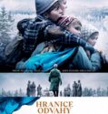

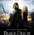


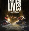

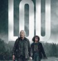
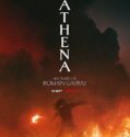

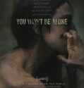
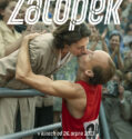


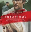


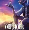


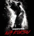


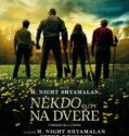


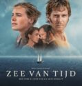


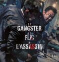


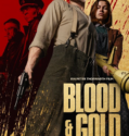
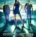


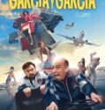

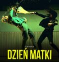
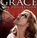
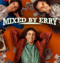


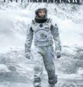


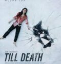

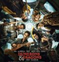

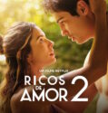


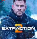
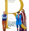
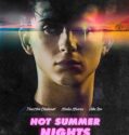

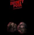
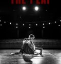
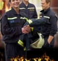
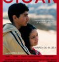


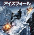
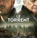
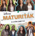
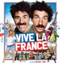


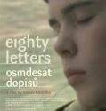


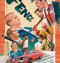
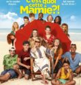
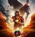


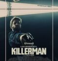


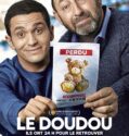


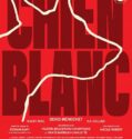


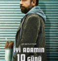


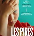


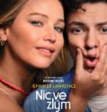
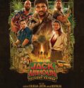


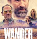
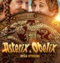
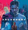

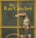


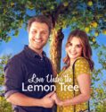
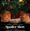


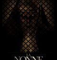
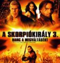
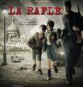


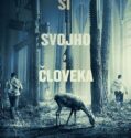
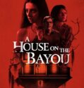


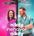


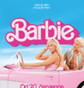


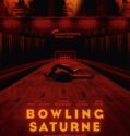


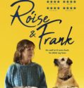
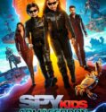
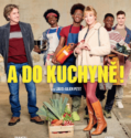

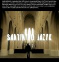


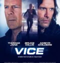


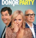


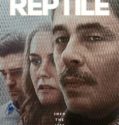


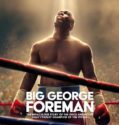
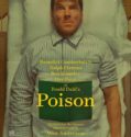

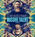

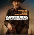
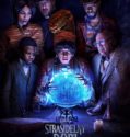


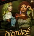
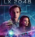

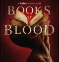


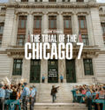
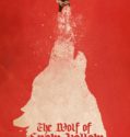


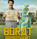
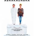


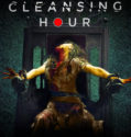
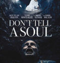


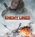
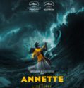


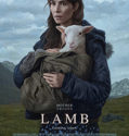
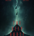
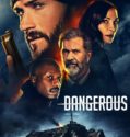
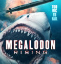
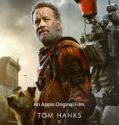
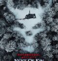


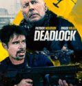
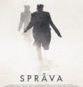
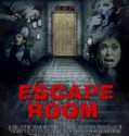


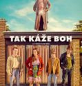


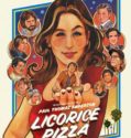


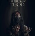

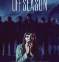


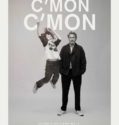
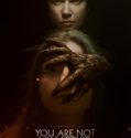


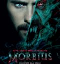
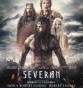
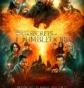
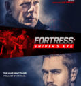


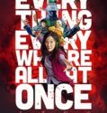

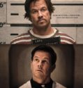
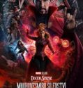


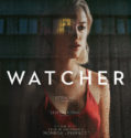
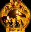


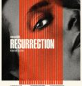
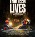


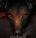

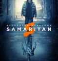


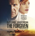
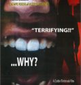
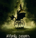
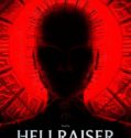
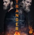

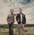
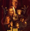

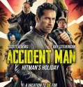
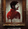
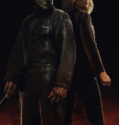
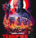
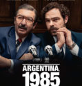


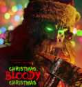


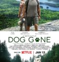
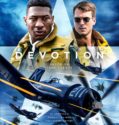

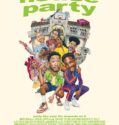
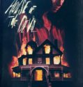


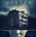


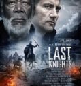


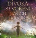


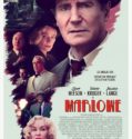
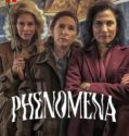
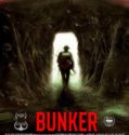


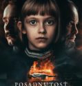
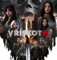


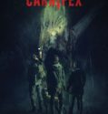


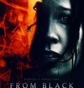


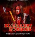
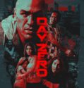

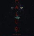
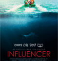


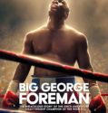

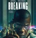


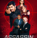
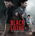
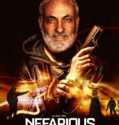
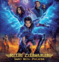
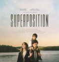

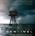
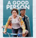

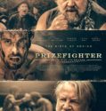

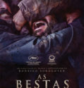
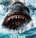
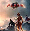
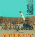

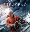
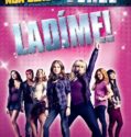
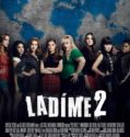
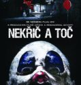


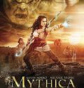

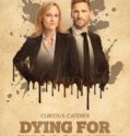

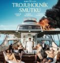


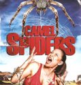
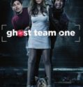


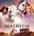


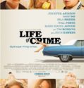
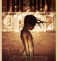
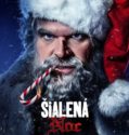


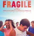

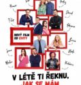


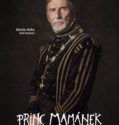
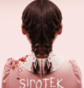
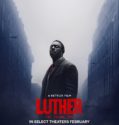


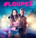

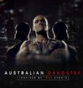


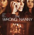

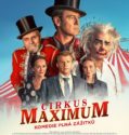
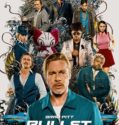
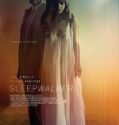


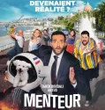

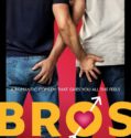

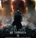

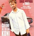


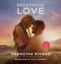


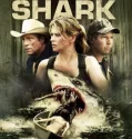
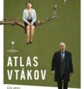
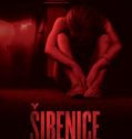

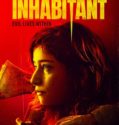

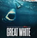


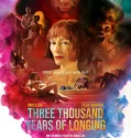

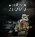


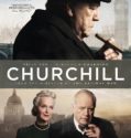


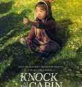


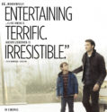
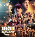
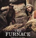

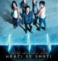


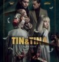

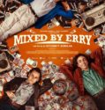


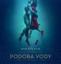


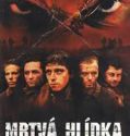
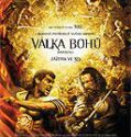


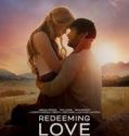
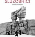
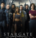


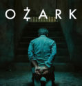

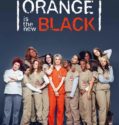


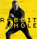


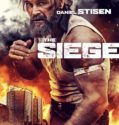


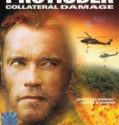


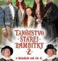


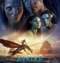


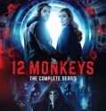
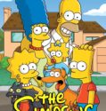

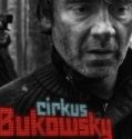


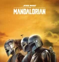
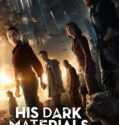


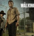

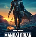
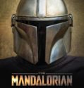


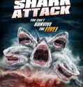


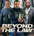


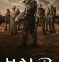

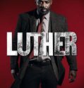
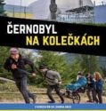

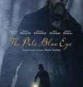

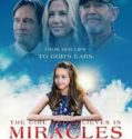
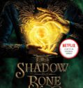
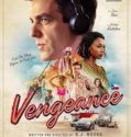


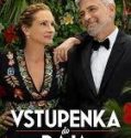


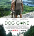


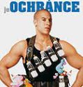

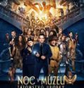


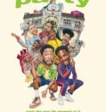


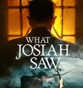

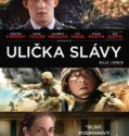

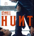


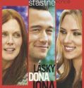

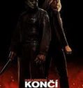

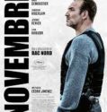
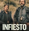


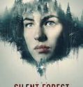


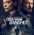
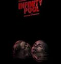


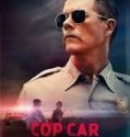


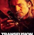


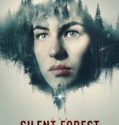

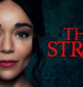


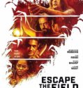
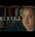


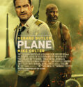


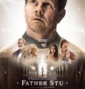


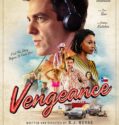


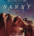


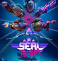
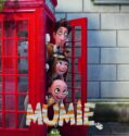


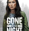


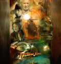


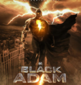


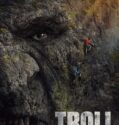


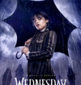
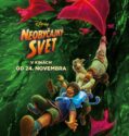
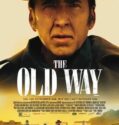
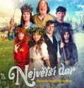


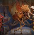
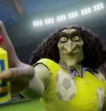


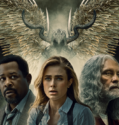


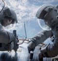


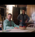

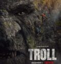


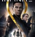


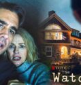


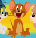


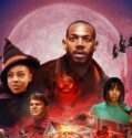


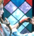


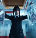
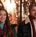
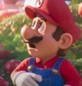

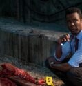


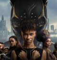
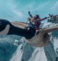


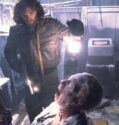


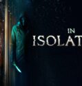


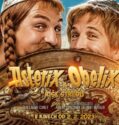


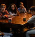
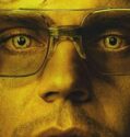
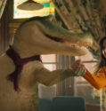


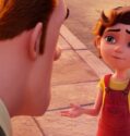


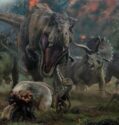


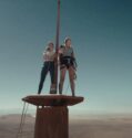


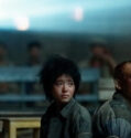
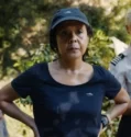


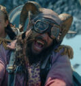


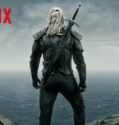


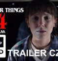


![TOP10: Seriály na Netflixe s ČESKÝM DANBINGOM [4K]](http://filmovadatabaza.sk/wp-content/uploads/2022/08/1661694889_maxresdefault-119x125.jpg)


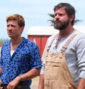


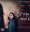

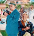


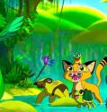


![TOP GUN: MAVERICK (2022) oficiální trailer [dabing]](http://filmovadatabaza.sk/wp-content/uploads/2022/08/1660276616_maxresdefault-119x125.jpg)


![JURSKÝ SVĚT: NADVLÁDA (2022) oficiální trailer [DAB]](http://filmovadatabaza.sk/wp-content/uploads/2022/08/1660142811_hqdefault-119x125.jpg)

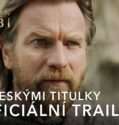

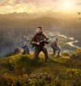


![Marry Me – Official Trailer [HD]](http://filmovadatabaza.sk/wp-content/uploads/2022/08/1660037592_maxresdefault-119x125.jpg)


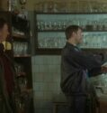


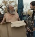


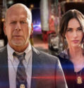


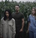
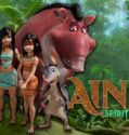


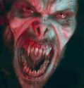


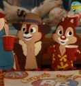
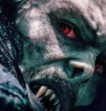


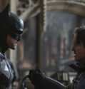


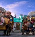
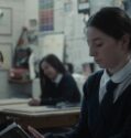
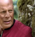


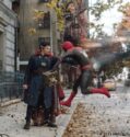


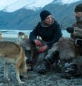
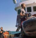
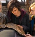
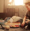
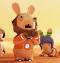


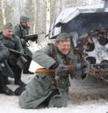


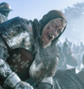
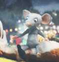
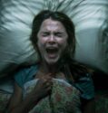
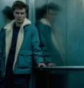
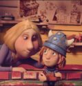
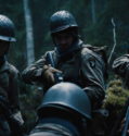


![Mumu (1972)(SK)[TvRip]](http://filmovadatabaza.sk/wp-content/uploads/2022/01/mumu-119x125.jpg)